
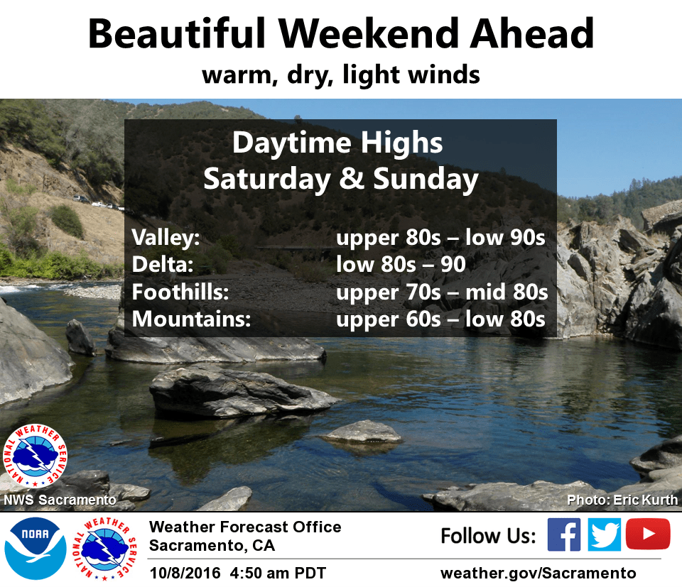
October 8, 2016 – Dry weather with warm temperatures continuing through the weekend. A cooling trend next week with a chance of precipitation spreading over northern California by the end of next week.
Discussion
High pressure will continue this weekend with temperatures above normal. A trough of low pressure moving through the Pacific Northwest will weaken the ridge early next week to start a cooling trend. A weak shortwave will move over the interior on Wednesday but the system continues to look dry at this time.
Extended discussion (Wednesday through Saturday)
High pressure over NorCal will break down in the long term forecast starting Wednesday as an upper level low pressure system begins to move into the region. The longwave trough and falling heights associated with the upper low have slowed compared to previous model runs, and precipitation chances now are shifting away from Wednesday and Thursday and look better for Friday and through the weekend.
Models are in decent agreement to having moderate to heavy precipitation at times starting mainly for the northern mountains and northern Sacramento valley on Friday and spreading southward for the weekend.
Better atmospheric dynamics will stay outside of the area, so not expecting widespread embedded thunderstorms with this system due to lack of instability. However, an isolated thunderstorm or two is possible over the coastal range as the system moves through the forecast area through the weekend. Snow levels should remain above 8000 feet, so not expecting significant snow accumulations at this time.