
October 7, 2016 – Dry weather with warm temperatures continuing through the weekend. A cooling trend next week with a chance of precipitation spreading over northern California by mid week.
Discussion
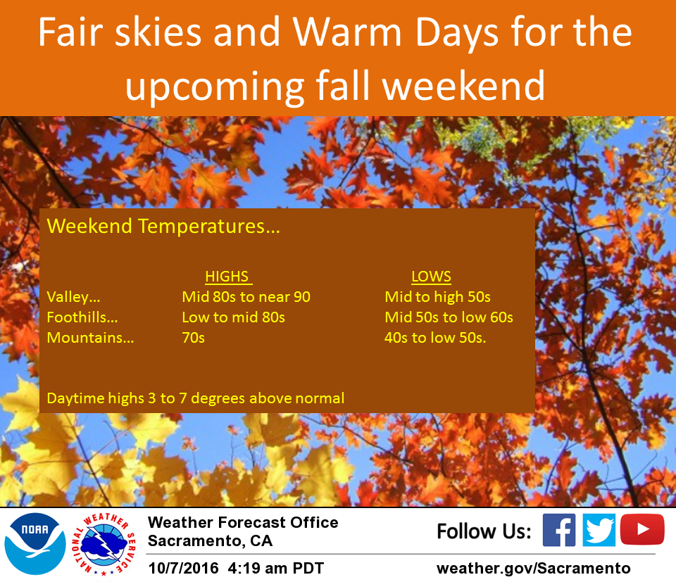
Fair skies and warm temperatures are expected through the weekend as an upper level high pressure ridge slides across northern California. Much of the weekend will see generally light winds with daytime highs around 4 to 7 degrees above normal for early October. An upper level trough will pass to the north on Monday. Overall effect on Norcal weather will be minor but an increased onshore flow will bring a slight cooling most areas. Although highs Monday will still be above normal it starts a cooling trend expected to last through the coming week.
Extended discussion (Tuesday through Friday)
A weak trough moves across Norcal Monday into Tuesday. Not much moisture is expected so much of our forecast area will remain dry. Cooling trend will continue and daytime highs on Tuesday will be a few degrees below normal with valley temps in the upper 70s.
Meanwhile, a stronger storm over the Eastern Pacific Ocean will be poised to move into NorCal. Details on this storm are uncertain at this point, but we are looking at a cooler, wetter weather pattern for the second half of the week.
The GFS shows a shortwave from this system moving into our region Wednesday. However, the ECMWF keeps our area dry. Have leaned towards the GFS and kept a chance of precipitation for Wednesday. Both models show the brunt of the storm moving inland Thursday evening into the weekend with better chances of precipitation across our entire CWA. Daytime highs Thursday and Friday will range 7-15 degrees cooler than average with valley highs in the mid 60s to low 70s.