
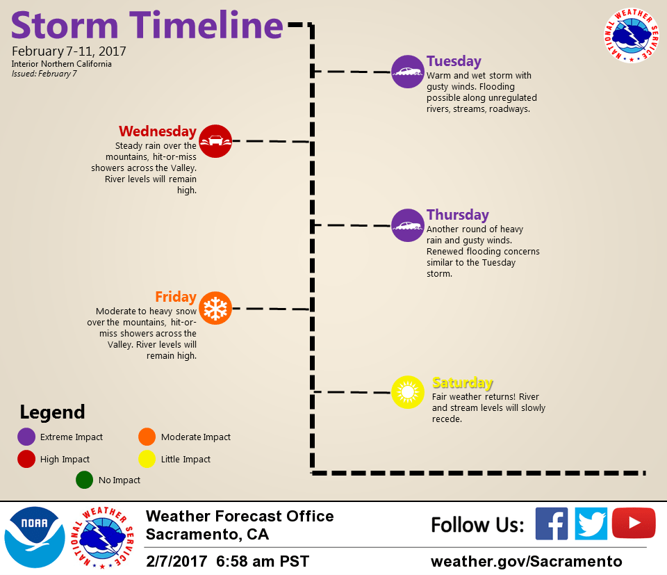
February 7, 2017 – Series of Pacific storms will bring periods of moderate to heavy rain and mountain snow with strong wind to Interior Northern California this week.
Discussion
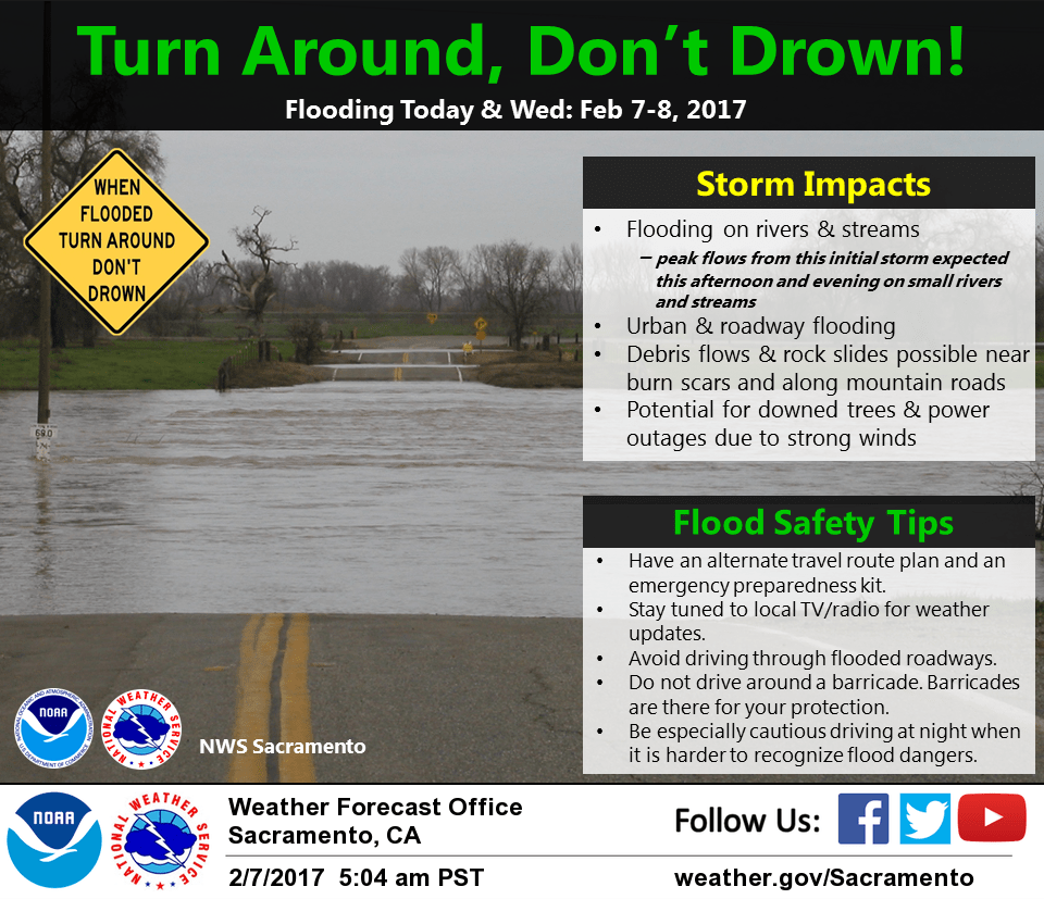
Moderate to heavy rain covers most of interior NorCal early this morning as the latest storm moves in.
Winds have increased considerable since Monday evening and gusts of 40-50 mph have been occurring through the Sacramento Valley. The Fresno to Redding gradient has increased to nearly 15 mbs and is forecast to tighten a bit more to around 17 mbs this morning.
Temperatures are very mild ranging from the 30s in the mountains to the lower to mid 50s in the Central Valley. Snow levels have been steadily increasing overnight, rising from around 5000 feet Monday evening to above 6500 feet currently. Blue Canyon was at 32 degrees at mid-evening on Monday and has risen to 39 by 3 AM.
Little change to previous forecasts with the peak winds expected through midday today. Heaviest rainfall is expected today with somewhat of a “break” anticipated Wednesday before the next round moves in Thursday.
Extended discussion (Saturday through Tuesday)
One last shortwave trough is projected to move through Northern California on Friday. That system looks to be a pretty typical winter storm, with light Valley rain and lowering snow levels over the mountains. This system does appear to move through the region rather quickly, so precipitation totals will be limited. Depending on the time of day this system passes through, a few afternoon thunderstorms may form.
Drier weather will begin on Saturday and continue through the weekend as high pressure builds across the region. Models are in good agreement with dry weather continuing into early next week.