
June 8, 2017 – Light rain spreading over the area today. Showers tonight spreading eastward on Friday. Showers northern areas over the weekend. Dry with near normal temperatures for the first half of next week. Temperatures warming to above normal by the end of the week.
Discussion
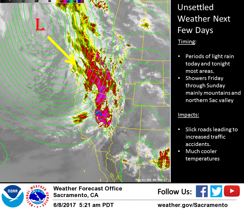
Weak frontal band dropping southeast through the north state this morning. Radar and satellite indicate front edge of the frontal band is along a line from about Red Bluff to Santa Rosa. Rainfall northwest of this area has been light and on the order of a few hundredths of an inch.
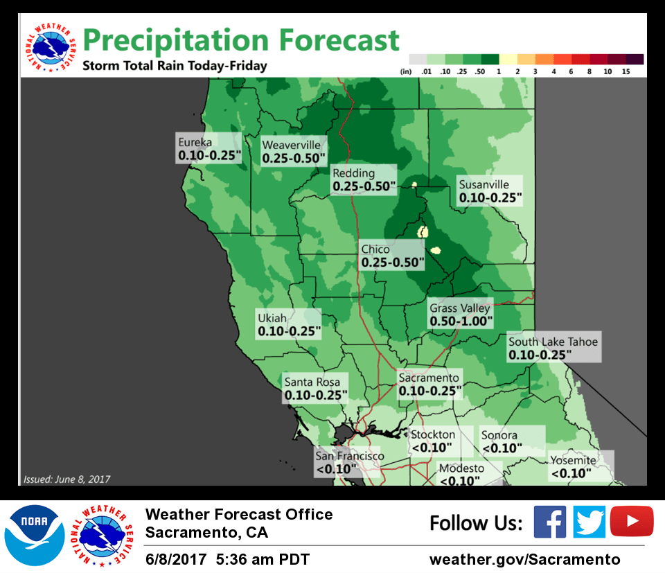
Front is forecast to sag slowly southeast today reaching south of the Sacramento area by 00z this afternoon. NAM still lightest on precipitation while GFS the heaviest. Either way, precipitation amounts should remain on the light side.
Cloud cover and cooler airmass will bring down daytime highs today with Max temperatures this afternoon on the order of 10 to 15 degrees below Wednesday highs. Shower activity shifts eastward tonight with most precipitation tonight focused on the northern Sierra.
Snow levels will remain above pass levels and precipitation amounts will remain light anyway so impacts over the Sierra will be minimal. Snow levels will remain above pass levels through the day Friday.
Meanwhile, upper low begins shifting into the Pacific northwest on Friday. This will keep a threat of showers going over the northern mountains. Daytime highs will remain below normal under the influence of the low.
Upper low center shifts onto the coast on Saturday. A shortwave trough pivoting around the low center will bring a threat of showers to areas north of about the Chico area. Still cooler air filtering into the region will bring down daytime highs still more with highs predicted to come in 15 or more degrees below normal.
Models differ some on track of upper low center Sunday. GFS has the upper low center clipping northeast corner of the state while the ECMWF and GEM track the low a bit farther east. Shower focus will be over the mountains and northern Sacramento valley Sunday but again precipitation amounts are not expected to be significant. GFS showing some instability over the southern Cascade region and have placed a slight thunderstorm threat here in the afternoon. High temperatures for the second half of the weekend remain well below normal.
Extended discussion (Monday through Thursday)
Cyclonic flow begins to weaken on Mon as the upper low moves from SErn ORE/NRN NV into ID allowing precip to end over Norcal. As the upper low moves into the Nrn Plains and Srn Canada the flow aloft transitions to Wly as 5H heights rise over the area. This will allow warmer air to advect into the area and temps will be trending upward through the period, after a very cool start. Mon’s max temps will some 5-10 degrees below normal, moderating closer to normal Tue/Wed, and then rapidly warming late in the week. By next Thu/Fri, 850 mbs temps forecast in the low to mid 20s degrees C suggest that max temps in the Valley will be in the 90s to low 100s and 70s and 80s in the mountains. Lowering humidities and drying katabatic winds will accompany the warming trend.