
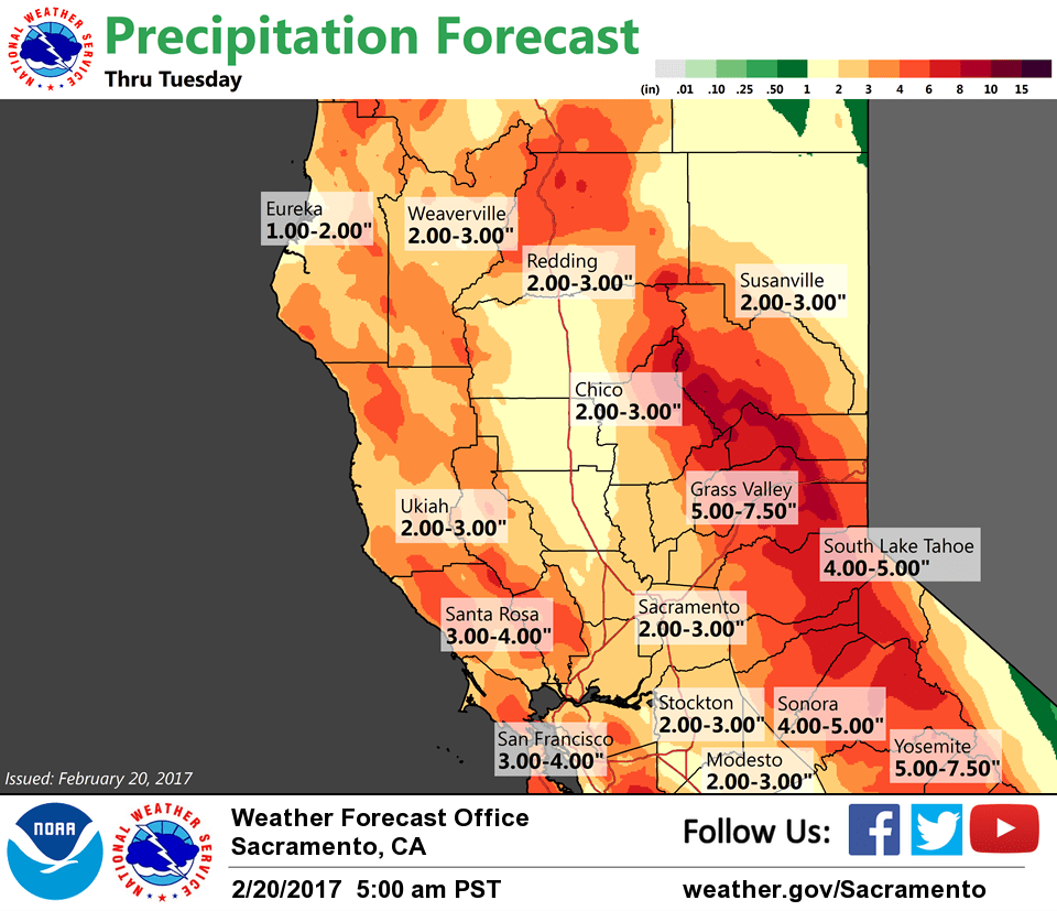
February 20, 2017 – Significant flooding concerns this week as heavy rain will add stress to waterways. Strong winds will cause numerous downed trees and extended power outages. Mountain communities and travel will be impacted with heavy snow and mudslides. Valley thunderstorms possible Tuesday and Wednesday.
Winter Storm Warning until 10 PM PST Tuesday for West Slope Northern Sierra Nevada-Western Plumas County/Lassen Park.
High Wind Warning from 4 PM this afternoon to 4 AM PST Tuesday.
Discussion
Not much new to add. Precip is on the upswing again the past several hours as the lull has ended and the “big” storm is moving in. Chico wind profiling radar has shown the snow level rising above 7K ft. Winds have also increased as the initial surface low passes-by a few hundred miles off the NW coast. Strongest winds now forecast around KSMF early this morning.
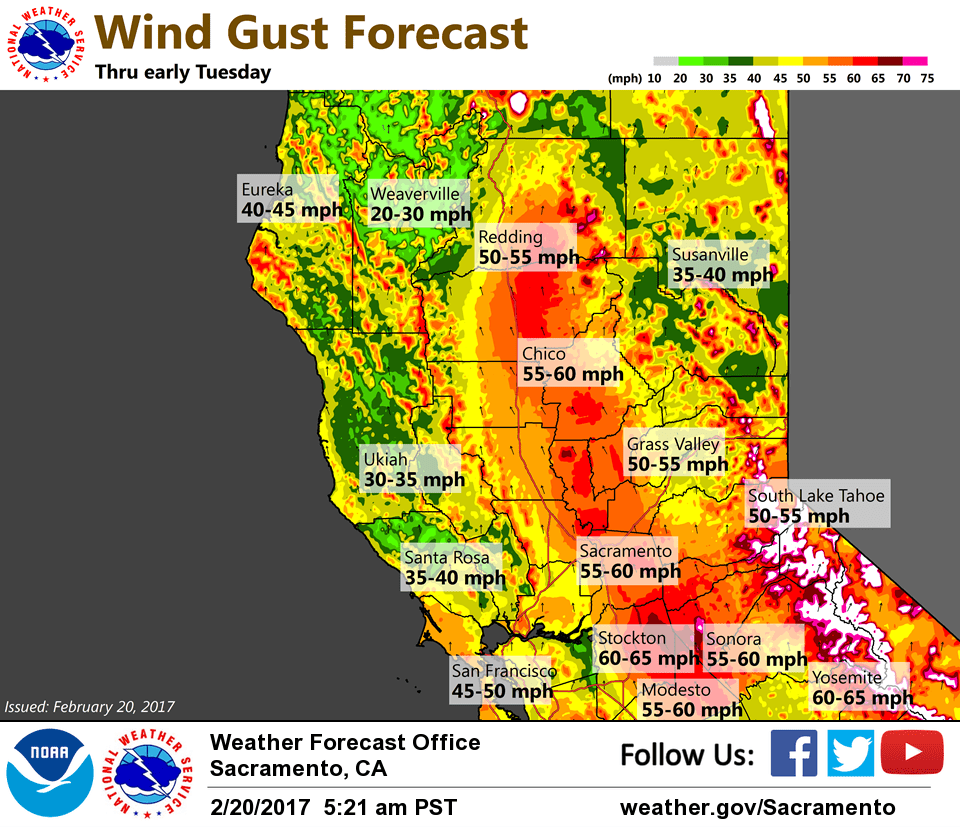
The second surface low moves closer to the NW coast by 12Z Tuesday with about a 12 mbs N-S gradient forecast. Stronger southerly winds will likely develop across the Central Valley this evening as this low approaches and the High Wind Warning remains in effect.
Look for precip to continue to focus over the W Slope northern Sierra today while a relative break or lull is forecast over the coastal range. Convergence line likely to form north of Redding and may be quite persistent with the potential for flooding.
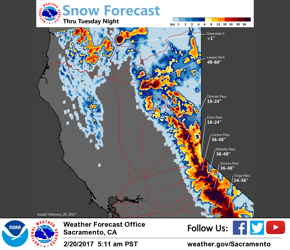
Warm front will continue to drench the Sierra tonight and into Tuesday while precip gradually decreases over the western portion of the CWA later tonight.
Chance of T-storms late tonight and Tuesday as the second front and strong embedded waves move through the broad Swly flow aloft. Be prepared for additional flooding.
Cooler and drier pattern settles in for Wednesday and Thursday with best remaining shower chances over the mountains.
Extended discussion (Friday through Monday)
The general unsettled, wet pattern continues into the extended period.
Widespread wet weather is expected to return by the end of the week as a system drops down from western Canada. Models are a little more consistent in the idea of wet weather returning, but the exact timing of when it begins remains uncertain. The system may begin spreading in during the day Friday, as the GFS and Canadian models show, or could hold off until evening. Even if it does begin Friday, precipitation amounts are expected to remain light and should be mainly over the northern mountains. By Saturday, there is good agreement with precipitation across the area, but with a much more limited moisture source amounts will be more of a typical winter storm than what than the current system.
There may be a brief lull early on Sunday, before a similar system arrives late Sunday into Monday.