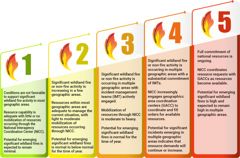
National Preparedness Level: 5 (On a scale from 1 to 5)
Northern California PL: 3
Southern California PL: 3
Smaller, local incidents are listed in the Happening Now section.
Current National Situation:
July 24, 2026 – Initial attack was light with 122 fires reported. 15 new large fires reported and 4 large fires contained.
| Nationwide yesterday | Year to date | 10-yr average |
| Fires: 122 Acres: 11,132 | Fires: 41,779 Acres: 4,010,417 | Fires: 32,625 Acres: 3,209,151 (2016 – 2025 as of today) |
| California | Year to date | 5-yr average |
| Fires: 3,750 Acres: 144,204 | Fires: 4,959 Acres: 230,844 |
Regional fires
| Incident Name | State | Lead Agency | Size (acres) | Percent Contained | Estimate of Containment | Personnel | Structures Destroyed |
| Mooney | CA | NEU | 25 | 100% | July 23, 2026 | 20+ | 1 |
| Chute, Yuba canyon | CA | NEU | 163 | 20% | July 28, 2026 | 1,246 | 0 |
| Elephant, Loyalton area | CA | TNF | 13,930 | 98% | August 18, 2026 | 180 | 0 |
California fires
| Incident Name | State | Lead Agency | Size (acres) | Percent Contained | Estimate of Containment | Personnel | Structures Destroyed |
| Biscar | CA | NOD | 69,344 | 42% | July 30, 2026 | 492 | 0 |
Out of state fires
Map information using data provided by the National Interagency Fire Center. The data is subject to change.
Weather Outlook
Elevated to locally critical fire weather conditions are expected near and east of the Cascades and northern Sierra, where gusty west to southwest winds, low relative humidity, and recent lightning activity will support new fire starts and large fire growth. Gusty west winds will also develop across the central Idaho Mountains and much of the Northern Rockies as showers and thunderstorms continue across the Southwest, Great Basin, and into the Northern Rockies, bringing thunderstorm activity to many areas that have recently experienced hot and dry conditions.
Farther east, breezy conditions and low relative humidity and hot temperatures will support elevated fire weather conditions across the southern High Plains, where isolated mixed wet and dry thunderstorms may lead to new fire starts. In Minnesota, a weak cold front will bring locally breezy conditions followed by isolated to scattered thunderstorms tonight. Heavy rain and possible flash flooding are also expected across portions of the southern Atlantic Coastal States and Middle Mississippi Valley. Farther south, isolated thunderstorms may reach southern Florida, where dry fuels remain receptive to new ignitions.