
Fire at a glance (numbers)
- Incident Name:
- State:
- Lead Agency:
- Size (acres):
- Percent Contained:
- Estimate of Containment:
- Personnel:
- Structures Destroyed:
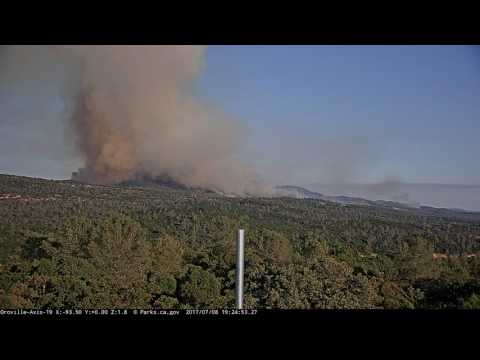
Wall, Butte Unit, Cal Fire. Eight miles southeast of Oroville, CA. Chaparral and tall grass. Minimal fire behavior.
July 17, 2017 at 8:28 AM
As of 8:00 am, the Wall Fire is now 100% contained.
July 16, 2017 at 8:25 AM
As of this morning, the fire is 98% contained.
July 14, 2017 at 7:18 PM
Final report unless significant changes.
July 14, 2017 at 7:14 AM
Firefighters continue to hold and improve fire lines and mop up hot spots. All evacuation orders, warnings, and road closures have been lifted.
Firefighters and resources are being demobilized from the incident and released back to their home units.
Both animal shelters will be closed at noon today. For assistance with animal pick up please call: (530) 538-7409
July 13, 2017 at 7:21 PM
Containment is up to 85%. Demobilization of excess resources has begun. No structures remain threatened.
July 13, 2017 at 6:50 AM
Still 1,362 firefighters assigned to the 6,033-acre fire. Containment is up to 75%.
July 12, 2017 at 6:59 PM
Firefighters continue to hold and improve fire lines and mop up hot spots. Current weather conditions continue to provide the opportunity for firefighters to make significant progress in containment. All evacuation orders, warnings, and road closures have been lifted. Currently, no structures are threatened. Damage inspection has been completed.
July 12, 2017 at 6:53 PM
ALL evacuation warnings related to the Wall Fire have been rescinded. All roads and areas in the fire area are open.
Residents are reminded to When returning home, residents are reminded to:
– Drive slowly as firefighters and heavy equipment are working in and around the fire area.
– Use caution when re-entering a burned area – flare-ups can occur.
– Check grounds for hot spots smoldering stumps and vegetation. Use your buckets of water.
– Check the roof and exterior areas for sparks and embers.
– Check the attic and throughout the house for hidden burning sparks and embers.
– Continue to check for problem areas for several days.
– Contact 911 if any danger is perceived.
– If burning outside your home was extensive, watch for soil erosion.
– Consult local experts on the best way to restore and replant your land with fire,safe landscaping.
Butte County is operating a Local Assistance Center at the Oroville Municipal Auditorium, 1200 Myers Street, for residents whose homes were damaged by the Wall Fire. A list of services available at the Local Assistance Center is available online at http://www.buttecounty.net/pathtorecovery.
July 12, 2017 at 11:26 AM
ALL evacuation orders have now been reduced to EVACUATION WARNINGS, for the entire fire area.
Evacuation warning areas are open to residents with ID only. Law enforcement officers will be heavily patrolling the area. Residents are reminded to drive slowly as firefighters and heavy equipment are working in and around the fire area.
Butte County has opened a Local Assistance Center at the Oroville Municipal Auditorium, 1200 Myers Street, for residents whose homes were damaged by the Wall Fire.
July 12, 2017 at 6:59 AM
Containment is up to 60%. 41 residences destroyed and 3 damaged; 57 other structures damaged or destroyed. 606 structures remain threatened.
July 11, 2017 at 8:17 PM
Evacuation Orders:
• All roads/areas south of Forbestown Rd. from the intersection of Highway 162 to Hurleton Swedes Flat Rd.
• All roads/areas accessed from Old Olive Hwy. at Hwy. 162
• All roads/areas accessed from Lost Horizon Dr. at Hwy 162
• All roads/areas accessed from Mt. Ida Rd. past Dadoma Ln.
• All roads/areas on Canal Dr. accessed from Feathervale Drive
• All roads/areas accessed from Hurleton Swedes Flat Rd. to Swedes Flat Rd.
• All roads/areas east of Miners Ranch Rd. from Hwy. 162 to Oro Bangor Hwy. (except for the warning areas of areas accessed off Mt. Ida Rd., see Evacuation Warnings below).
• All roads/areas east of Oro Bangor Hwy. from Miners Ranch Rd. to Avocado Rd.
• All roads/areas west of Oro Bangor Hwy. from Swedes Flat Rd. to Avocado Rd.
• All areas accessed from Swedes Flat Rd. at from Stoney Oaks Loop to Old Bangor Hwy.
• All areas accessed from Hurleton Swedes Flat Rd. from Swedes Flat Rd.
Evacuation Warnings:
• The Greater Stoney Oaks Loop community accessed from Robinson Mill Road at Swedes
Flat Road.
• All areas/road accessed by Mt. Ida between Miners Ranch Rd. and Dadoma Ln.
• All areas/roads accessed by Feathervale Dr. from Mt. Ida Rd. (except Canal Dr.)
Evacuation Centers:
Church of the Nazarene
2238 Monte Vista Avenue, Oroville, CA
Road Closures:
• Hurleton Swedes Flat Rd. is closed at Forbestown Rd.
• Swedes Flat Rd. is closed at Robinson Mill Rd.
• Hurleton Swedes Flat Rd. is closed at Swedes Flat Rd.
• Swedes Flat Rd. is closed at Stoney Oaks Blvd.
• Lefevre Ln. is closed at Upham Rd.
• Upham Rd. is closed at La Porte Rd.
• Avocado Rd. is closed at Oro Bangor Hwy.
• Oro Bangor Hwy. is closed at Miners Ranch Rd.
• Caroline Dr. is closed at Miners Ranch Rd.
• Mt. Ida Rd. is closed at Miners Ranch Rd. (open to residents with ID)
• Mt. Ida Rd. is closed at Dadoma Ln.
• Canal Dr. is closed at Feathervale Dr.
• Old Olive Hwy. is closed at Forbestown Rd.
• 500 Forbestown Rd is closed
• Little Oak Rd. is closed at Forbestown Rd.
• Forbestown Circle is closed at Hwy. 162 (both intersections)
• Hideaway is closed at Forbestown Rd.
• Old Olive Hwy. is closed at Hwy. 162
• Lost Horizon Dr. is closed at Hwy. 162
Animal Shelter: Small Animal Shelter: Del Oro Ave. “Old County Hospital”, Oroville, CA
Large Animal Shelter: Camelot on Clark Road in Butte Valley, CA
Animal Rescue Helpline: (530) 895-0000
July 11, 2017 at 5:02 PM
Additional evacuation reductions:
The following evacuation orders have been reduced to an evacuation warning:
South side of the fire area: (open to residents with ID)
– The Greater Stoney Oaks Loop community accessed from Robinson Mill Road at Swedes Flat Road.
o No traffic will be allowed northbound on Hurleton Swedes Flats Road from Swedes Flat Road.
o No traffic will be allowed westbound on Swedes Flat Road from Stoney Oaks Boulevard.
The following evacuation warnings have been rescinded:
North end of the fire area:
– All affected roads/areas north and west of Highway 162 from Miners Ranch Rd. to Lake Oroville. (Highway 162 is open)
– All affected roads/areas north of Forbestown Rd. from Highway 162 to Hurleton Swedes Flat Rd.
o Highway 162 is now open in both directions.
o Hurleton Rd. at Hurleton Circle is open in both direction
All other evacuation orders and warnings remain in effect.
July 11, 2017 at 2:43 PM
Pacific Gas and Electric Company (PG&E) continues to replace equipment damaged in the Wall Fire and expects to restore power to all 87 remaining customers by 8 p.m. today.
July 11, 2017 at 12:56 PM
The following evacuation orders have been reduced to an evacuation warning:
North end of the fire area: (open to residents with ID)
• All affected roads/areas north and west of Highway 162 from Miners Ranch Rd. to Lake Oroville. (Highway 162 is open)
• All affected roads/areas north of Forbestown Rd. from Highway 162 to Hurleton Swedes Flat Rd.
West side of the fire area: (open to residents with ID)
• All areas/road accessed by Mt. Ida between Miners Ranch Rd. and Dadoma Ln.
• All areas/roads accessed by Feathervale Dr. from Mt. Ida Rd. (except Canal Dr.)
The following evacuation warnings have been rescinded:
East side of the fire area (Greater Black Bart Loop community)
• All areas/roads accessed by Forbestown Rd. from Hurleton Swedes Flat Rd. to Robinson Mill Rd. (includes the Hurles Circle Rd. area)
• All areas/roads accessed by Robinson Mill Rd. from Forbestown Rd. to Swedes Flat Rd.
All other evacuation orders and warnings remain in effect. All residents are reminded to bring all necessary supplies they may need with them before re-entering the area.
July 11, 2017 at 10:06 AM
Latest damage assessment report by Cal Fire:
Single Family Residences Destroyed: 41
Single Family Residences Damaged: 3
Other Minor Structures Destroyed: 46
Other Minor Structures Damaged: 7
Commercial Structures Destroyed: 2
Total Structures Destroyed and Damaged: 99
Fire activity has reduced significantly as firefighters continue to improve fire line and make the affected area safe. Evacuation orders and warnings are still in effect, and being reevaluated frequently. Damage inspection teams are continuing to evaluate the extent of the damage.
July 11, 2017 at 8:18 AM
Weather forecast: High pressure aloft will weaken a bit more Tuesday. This will result in slightly cooler conditions . The increased onshore low- level flow will bring some afternoon breezes to the fire area, especially exposed and blackened locations. Improved humidity recovery can be expected Tuesday night. Weaker onshore flow Wednesday will bring a little less wind , but minimal to no temperature change.
July 11, 2017 at 7:38 AM
A Local Assistance Center will open today at noon at the Oroville Municipal Auditorium, 1200 Myers Street, for residents whose homes were damaged by the Wall Fire. Residents can come to the Local Assistance Center to learn if their home was damaged by the fire. Residents should bring any form of identification they have available. A form of identification with a photo and the property address would be ideal if it is available. Local Assistance Center Open July 11th Noon to 7:00 pm
July 11, 2017 at 7:34 AM
No change in acreage overnight, containment up to 45%.
July 10, 2017 at 9:26 PM
Updated damage assessment lists 37 structures (homes and outbuildings) destroyed and 5 damaged.
July 10, 2017 at 8:01 PM
Fire activity has reduced significantly as firefighters continue to improve fire line and make the affected area safe. Evacuation orders and warnings are still in effect. Damage inspection teams are continuing to evaluate the extent of the damage.
For a Live Evacuation Map please visit: https://tinyurl.com/y7q3bse6
For tips on returning home after a fire visit: visit www.buttecounty.net/pathtorecovery
July 10, 2017 at 7:05 PM
Damage inspection is in progress. Repopulation plan has been implemented. Communities under evacuations are Forbestown, Swedes Flat, Robinson Mill, Hurleton, Miners Ranch. Threat to 115 kV powerlines.
July 10, 2017 at 5:21 PM
The following areas have been downgraded from an Evacuation Order to an Evacuation Warning:
• Areas north of Forbestown Rd. at Hurleton Swedes Flat Rd. east to Robinson Mill Rd. This includes the Hurles Circle Rd. area.
• Areas east of Forbestown Rd. at Hurleton Swedes Flat Rd. not including Hurleton Swedes Flat Rd. south from Forbestown Rd.
• Areas south of Forbestown Rd. at Hurleton Swedes Flat Rd. to Robinson Mill Rd.
• Areas north of Robinson Mill Rd. between Swedes Flat Rd. to Forbestown Rd.
The road closures affecting these areas are as follows:
• Forbestown Rd. is closed to westbound traffic at Hurleton Swedes Flat Rd.
• Hurleton Swedes Flat Rd. is closed to southbound traffic at Forbestown Rd.
• Hurleton Rd. is closed to westbound traffic at Hurleton Circle.
• Upper Black Bart Rd. is open to residents only at Forbestown Rd.
• Swedes Flat Rd. is closed to westbound traffic at Robinson Mills Rd.
July 10, 2017 at 3:15 PM
The Evacuation Warnings on the west side of the fire have been rescinded. This includes:
1. All areas west of Miners Ranch Rd. and Dunstone Dr. from Hwy. 162 to Grubbs Rd.
2. Everything to the north of Upper Palermo Rd. at Grubbs Road to Grubbs Road at Dunstone Dr.
3. All roads/areas along Foothill Blvd. at Oro Bangor Hwy. to Oro Bangor Hwy. at Lower Wyandotte Rd, continuing south on Lower Wyandotte Rd. to the intersection of upper Palermo Road and Grubbs Rd, encompassing everything to the west to Oro Bangor Hwy, including homes off of Mission Olive Road.
4. All roads/areas east of Oro Bangor Hwy. at Foothill Blvd. to Pinedale Ave., Pinedale Ave., north to Edgewood Dr., North to Hilldale Ave., west to Hwy. 162.
5. All roads/areas along Glen Dr. from Oro Dam Blvd. East to Oro Quincy Hwy. and everything to the east of Glen Dr.
6. All roads/areas along Oro Dam Blvd. East from Glen Dr. to Kelly Ridge Rd. All roads/areas east and west of Kelly Ridge Rd. from Oro Quincy Hwy. up to Oro Dam Blvd
All other evacuation orders and warnings remain in effect. All residents are reminded to bring all necessary supplies they may need with them before re-entering the area.
July 10, 2017 at 11:26 AM
Crews from Pacific Gas and Electric Company (PG&E) have restored power to more than half of the homes that lost power due to the Wall Fire in Butte County.
Cal Fire gave PG&E permission today to access more of the burn area so crews can replace about 35 burned poles and power lines to restore power to 288 homes in and near the Wall Fire, which began Friday. About 800 homes lost power as PG&E de-energized power lines for firefighter safety or fire-damaged poles.
Today about 50 PG&E personnel are replacing burned poles near Forbestown Road and Olive Highway, with the remainder replaced once fire areas can be safely accessed.
Throughout the weekend, PG&E crews pre-treated more than 400 wooden poles with fire retardant and re-energized areas once it was safe to do so. PG&E made repairs and restored power to homes along Swedes Flat Road on Sunday.
July 10, 2017 at 9:21 AM
Butte County: We have the best community! Thank you for all the donations. We have received plenty of donations for the #wallfire. Please feel free to drop off donations you have already collected by 1:00 pm today at the County General Services North parking lot, 2081 2nd Street in Oroville. No additional donations are needed at this time.
Other ways to help the local community affected by the Wall fire:
Donate to Red Cross locally: http://www.redcross.org/local/california/gold-country/ways-to-donate
Donate to the North Valley Community Foundation Wall Fire Emergency Response fund. https://www.nvcf.org/fund/wall-fire/
July 10, 2017 at 8:42 AM
Firefighters are continuing to establish and maintain control lines and reduce the threat of property damage. Evacuation orders and warnings are still in effect. Damage inspection teams are evaluating the area determining the extent of the damage. Approximately 4,000 people have been evacuated.
The area west of Miners Ranch Rd. from Hwy. 162 to Oro Bangor Hwy. was downgraded to an evacuation warning last night.
Evacuation Orders:
• All roads/areas north and south of Forbestown Rd. from the intersection of Highway 162 at Lumpkin Rd.
• All roads/areas south of Forbestown Rd. from Lumpkin Rd. to Robinson Mill Rd.
• Bangor Highway to Miners Ranch Rd. and Naranja Ave.
• All roads/areas east of Oro Bangor Hwy. from Miners Ranch Rd. to Avocado Rd.
• All roads/areas west of Oro Bangor Hwy. from Swedes Flat Rd. and Avocado Rd.
• All roads/areas north and south of Swedes Flat Rd. to Robinson Mill Rd.
• All roads/areas east of Miners Ranch Rd. from Hwy 162 south to Swedes Flat Rd.
Evacuation Warnings:
1. All areas west of Miners Ranch Rd. and Dunstone Dr. from Hwy. 162 to Grubbs Rd.
2. Everything to the north of Upper Palermo Rd. at Grubbs Road to Grubbs Road at Dunstone Dr.
3. All roads/areas along Foothill Blvd. at Oro Bangor Hwy. to Oro Bangor Hwy. at Lower Wyandotte Rd, continuing south on Lower Wyandotte Rd. to the intersection of upper Palermo Road and Grubbs Rd, encompassing everything to the west to Oro Bangor Hwy.
4. All roads/areas east of Oro Bangor Hwy. at Foothill Blvd. to Pinedale Ave., Pinedale Ave., north to Edgewood Dr., North to Hilldale Ave., west to Hwy. 162.
5. All roads/areas along Glen Dr. from Oro Dam Blvd. East to Oro Quincy Hwy. and everything to the east of Glen Dr.
6. All roads/areas along Oro Dam Blvd. East from Glen Dr. to Kelly Ridge Rd.
7. All roads/areas east and west of Kelly Ridge Rd. from Oro Quincy Hwy. up to Oro Dam Blvd.
Road Closures:
Forbestown Rd. at Hwy. 162 Lumpkin Rd. at Forbestown Rd. Upper Black Bart at Forbestown Rd. Oro Bangor Hwy. at Miners Ranch Rd. Swedes Flat at Robinson Mill Rd. Oro Bangor Hwy. at Avocado Rd.
Miners Ranch Rd. at Hwy. 162
Miners Ranch Rd. at Mt. Ida Rd.
Miners Ranch Rd. at Caroline Dr.
July 10, 2017 at 6:48 AM
Official containment figure is 35%.
July 10, 2017 at 6:15 AM
The Wall Fire is estimated at 6,061 acres. Not much movement overnight, firefighters took advantage of the conditions to improve containment.
July 9, 2017 at 8:45 PM
Limited downgrading of evacuation orders for the area west of Miners Ranch Rd. from Hwy. 162 to Oro Bangor Hwy.
17 structures destroyed, 5 damaged. The damage assessment is ongoing.
July 9, 2017 at 7:33 PM
Ophir Principal: Ophir School, Oroville is located inside the mandatory evacuation area #Wallfire and will be closed tomorrow to keep all of our staff safe.
July 9, 2017 at 6:59 PM
Erratic winds, record high temperatures, and low humidity are having an effect on fuels conditions resulting in extreme fire behavior. To date over 4,000 civilians have been evacuated. Threat continues to structures and powerlines.
July 9, 2017 at 6:20 PM
Fire behavior greatly moderated today. No column has developed over the fire.
Air Attack in response to a query by Wall Command stated if everything stays the same, no need for early up aircraft.
July 9, 2017 at 6:05 PM
Cal OES Director Secures Fire Management Assistance Grant from FEMA to Assist Response Agencies Battling Wall Fire in Butte County
July 9, 2017 at 3:53 PM
Governor Edmund G. Brown Jr. today issued an emergency proclamation for Butte County due to the effects of the Wall Fire, which has burned hundreds of acres, damaged critical infrastructure, threatened homes and caused the evacuation of residents.
July 9, 2017 at 3:29 PM
Oroville Municipal Auditorium (cooling center only) will close at 8 pm tonight. They will re-open at 8 am tomorrow morning, per Butte County.
July 9, 2017 at 1:26 PM
Caltrans: Butte Highway 162 is CLOSED to eastbound traffic from Miner Ranch Road South to Miner Ranch Rd. Westbound lanes remain open. No ETO.
July 9, 2017 at 1:23 PM
Over 4,000 civilians are under mandatory evacuations and 7,400 civilians are under evacuation warnings. Additionally, the Oroville Spillway reconstruction project is under voluntary evacuations. Inspections are underway to identify damage to critical infrastructure.
July 9, 2017 at 1:00 PM
Cal Fire has upped the acreage of the Wall Fire to 5,000 acres, still 17% contained.
July 9, 2017 at 12:24 PM
Residents who would like to volunteer their time for the #WallFire should contact Caring Choices at 530-343-0727
July 9, 2017 at 12:05 PM
Air Attack 210 is now Wall Air Attack.
July 9, 2017 at 11:21 AM
New fire, 1 acre in heavy fuels reported west of the fire. West Air Attack is over the fire. The new incident is called the Alice Fire, Alice IC reports the forward progress has been stopped.
July 9, 2017 at 10:39 AM
New Evacuation order:
Oro Bangor Highway from Swedes Flat to Avacado Road, including all connecting roads and areas.
July 9, 2017 at 10:28 AM
Butte County: Donations for the #WallFire may be dropped off at the General Services North parking lot, 2081 2nd St. in Oroville between 10 am-4pm. Donations needed: adult diapers, child diapers, baby wipes, water, Gatorade and ice in ice chests that do not need to be returned.
July 9, 2017 at 10:09 AM
Cal OES Inland Region Emergency Operations Center activating and additional staff deploying to Oroville to support County of Butte with the Wall Fire.
July 9, 2017 at 9:06 AM
Fire has not crossed the Honcut Creek drainage. Air Attack is requesting one scooper.
July 9, 2017 at 9:03 AM
Air Attack reports the fire is looking pretty good this morning, a few smokes on the northwest side. The northeast side on the fire is very smoky. Helicopters are working the fire already, air tankers will be up as soon as visibility improves.
July 9, 2017 at 8:56 AM

The Temporary Flight Restriction (TFR) over the fire is extended from the surface up to and including 7000 feet MSL. 5 nautical miles radius.
This includes drones.
July 9, 2017 at 8:38 AM
Air Attack is up.
July 9, 2017 at 8:06 AM
10 structures destroyed, 5 damaged. 750 structures are threatened.
July 9, 2017 at 8:03 AM
Fire behavior forecast:
Sunrise 0537, sunset 2037, 15 hours daylight. Probability of ignition near 100% during daylight hours. Fuels very receptive to spotting. Much of the fire is within the Swedes Fire perimeter from 2013. Heavy loading of fine fuels and many dead standing and down large diameter fuels inside the old burn area. Potential spotting distance 0.2-0.3 miles.
Air Operations:
No smoke or visibility problems anticipated after 1300.
July 9, 2017 at 6:44 AM
Weather forecast: Hot and dry conditions will continue at the wildfire tonight into Sunday. Sunday should be a bit less hot than Saturday. Overnight humidity recoveries will remain to be poor to moderate. Easterly or drainage winds overnight should turn to west or upslope during afternoon heating.
July 9, 2017 at 6:23 AM
The following roads are currently under an EVACUATION ORDER:
All areas west of Miners Ranch Road from the intersection of Highway 162 to Oro-Bangor Highway., including the Oaks mobile home park, Mt. Ida Road, Skyline Blvd. and Oakvale Ave.
All areas south of Highway 162 from the intersection of Miners Ranch Road to Oakvale Ave.
All areas east of Oakvale Ave. from Highway 162 to Miners Ranch Road including Oro Bangor Highway.
The following roads are currently under an EVACUATION WARNING:
All areas north of Highway 162 from Miners Ranch Road to Glen Drive/Oro Quincy Highway.
All areas east of Oro Dam Blvd. from Highway 162 to Lake Oroville, including Canyon Drive and Longview Drive.
All areas east of the follow roads:
o Arbor Ave. from Highway 162
o Hillsdale Ave.
o Edgewood Ave.
o Pinedale Ave.
o Foothill Blvd. to Oro-Bangor Highway
o Oro-Bangor Highway from Foothill Blvd. to Lower Wyandotte Rd.
o Upper Palermo Rd. to the intersection of South Villa Rd.
All areas north of South Villa / Grubbs Road from the intersection of Upper Palermo to Dunston Rd.

July 8, 2017 at 10:09 PM
Immediate Evacuation Orders:
All roads north of Forbestown Road between Lumpkin Road and Highway 162.
All roads east of Miners Ranch Road between Lumpkin Road and Highway 162.
Hurleton Swedes Flat Road from Grand Oak to Swedes Flat and all connecting roads.
Swedes Flat Road from Chinese Wall Road to Robinson Mill Road and all connecting roads.
Swedes Flat Road from Oro Bangor Hwy to Chinese Wall Road and all connecting roads.
Black Bart Road and all connecting roads.
Evacuation Warning
All roads south of Olive Highway between Oakvale Avenue and Miners Ranch Road.
All roads east of Oakvale Avenue between Olive Highway to Miners Ranch Road.
Foothill Blvd. from Dunstone Drive to Miners Ranch Road
Robinson Mill Road and all connecting roads
Forbestown Road from Hurleton Road to Old Forbestown Road
Forbestown Road from Upper to Lower Hurleton Road
Oro Bangor Hwy from south of the Jandar Crossing to north of Avocado Road
July 8, 2017 at 9:36 PM
Small animal shelter will accept animals throughout the night. Remember food, water & bedding for animals. Large animal shelter will allow owners to bring animals all night. Animals must stay in trailers until morning. Large animal shelter located at Camelot Equestrian Park, 1985 Clark Road.
July 8, 2017 at 8:59 PM

The fire has crossed Forbestown Rd near Little Oak.
All personnel are advised to leave the area.
July 8, 2017 at 7:22 PM
The fire has become extremely active, rotation is developing in the column as seen from the Oroville cam. Additional evacuation orders have been issued for all roads north of Forbestown between Lumpkin Road and Hwy 162 – All roads between Miners Ranch in the Mt. Ida/Old Olive Highway area.
July 8, 2017 at 5:42 PM
The following roads are currently under an evacuation order:
Hide-Away Road,Hope Lane, Mittens Lane, Grand Oak Drive, Grand Oak Court, Spring Valley Court, Rosie-O’Grady Lane, Rex Lane, Hardrock Road, Saddle Ranch Road, Black Bart Road, Lone Oak Drive, Lyons Lane, Davidson Hill Lane, Bandit Lane, Ambush Hill Lane, Shenandoah Lane, Renegade Road, Cold Creek Lane, Fire Camp Road, Shirley Lane, Sandra Lane, Eagle Vista Court, Eagle Vista Drive, Janet Lane, West Sandra Lane, Dedeker Lane, Jims Bar Road, Jernigan Way, Quality Lane, Verner Oaks Drive, Soda Creek Ranch Road, Ricky Road, Lorretta Lane, Ooti Way, Maple Lane, Purple Rocks Lane, Mistletoe Lane, Dickerson Lane, Hurleton Swedes Flat Road from Forbestown Road south to Swedes Flat Road, Greerty Road, Stoney Oaks Blvd., Stoney Oaks Loop, Obert Drive, Gaston Booth Road, Gold Mountain Road, Century Court, Le Fevre Lane, Deer Valley Road, Cedar Wood Drive, Turkey Creek Trail, Chinese Wall Road, Fox Lane, Spring Creek Road, Nichols Ranch Road, Romo Road, Swedes Flat Road from Oro Bangor Highway to Robinson Mill Road, Upham Road from Le Fevre Lane to Robinson Mill Road, Forbestown Road from Rosie O’Grady Lane to Hide-Away
The following roads are currently under an evacuation warning:
Lower Forebestown Road from Ponderosa Way to Forbestown Road, Red Bird Court, Eddy Court, Peace Court, Dozier Court, Ponderosa Way from Robinson Mill Road to the Yuba County Line, Chataqua Way, Handel Street, Greenbush Road, Silesian Way, Black Trail Road, Richmont Court, Richmont Drive, Whispering Woods Way, Rebie Way, White Fur Lane, Powell Ridge Road, St. Arlene Way, Lake Haven Way from Lumpkin Road to St. Arlene Way, Starziak Lane, Elsa Lane, Wicks Way, Elams Ranch Road, Stringtown Road, Lakeview Ridge Road, Rebel Lane, Summer View Drive, Dancing Wind Drive, Maidu Run, Lothrop Lane, Empire Point Drive, Mountain Oak Road, Mather Lane, Finlayson Court, Nice Place, Romelt Lane, Rosa Way, Mackey Court, Hershel Lane, Angle Way, Hurleton Road from Kim Drive to Hershel Lane, Forbestown Circle, Lake Wyandotte Drive, Diamond Bar Court, Gold View Court, Gloriana Road, Harry Lane, Old Post Drive, Kim Drive, Justin Lane, Little Oak Road, Oro Bangor Highway from Jan-Dar Road to Coyote Moon Trail, Forbestown Road from Little Oak Road to Hide-Away, Forbestown Road from Rosie O’Grady Lane to Robinson Mill Road, Mission Olive Road, Spangler Court, Ruth’s Court, Friedman Court, Nugget Ranch Road, Froggie Lane, Mission Olive Court, Ramos Court, Misty View Way, Live Oak Knoll Drive, Olive Tree Lane, Pleasant View Lane, Ybarra Court, Hassler Court, Manzanella Court, Culet Ranch Road, Blazford Gulch, El Corto Way, Damon Lane, Rossini Pond Drive, Winding Creek Way, Shady Oak Drive, Brooktree Lane, King Request Road, Deflore Drive, Jan-Dar Road, Boyd Lane, Indian Rock Road, Oro Bangor Highway from Swedes Flat Road to Miners Ranch Road, Rutherford Lane, Mission Crest Drive, Coal Lane, Cornett Lane
The following roads are currently under an evacuation warning:
All roads south off Olive Highway between Oakvale Avenue and Miners Ranch Road
All roads east off Oakvale Avenue between Olive Highway to Miners Ranch Road
Road Closures: Forbestown Road to Black Bart Road (upper). Forbestown Road at Lumpkin Road. Forbestown Road at Hurleton Road (lower west end). Upham Road at Le Fevre Road. Swedes Flat Road at Oro Bangor Highway. Swedes Flat Road at Robinson Mill Road.
July 8, 2017 at 3:54 PM
Per Cal Fire Butte County: [update] off Chinese Wall Rd, north of Bangor (Butte County) is now 2,000 acres & 5% contained.
July 8, 2017 at 3:12 PM
Air Attack is requesting any tankers that are on hold, specifically at Grass Valley and Chico bases to the fire.
July 8, 2017 at 3:01 PM
An Evacuation Warning has now been issued for residents on Foothill Blvd. from Dunstone Drive to Miners Ranch Road.
July 8, 2017 at 2:58 PM
Smoke inversion has lifted and large air tankers are assisting ground resources. Tanker 164 and Tanker 05 are on scene now.
July 8, 2017 at 1:44 PM
Per Butte County: Small animal shelter will take animals until 11pm tonight, resume intake at 6am tomorrow. The shelter is located at Old County Hospital, 2279 Del Oro and Mono, Suite E. Large animal shelter at Camelot Equestrian Park, 1985 Clark Road for will take animals until dark tonight (9pm), resume intake at 6am.
July 8, 2017 at 1:18 PM
Tankers 91 and 95 are en route to the fire.
July 8, 2017 at 12:42 PM
Evacuation orders remain in effect. Law enforcement is not allowing anyone into the evacuated areas, including evacuees.
July 8, 2017 at 12:27 PM
There are no VLAT or large air tankers available for dispatch to the fire at this time.
July 8, 2017 at 10:37 AM
Approximately 400 homes are without power in the fire perimeter. PG&E crews are unable to access the area.
July 8, 2017 at 10:02 AM
Short range spotting causing multiple spot fires continued to challenge fire crews even overnight. Mandatory evacuations are in place. CALFIRE IMT-6 will be assuming command this morning.
July 8, 2017 at 9:52 AM
Nevada Seismo Lab fire cams: Continued and accelerated growth in the 4 AM hour as seen from the Sugar Bowl fire camera atop Mt. Lincoln. This video clip is recorded in near-IR…Camera is about 60 miles away from the fire!

July 8, 2017 at 9:50 AM
Evacuation recap:
Immediate Evacuation Orders
Hurleton Swedes Flat Road from Grand Oak to Swedes Flat and all connecting roads.
Swedes Flat Road from Chinese Wall Road to Robinson Mill Road and all connecting roads.
Swedes Flat Road from Oro Bangor Hwy to Chinese Wall Road and all connecting roads.
Black Bart Road and all connecting roads
Evacuation Warning
Robinson Mill Road and all connecting roads
Forbestown Road from Hurleton Road to Old Forbestown Road
Forbestown Road from Upper to Lower Hurleton Road
Oro Bangor Hwy from south of the Jandar Crossing to north of Avocado Road
July 8, 2017 at 9:15 AM
Tanker 100 is over the fire, as well as four additional air tankers and 4 helicopters. VLAT as needed.
July 8, 2017 at 8:42 AM
The road is now open at Forbestown Rd. from Lumpkin Rd. to Robinson Mill Rd for residents of Feather Falls to get in and out.
July 8, 2017 at 8:27 AM
Retardant line at the head is holding, per Air Attack. Some spots outside the line within the road system. The left flank of the fire is open right now, good for retardant drops.
July 8, 2017 at 7:28 AM
Objectives for today include:
-Keep the fire East of Oroville Bangor Hwy
-Keep the fire South of Hwy 162 – Forbestown Rd
-Keep the fire West of Robinson Mill Rd
-Keep the fire North of La Porte Rd
Known difficulties include: Steep and rugged terrain with difficult access. Active area for fire history. Wild land Urban Interface/ Intermix threat. Narrow roads and limited access.
Weather forecast calls temperatures in the 100-105F range, minimum humidity 7-12% with east winds 4-8mph shifting to the west 5-10mph in the afternoon.
July 8, 2017 at 7:25 AM
Per Yuba County OES: We’ve opened the Yuba County Emergency Operations Center. We’re watching the #WallFire burning in Butte County. Questions? Call us at 749-7520
July 8, 2017 at 7:07 AM

A Temporary Flight Restrictions is in effect over the fire. This includes drones.
July 8, 2017 at 6:59 AM
Overnight, evacuations were ordered Swedes Flat Rd from Chinese Wall Rd to Oro Bangor including Spring Creek Rd and Romo Rd.
July 7, 2017 at 9:46 PM
Cal Fire Butte County update: 10 homes have been destroyed. 6 minor injuries have been reported, 5 civilians and 1 crew member.
July 7, 2017 at 9:20 PM
Fire behavior has greatly moderated. South side of the fire has a retardant line on it, east side and north side still a lot of open line. Still estimated at over 900 acres. Winds are expected to push the fire back in a southerly direction during the night. PG&E crews will be out repairing poles and transmission lines when safe, approximately 354 homes are out of power.
July 7, 2017 at 8:59 PM
On order for tomorrow: 16 Charlie Strike Teams (engines), 14 Golf Strike Teams (crews) & 10 Lima Strike Teams (dozer).
July 7, 2017 at 8:47 PM
CHP has road blocks at Forbestown Rd at Lumpkin Rd, Forbestown Rd at Lower Hurleton Rd, Forbestown Rd at Robinson Mill, with road blocks La Porte Rd at Upham Rd and Robinson Mill Rd at La Porte Rd.
July 7, 2017 at 8:36 PM
BCSO Deputies are working to notify residents of Evacuation Orders and Warnings by going door to door in addition to information being sent over our mass notification system.
Wall Fire Evacuation Updates:
Evacuation Warnings: all of Forbestown Road from Hurleton Swedes Flad Road to Eddy Court.
Evacuation Warning: All of Hurlton Road including Stringtown Road and all connection roads from Forbestown Road to Hurleton Swedes Flat Road.
The area of Black Bart Road that was under an Evacuation Warning has been updated to an Evacuation Order.
A shelter has been set up at the Church of the Nazarene located at 2238 Monte Vista Ave in Oroville for evacuated residents.
A Small Animal Shelter has been established at the Old County Hospital located at 2279 Del Oro and Mono Ste E. in Oroville.
A Large Animal Shelter will be established at Camelot located at 1985 Clark Road starting at 9pm tonight.
A Public Information Line for the #WallFire is available at (530) 538-7826.
July 7, 2017 at 8:00 PM
Preliminary reports of 10 structures destroyed or damaged. Significant threat to life and property with evacuations in progress.

July 7, 2017 at 7:27 PM
Forbestown Rd from Upper to Lower Hurleton Rd are under an Evacuation Warning. Forbestown Rd from Hurleton Rd to Old Forbestown Rd and all connecting roads are under an Evacuation Warning.
July 7, 2017 at 7:18 PM
Large animals evacuated due to the #WallFire can be taken to Camelot, 1985 Clark Road starting at 9pm tonight.
July 7, 2017 at 7:08 PM
5 structures damaged or destroyed, 4 civilian injuries per the IC, large resource order for the extended attack tomorrow morning.
July 7, 2017 at 6:54 PM

Fire is now at 1,000 acres. No divert is still in place for the 4 air tankers assigned to the fire. CalFire IMT-6 (Estes) has been activated.
Immediate Evacuation Orders:
Hurleton Swedes Flat Road from Grand Oak to Swedes Flat and all connecting roads.
Swedes Flat Road from Oro Bangor Hwy to Robinson Mill Road and all connecting roads.
Black Bart Road and all connecting roads
Evacuation Warnings
Robinson Mill Road and all connecting roads
Evacuation Shelter
Church of the Nazarene, 2238 Monte Vista Avenue (open 5:30 pm)
Animal Shelters
Small Animals: Old County Hospital 2279 Del Oro and Mono, Suite E (open 6:00 pm)
July 7, 2017 at 6:37 PM
The fire is now estimated at 800-1,000 acres.
July 7, 2017 at 6:22 PM

Black Bart Road and all roads connecting to Black Bart Road are now under an Immediate Evacuation Order
July 7, 2017 at 6:15 PM
Small Animal evacuations: Old County Hospital 2279 Del Oro and Mono, Suite E (open 6:00 pm)
July 7, 2017 at 6:08 PM
An evacuation warning has been issued for all of Black Bart Road and Robinson Mill Road including all roads connecting to Black Bart Road and Robinson Mill Road.
July 7, 2017 at 5:43 PM
Evacuation Order has been extended to include the area south of Swedes Flat Road from Oro Bangor Hwy to Robinson Mill Road South to Laporte Road.
July 7, 2017 at 5:33 PM
When evacuating due to the #WallFire, if you are unable to take large animals, leave them in open pastures. DO NOT lock them up in a barn.
July 7, 2017 at 5:30 PM
Wall IC: No divert on all aircraft due to significant life threat, several dozen homes are immediately threatened.
July 7, 2017 at 5:26 PM
Latest estimate puts the fire at 500 acres.
July 7, 2017 at 5:16 PM
Residents evacuating due to the #WallFire should take animals along with food, water and bedding.
July 7, 2017 at 5:14 PM
Fire is bumping structures on Maple Lane off Hurleton-Swedes Flat Road.
July 7, 2017 at 4:53 PM
Road Closures – All of Swedes Flat Road and all of Hurleton Swedes Flat Road are CLOSED. Please use alternate routes.
July 7, 2017 at 4:48 PM
DC 10 is inbound to the fire.
July 7, 2017 at 4:47 PM
Evacuation shelter will open at 5:30pm at the Church of the Nazarene in Oroville, 2238 Monte Vista Ave.
July 7, 2017 at 4:37 PM
Cal Fire Butte County: Immediate Evacuation Orders for Swedes Flat Rd from Chinese Wall Road to Robinson Mill Rd and all connecting Roads.
July 7, 2017 at 4:34 PM
Evacuations and road closures on Swedes Flat Rd and Hurleton-Swedes Flat Rd.
July 7, 2017 at 4:22 PM

@ButteWxSpotter
The fire is exhibiting extreme behavior, spotting and immediate structure threats reported. IC is requesting two additional strike teams, four hand crews, 10 water tenders and 8 dozers.
July 7, 2017 at 4:22 PM
Redding Fire deploying resources/personnel along with other Shasta Co agencies to the #WallFire in Butte County. Immediate Need request.
July 7, 2017 at 4:12 PM
Wall Air Attack (USFS 17) is requesting large and very large air tankers if available.
July 7, 2017 at 4:05 PM
Weather conditions at 2 pm:
Bangor RAWS
Air Temp 104
Wind: 7 mph, gusts to 15
RH: 14%
July 7, 2017 at 3:59 PM
Two civilians have reportedly been injured in the fire, medics are treating them now.
July 7, 2017 at 3:58 PM
Units are now seeing a second fire in the Feather Falls area
July 7, 2017 at 3:44 PM
Evacuations in progress.

July 7, 2017 at 3:37 PM
The fire is burning in brush and timber at a rapid rate of spread. Structures are threatened.
Firefighters, aircraft and apparatus from Yuba and Nevada County are responding.