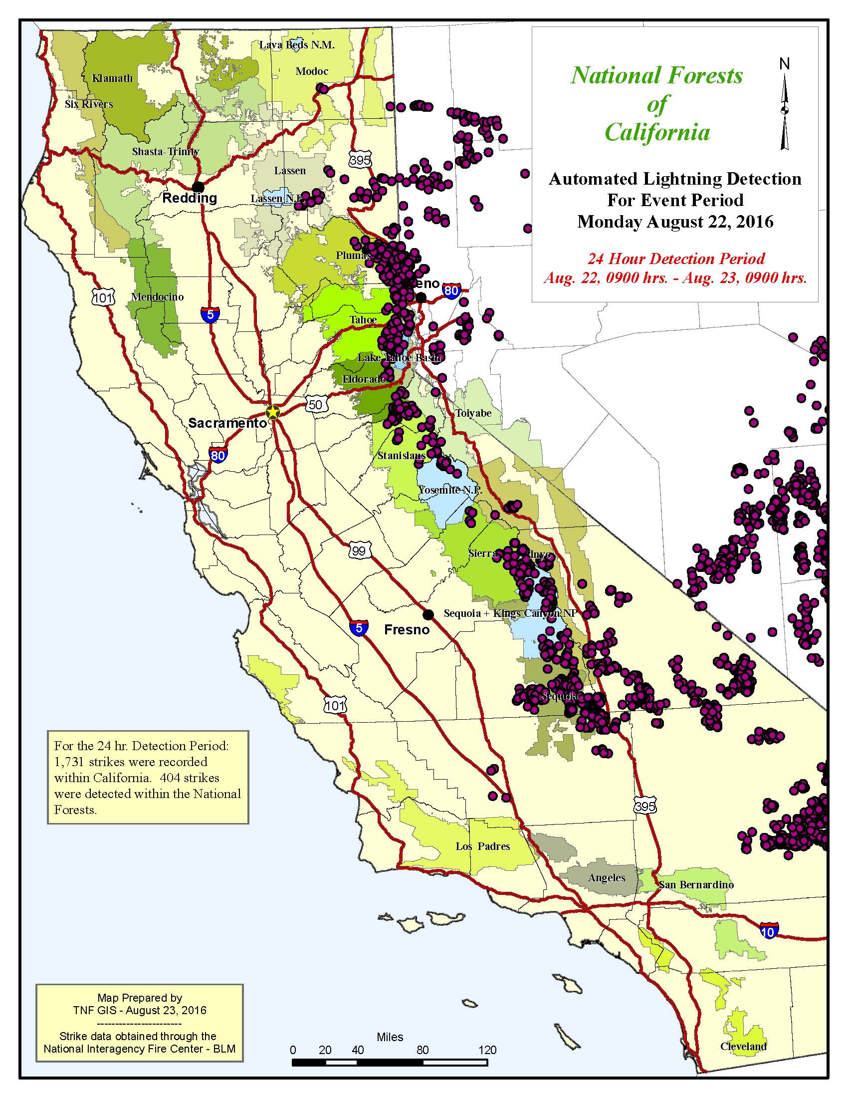
NEVADA CITY, Calif. August 23, 2016 – Lightning activity picked up on Monday with 1,731 recorded downstrikes throughout the state. The Sierra Nevada again functioned as the proverbial lightning rod, attracting the majority of the activity.
The lightning event caused several new fires, initial attack resources have been able to keep fires small. The Sequoia National Forest reports 5 new lightning starts, all are extinguished now.
Plumas, Tahoe, Eldorado, Stanislaus, Sierra and Inyo National Forests were the hardest hit, with a total of 404 strikes.

Locally, the Tahoe National Forest recorded 12 confirmed strikes, all in the Truckee Ranger District.
The fire weather forecast is somewhat encouraging: “The low pressure trough responsible for the recent thunderstorm activity has moved off to the east. A high pressure ridge in the eastern Pacific will be the dominant weather feature for the North Ops region today. A dry NW flow aloft will prevail today, although there is a chance of thunderstorms just to our SE over the central Sierra and across central NV. Warm and dry conditions will prevail today, with temperatures 2-5 degrees above normal and humidity dropping to 7-17% in inland areas. W to NW winds will gust to 25-30 mph from the Cascade-Sierra crest east, especially toward the OR state line. The north coast will also be dry with light offshore winds and poor overnight RH recovery while a deeper marine layer keeps the Bay Area marine zone cool and humid. From Tuesday through Friday a weak trough will be over the North Ops region. Dry and warm weather will continue. Temperatures will continue around 2-5 degrees above normal, with low humidity both in the day and at night in inland areas. Light offshore winds will continue to keep the north coast areas very dry, while a better onshore flow keeps the Bay Area marine zone cool and humid. On Saturday the weak trough will move east, but little change is expected in weather conditions. A stronger system to our NW beginning Sunday will cause increasing SW flow over the region, and S to W winds gusting to 25-30 mph will combine with low RH to increase fire potential a bit. A deeper marine layer will move farther inland, and the north coast will benefit from the cool humid air, as well.”
The Fuels/Fire Potential Outlook reads as follows: “Peak winds are expected to remain below High Risk criteria through Saturday, but may approach High Risk criteria east of the Cascade-Sierra crest beginning Sunday. Very dry conditions will continue in many areas, and with abundant warm sunny weather and locally gusty winds in some areas may cause holdover fires begin to spread. The dry and warm conditions will also lead to typical late August initial attack conditions in many areas.”