November 30, 2016 – Light rain possible today north of about Chico with light snow above about 4500 to 5500 feet. A few light showers over the Sierra crest Thursday. Breezy north winds and a little warming Thursday through Saturday. Light rain or showers over the northern mountains early next week, remaining dry elsewhere.
Short Term Discussion
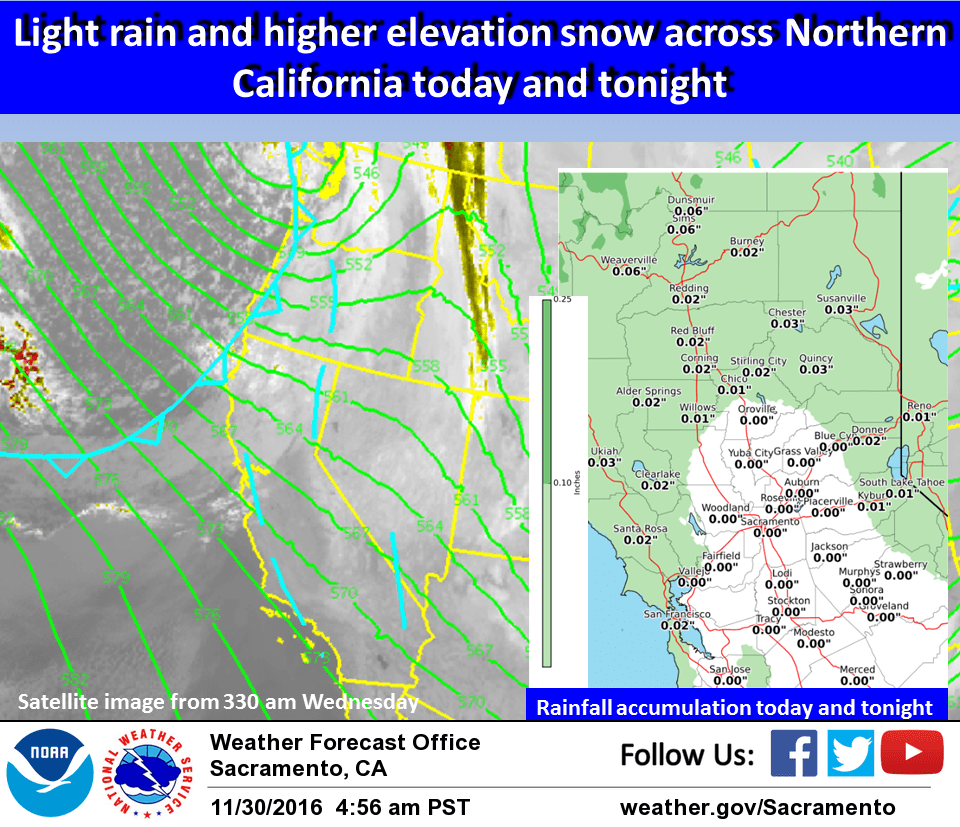
Tail end of weak Pacific frontal band now moving into the north state bringing spotty light rain showers northwest of about Redding. Cloud cover from this system extends southeast to about Marysville.
Clearer skies to the south has allowed light fog to from in the Sacramento area southward into the northern San Joaquin valley. Increasing cloud cover in this area should keep fog from becoming significantly dense later in the morning hours.
Temperatures in the valley this morning are in the mid 30s but the increasing cloud cover should also keep minimum temperatures at least a few degrees above the freezing mark.
Light rain will spread eastward as the front progresses but precipitation will likely remain over the northern half of the CWA and mainly over the mountains. Daytime highs under a cool airmass should remain several degrees below normal today. Upper level flow transitions to northwest by Thursday morning as the upper trough moves into the Great Basin. Shortwaves dropping into the trough in this northwest flow may bring a few showers to the northern Sierra. Clearer skies will allow for a little warming elsewhere.
Upper level northwest flow and a northerly surface gradient of about 10 mb from MFR to SAC will bring breezy north winds to most of the CWA Thursday and Friday. This wind and a warming airmass will bring temperatures up to right around normal for this time of year.
Winds will be on the decrease Saturday as the upper ridge centers over the west coast. Daytime highs Saturday will continue to warm reaching several degrees above normal and the warmest temperatures of the forecast period.
Extended discussion (Sunday through Wednesday)
Upper trough moves through Sunday into Monday bringing cooling, gusty wind over higher terrain, and a threat of light showers mainly over Shasta county and higher mountain elevations of Plumas County and the Northern Sierra Nevada. Temperatures cool to below normal Monday. Upper ridging moves through Tuesday into Wednesday bringing drier weather then a wetter system possible towards the end of next week.