August 6, 2017 – Showers and thunderstorms are possible over the next several days, mainly over the mountains. Near to a little above normal temperatures expected through the week.
Discussion
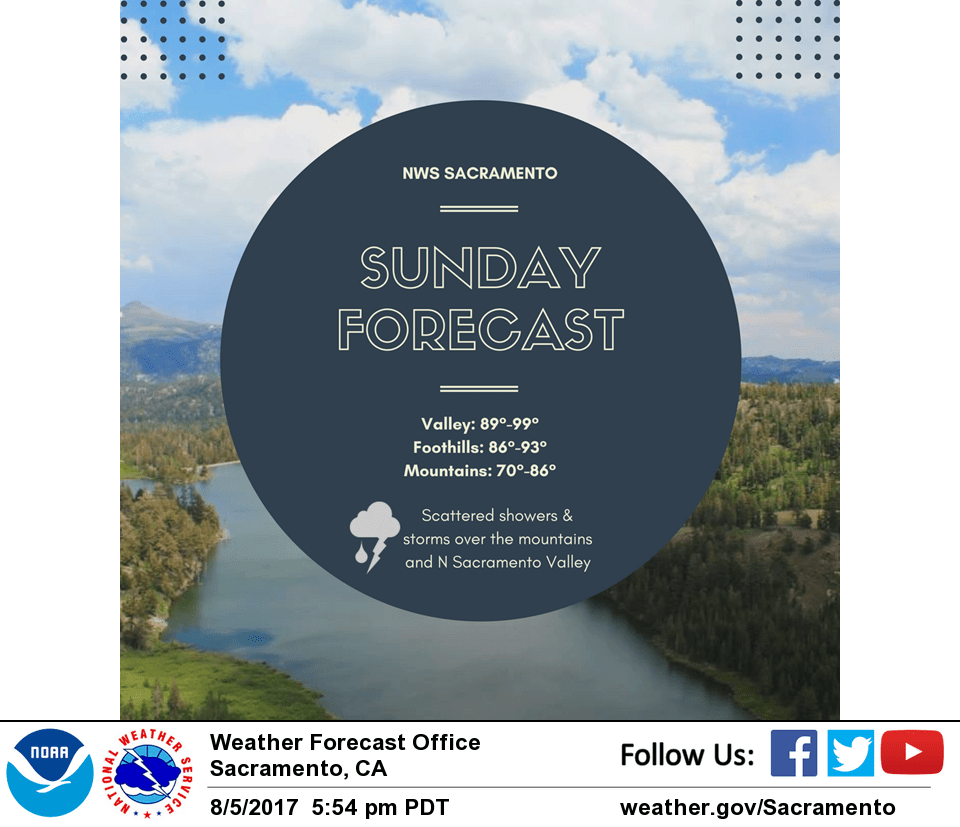
583 DM upper low centered about 125 NM SW of KUKI this morning with some ACCAS rotating across this feature across Interior NorCal. Marine layer has deepened to around 2000 ft in response to the low approaching. Flow through the Delta is strong attm and advecting marine air into the Central Valley. This combined with overall synoptic cooling is resulting in temperatures running about 2 to 7 degrees lower this morning. The low is forecast to slowly track inland today. Elevated instability progs along with synoptic lift point to a potential for isolated showers and thunderstorms, mainly this afternoon into evening over the Coastal, Shasta, and Western Plumas mountains. Highs today will be near normal with 90s in the Central Valley and 70s to lower 90s for the mountains and foothills.
Upper low forecast to linger over Interior NorCal Monday then retrogress slightly back off the coast Tuesday into Wednesday. This will keep a threat of mainly afternoon showers and thunderstorms primarily over the mountains. Slight warming expecting into midweek as upper low and associated synoptic cooling weaken.
Extended discussion (Thursday through Sunday)
A weak upper low over northwest California lingers into Thursday. This will bring just a slight chance of some showers and thunderstorms for the Lassen National Park to Burney Basin area. Elsewhere conditions should remain dry. Dry weather is expected across the area into the weekend as the ridge rebuilds with stable southwest flow. Onshore flow will keep overnight temperatures relatively cool in the valley. Daytime highs are forecast to be about 5 degrees above normal towards the end of the week, though extended models diverge some for the weekend. The latest European model has a shortwave trough brushing through northwest California, which could bring some cooler temperatures, while the GFS maintains a stronger ridge. Will go with the warmer, more consistent solution for now.