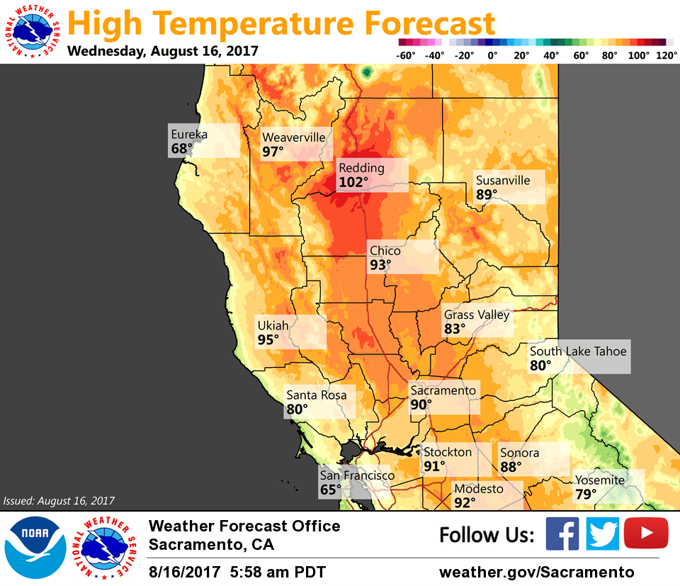
August 16, 2017 – Temperatures warming back to near or slightly above average. Slight chances for late-day mountain thunderstorms.
Discussion
Mostly clear skies across the region early this morning. Current temperatures are pretty similar to 24 hours ago and generally range from the lower 50s in the mountain valleys to around 70 across the warmest portions of the Central Valley.
Short-wave energy continues to drop down the front side of the ridge building into NorCal from the eastern Pacific. Enough lingering moisture/instability for another chance for afternoon thunderstorms over the mountains again today. Otherwise, warmer weather returns today with synoptic warming of the airmass and slackening of onshore flow.
Temperatures max out Thursday and Friday as the upper ridge peaks, then begin to taper a bit by the end of the week as weakness redevelops along the West Coast and onshore flow strengthens. Late-day thunderstorm chances continue over the mountains.
Extended discussion (Sunday through Wednesday)
Gradually cooling temperatures along with an increase in diurnal mountain thunderstorms possible early next week as weakness along the West Coast morphs into a closed low off the central California coast. Temperatures around average for mid-late August.