February 11, 2017 – Isolated light showers early this morning in the valley and western Sierra slopes. Otherwise, drier weather this weekend through early next week. Another round of wet weather arrives Wednesday into next weekend.
Discussion
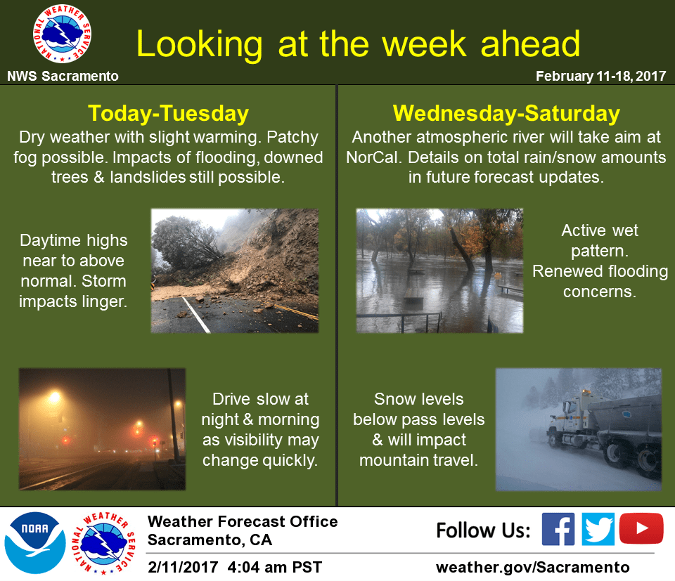
A much needed break from the rain will occur through the middle of next week. High water issues will remain a problem for some areas into next week so the flood warning was extended into Monday. Hillsides remain water logged and will take several days to dry out and become more stable.
High pressure over the region with valley temperatures warming into the 60s each day through Tuesday to the 40s and 50s in the mountains.
Previous Discussion
3 am radar shows some isolated light showers in the vicinity of Corning, Chico over to Bucks Lake down to Lincoln and Rocklin area. The latest HRRR run indicates these showers should dissipate within the next couple of hours. Then interior NorCal will finally gets a respite from the wet weather this weekend into the first part of next week. Breezy north winds will develop this afternoon in the valley with a few gusts to 25 mph, mainly along the I-5 corridor and westward.
Residents should note that even though precipitation is subsiding this weekend, many rivers and streams are running high while several dams are near capacity or overtopping. Flood concerns do not disappear when the rain ends, landslides and downed trees could also still occur in the next few days with the saturated soils.
High pressure ridge over the eastern Pacific will build into the Western U.S. and keep NorCal dry through Tuesday. Localized to areas of fog will be possible during the early mornings with abundant low-level moisture under generally clear skies and light winds. Daytime highs will be in the 60s across the valley into the foothills with 40s and 50s across higher terrain. Tuesday should be the peak of this subtle warming trend with much of the valley in mid to upper 60s.
Extended discussion (Wednesday through Saturday)
Dry conditions will persist through Wednesday as high pressure remains over the region. The return of another wet pattern is expected beginning Wednesday night. A Pacific front moves through on Thursday bringing periods of moderate rain, gusty wind and mountain snow. Snow levels will be generally above pass levels before lowering to 5000-6000 ft Thursday night and Friday. Scattered showers possible Thursday night into Friday in the post frontal unstable airmass. There is the potential for another storm by next weekend.