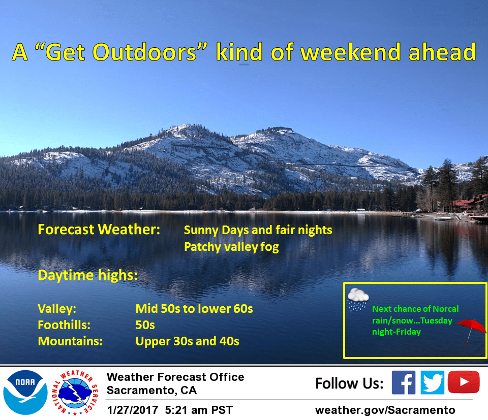
January 27, 2017 – Dry next several days with patchy valley fog. Wet pattern returns with light precipitation Tuesday night and Wednesday with heavier rain and mountain snow Thursday and Friday.
Short Term Discussion
An upper level high pressure ridge over the west coast will keep the forecast dry with warm daytime temperatures through the short term forecast period. Light northerly winds have kept fog formation in the valley to a minimum. Daytime highs today will come in a little below normal except in the northern Sacramento valley where continued light north winds and adiabatic warming will bring in daytime highs a little above normal.
Upper ridge axis shifts inland tonight bringing fair skies for cool overnight lows. Subsidence under the ridge may bring enough instability for some valley fog but light northerly winds will likely limit any fog to the valley from about Sacramento southward.
Saturday should be fairly similar to Friday with a little more warming most areas bringing highs up to near normal except the northern Sacramento valley again where the continued light north winds will bring temperatures in a few degrees above normal. Little change in the forecast for Sunday with fair skies and possible morning valley fog Sacramento area southward. Temperatures continue to warm a bit on Monday reaching at least a little above normal most areas.
Extended discussion (Tuesday through Friday)
Upper level ridge in place over northern California will begin to break down Tuesday as an upper level trough approaches from the eastern Pacific. Forecast models appear to be coming into better agreement related to progression of precipitation coming into the region. Scattered light rain and snow will begin, mainly for mountain areas on Tuesday night.
The heavier precipitation will move into the region Wednesday through Thursday ahead of a series of enhanced upper level lift. The upper level low will continue to spin over the west into Friday providing increased cloud cover and chances for rain and snow.