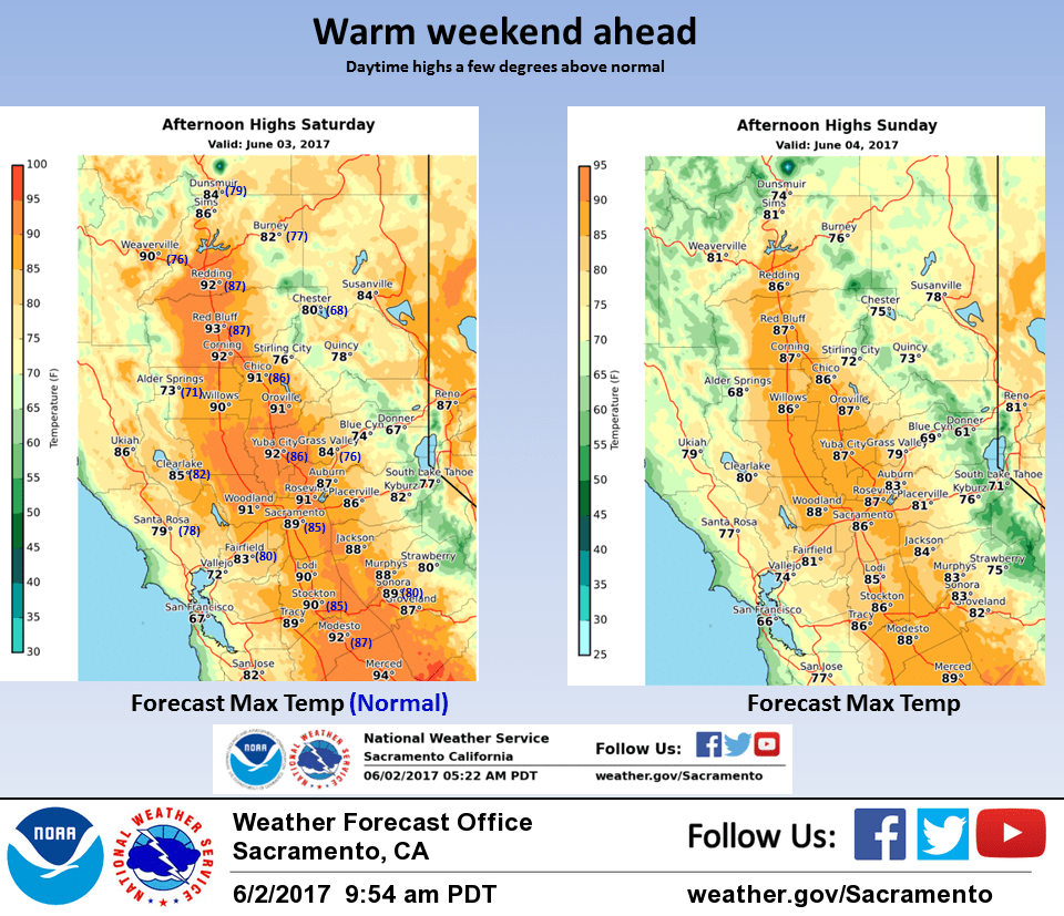
June 3, 2017 – Warm and dry weather through the middle of next week. Cooler with a chance of precipitation late next week.
Discussion
A broad upper level ridge is centered over the Great Basin, extending west over California. Some high clouds have moved over the region, and should remain over the area through about midday. Temperatures across the forecast area are running a few degrees warmer than 24 hours ago. A strong breeze is blowing through the Carquinez Strait into the Delta region, but the marine layer along the coast is now running below 1000 ft deep, limiting the amount of cooling.
Dry weather will continue across most of the forecast area through the weekend. An approaching upper trough will move through the Pacific Northwest tonight into Sunday. This system may bring just enough moisture and instability to bring a thunderstorm or two to the mountains of Shasta County, but the vast majority of convection is expected to remain farther north. This trough should also help to deepen the marine layer along the coast, as well as enhance onshore flow. It wouldn’t be surprising if a few coastal clouds make it inland into the Valley near Sacramento Sunday morning.
High pressure rebuilds over the Great Basin early next week, bringing another round of warmer than normal temperatures. Expect temps to rise into the 90s across the Valley, with 60s to 80s over the mountains.
Extended discussion (Wednesday through Saturday)
High pressure over the western U.S. will bring continued fair skies and warm temperatures Wednesday. The upper ridge axis is forecast to shift east a bit allowing for a slight bump in the delta breeze and a slightly cooler airmass for a slight drop in high temperatures.
Extended models coming together on idea of bringing tail end of weak frontal band through the far north state on Thursday. Models differ slightly on placement of precipitation but could see measurable rain as far south as about Red Bluff.
Otherwise, airmass will see a significant cooling as an upper low digs into the northeast Pacific. Should see highs Thursday dropping from 5 to 10 degrees from Wednesday.
Upper low pushes into the Pacific northwest on Friday so expecting daytime highs to remain a little below normal. Enough instability for a shower threat over the northern mountains and down the Sierra but at this time instability does not look sufficient enough for a thunderstorm threat.
Still more cooling expected on Saturday as the upper low center moves inland. Daytime highs Saturday are forecast to come in as much as 10 degrees below normal. Still looks like a shower threat for the northern mountains but again stability appears too limited for t-storms.