Above normal temperatures will bring areas of moderate heat risk to the Valley this week. Mountain shower and thunderstorm chances may return over the weekend. Rivers and creeks will continue to flow high, cold, and fast as a result of mountain snowmelt.

Discussion
Still a few thunderstorms ongoing across far northeast California early this morning, but skies are mostly clear over the remainder of the region other than some marine stratus working its way into far southwest Solano County. The marine layer is around 2-2.5k ft deep and enough onshore surface pressure gradient remains for perhaps a little stratus to briefly make it inland into the valley from about Lodi up to Sacramento this morning. Otherwise, current temperatures are running around 5-15 degrees cooler compared to 24 hours ago and range from the mid 40s to mid 50s in the mountains, to the mid 50s to lower 70s in the Central Valley (warmest at the north end of the valley).

The closed low will drift northward over the PacNW today allowing high pressure to build over NorCal. Deeper moisture and instability will also shift to the north. Onshore flow will wane today, but highs will likely be similar to Sunday’s, or perhaps a few degrees cooler
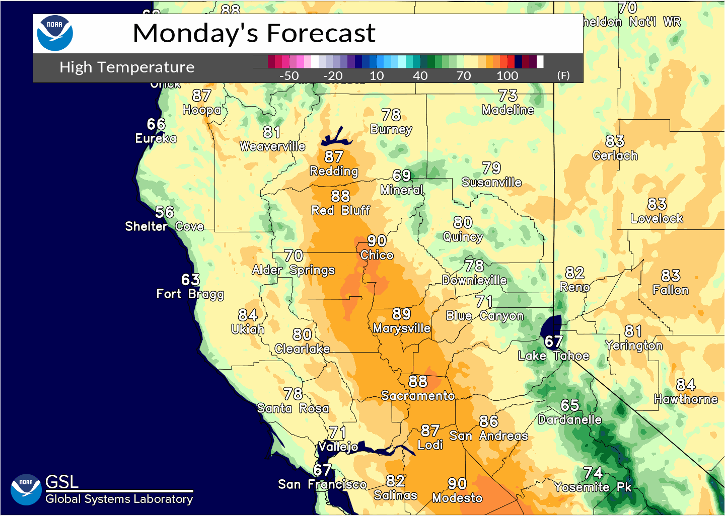
Warming returns Tuesday and continues through the week. Highs are expected to be in the lower to mid 90s in the Central Valley, and in the 70s and 80s over the mountains (about 10 degrees above average for mid-May). Some areas of moderate heat risk are expected in the valley. Overnight lows are also expected to be around 5-10 degrees above normal.
Extended Discussion (Friday through Monday)
Ensembles and clusters continue to favor ridging through the extended forecast period, with some weakening early next week. This will result in continued above normal high temperatures, with upper 80s to mid 90s in the Valley.
Areas of moderate heat risk will be possible across the central Sacramento Valley Friday and Saturday, becoming widespread late this weekend.

Afternoon showers or thunderstorms may develop over the higher elevations of the Sierra Nevada this weekend and into Monday given increased moisture. NBM advertises a 10-20% probability of thunderstorm development during that timeframe, especially on Saturday.