August 22, 2017 – Showers and thunderstorms possible the next couple of days, then dry weather returns for the end of the week. Temperatures around average thru mid-week, then warming for the end of the week.
Discussion
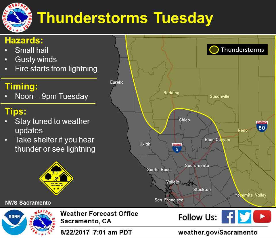
Plenty of moisture and elevated instability continues across NorCal as the upper low remains off the central California coast. Ripples embedded in the flow around the low continue to spark showers and thunderstorms – one moved across last evening and another is moving up from the southeast early this morning. Temperatures remain quite mild with the cloud cover, in the 50s in the mountain valleys with generally 60s and lower 70s elsewhere.
Convective activity becomes more extensive today with chances spreading to the northern mountains and northern Sacramento Valley by this evening as another wave moves up from the south. Red Flag Warning has been issued for northern portions of the state for potential for abundant lightning. Heightened concern for fire starts with holdover fires later this week as temperatures rise.
Temperatures will be near- average through mid-week as onshore flow continues. Breezy winds likely through the Delta with cooler temperatures in that vicinity.
Low moves onshore Thursday, opening up into a trough. Moisture and instability will decrease, ending chances for thunderstorms. Temperatures will begin to warm with highs topping out a few degrees above normal.
Extended discussion (Saturday through Tuesday)
Quiet weather pattern ahead for the long term forecast period starting Saturday. A stable upper level ridge of high pressure positioned over the west will provide clear skies and dry weather in place with above normal temperatures across northern California. High temperatures can be expected in the 90s/100s for the valley and foothills with 70s/80s in the mountains.