Dry and warm conditions are forecast to prevail through the week ahead. Temperatures will begin to warm on Thursday with continued warming next weekend with widespread triple digits in the Valley.

Discussion
Infrared imagery reveals clear skies overhead central and northern interior California this early morning. A well-developed marine stratus deck sits along the California coast, and is intruding inland to much of the Bay Area. With the marine layer depth just above 2,000 ft along with an onshore gradient 3.3 mb between San Francisco and Sacramento, can’t rule out some patchy stratus pushing into the Delta region through early morning.

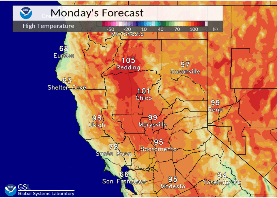
Main story over the coming days will be the upper level ridge over the Desert Southwest that will dominate our synoptic pattern. The week will start off with highs near normal in/around the Delta (upper 80s to middle 90s), and continued above normal temperatures in the northern Sacramento Valley (upper 90s to around 105 deg F).
Any shower/thunder chances in the mountains will generally remain to the east of the Sierra crest through at least the middle of the week. By Thursday, ensemble means depict the ridge building westward toward the Central Valley, by which point widespread triple digit heat seems likely for most Valley communities. Continued warming is likely in the extended.
Extended Discussion (Friday through Monday)
The Desert Southwest ridge will continue to strengthen and build over western Nevada and eastern California through the rest of the week and into the weekend. Latest ECMWF ENS mean 500 mb geopotential heights exceed 597 decameters for a significant portion of the Golden State by Saturday with the maxima near 600 decameters.
It’s noteworthy that the latest run of the National Blend of Models already gives Redding a 60 percent and 73 percent chance of exceeding 110 deg F next weekend Saturday and Sunday, respectively. Redding has already observed 10 consecutive days at/above 100 deg F, and looks like we’ll easily add at least 8 more days on top of the current streak.
The forecast heat risk reaches widespread high category by Saturday and areas of very high risk by Sunday. Will have to keep a close eye on the extended forecast as excessive heat potential is becoming more and more likely.