March 23, 2017 – Dry day today then rain and mountain snow returning tonight and Friday. Sierra snow impacts likely late tonight into Saturday. Brief break in precip mid weekend but more precipitation early next week.
Discussion
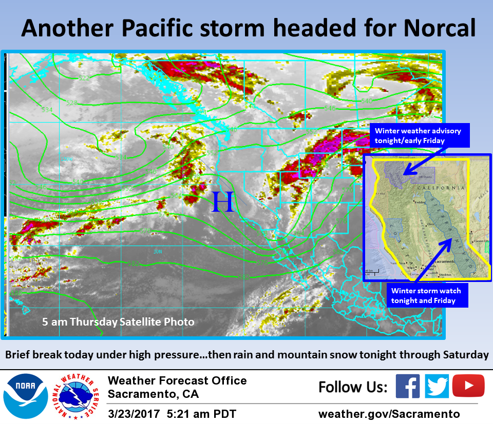
Radar is clear this morning as upper trough shifts farther into the Great Basin and high pressure builds over the state. Enough clearing has occurred to allow some patchy fog to form in the valley this morning. Once this fog clears, skies should be generally fair most areas today with daytime highs warming to just a bit below normal. Upper ridge axis quickly shifts eastward into the Great Basin tonight with the next upstream frontal system pushing into NorCal by this evening.
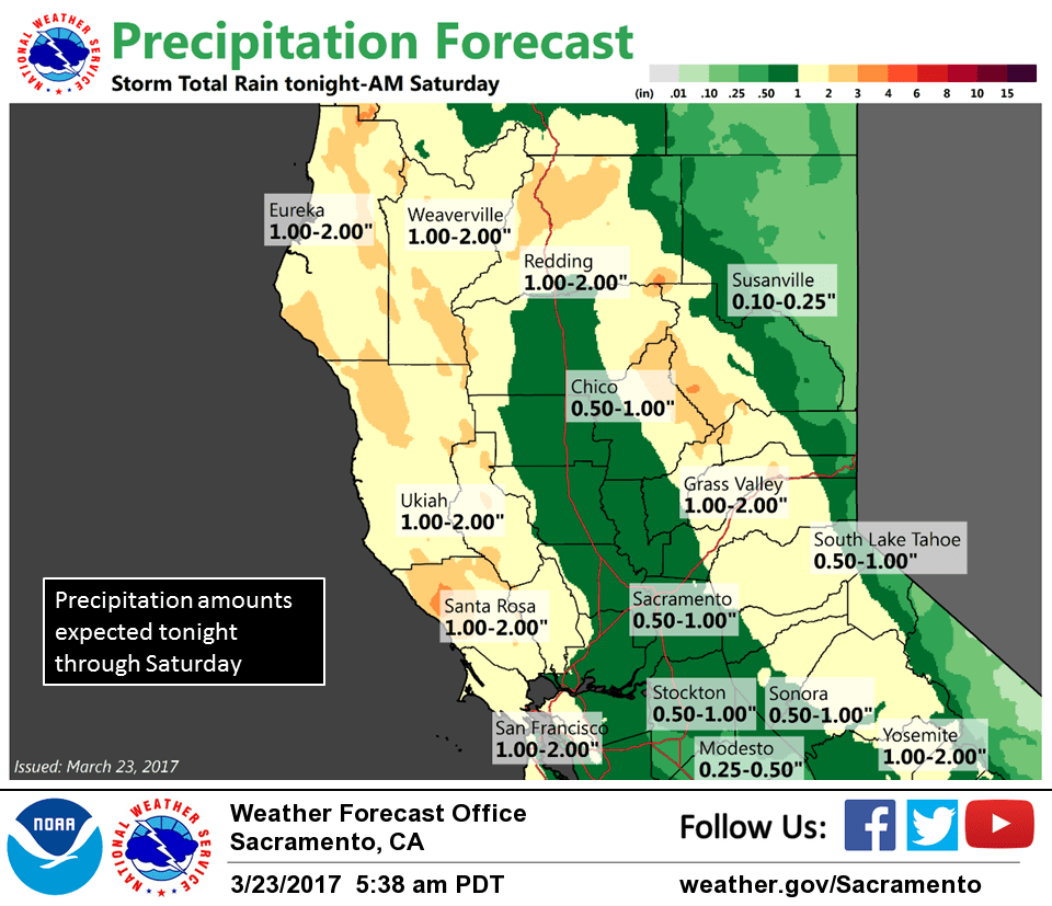
A moderate precipitable water plume associated with this system will bring moderate amounts of precipitation on the order of a half to an inch of rain in the valley and up to a couple inches over the higher terrain between late tonight and Saturday. Moderately high snow levels will mean impacts for Sierra Travel and have issued a winter weather watch for Sierra zones. At this time, snow amounts appear will come in at high advisory or low warning amounts so will have to see how subsequent QPF forecasts pan out.
Most precip from this system will end Saturday morning as the front shifts east of the state but a few showers will continue Saturday as NorCal remains under cyclonic flow behind the upper trough axis.
Early Sunday looks dry under upper level ridging so likely to see some patchy valley fog again Sunday morning. Another quick moving system brings overrunning precipitation into the north state by Sunday afternoon. A fairly weak frontal system is forecast to bring light precipitation to the forecast area Sunday night.
Extended discussion (Monday through Thursday)
Lingering showers over Interior NorCal Monday as upper trough moves through then drier weather expected Tuesday and Wednesday under upper level ridging. Models suggest another short wave trough will bring a threat of some precipitation mainly over northern and eastern portions of the forecast area Thursday.