July 13, 2017 – Not as hot the next couple of days then hotter again this weekend. Slight chance of thunderstorms along the Sierra crest this weekend.
Discussion
Clear skies across interior NorCal early this morning. Current temperatures are running slightly milder compared to 24 hours ago and generally range from the mid 40s to lower 50s in the mountain valleys to the 60s to mid 70s elsewhere.
Little change expected in the weather across the region today and Thursday. Satellite imagery shows some moisture beginning to impinge on the southeast corner of the forecast area, and we may finally see a few storms pop along the Sierra crest south of Tahoe later today.
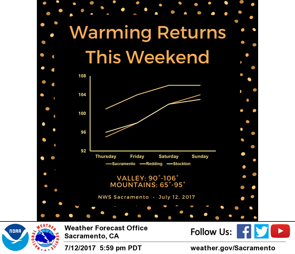
A warming trend is expected Friday into the weekend as an upper ridge over the Four Corners builds westward. Triple digits will be possible across the valley with moderate heat risk for sensitive groups possible over the weekend. Daytime highs will be around 10 degrees above average during this period. Thunderstorm risk may expand northward along the Sierra crest on Saturday.
Extended discussion (Monday through Thursday)
A weak trough breaks down the ridge for the start of next week with temperatures back within a degree or two of normal through Wednesday. Onshore flow should keep the Delta Breeze going with afternoon temperatures in the 80s in that area. Monsoonal moisture remains shunted to the SW portions of the state, so have kept with dry forecast through the period.