Hot dry weather today with areas of smoke, then near-normal temperatures are forecast for Sunday. Gradual warming trend will begin Monday with temperatures becoming 5 to 15 degrees above seasonal normals.
Discussion
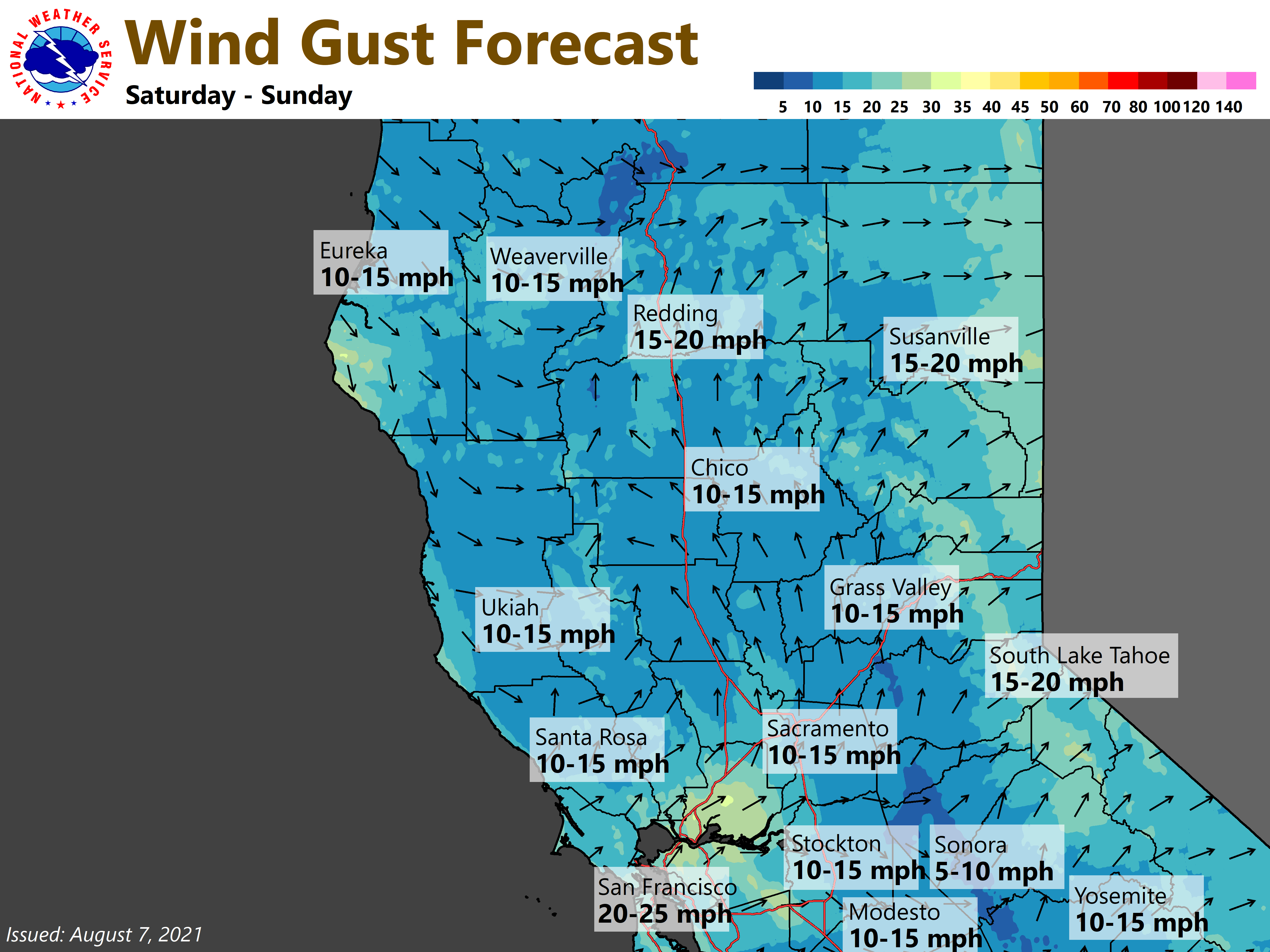
Smoke will continue to impact the region today but there is some good news. The winds will shift this afternoon from northerly to southwest to west direction. This will help to start to improve conditions. Gradual clearing is expected of the smoke covered skies but probably not until tonight.
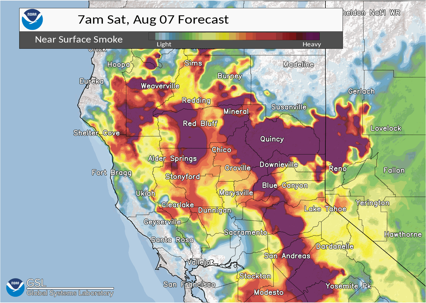
A stronger Delta breeze later in the afternoon and tonight will help clear the surface level smoke as well. By Sunday conditions should be greatly improved over the interior.
For today areas of visibilities are currently 2 to 5 miles in the valley with 1 to 4 miles in the foothills and mountains. Conditions should start to improve this afternoon.
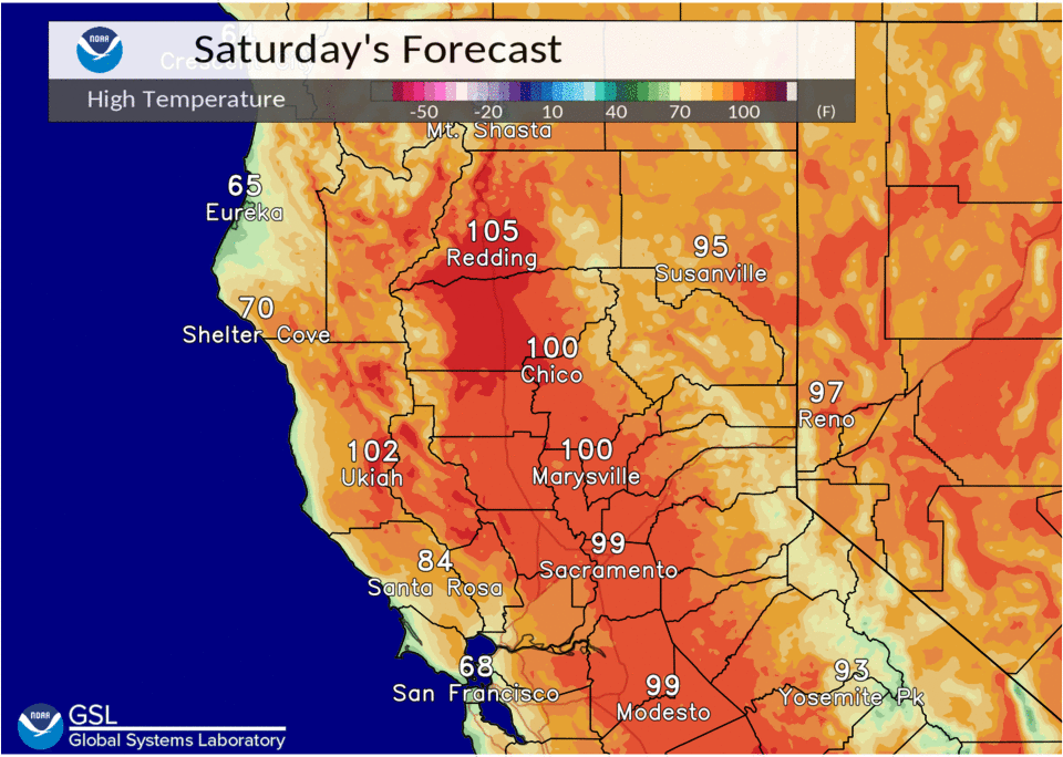
A low pressure area will move through the Pacific Northwest tonight and Sunday that will shift the winds and bring us a stronger Delta Breeze. This will also help to cool temperatures for Sunday which looks like it will be the coolest day of next week. A ridge of high pressure will then build heating temperatures up each day with temperatures mainly becoming 100 plus throughout the central valley by Tuesday.
Extended Discussion (Wednesday through Saturday)

Strong high pressure will remain in place with places well inland away from the Delta warming into the 105 to 112 range in the central valley. Temperatures will be hot in Sacramento as well but daily changes to the Delta Breeze should mainly keep us in the upper 90s to 105 degrees range during this period.
A weak low will move into the Pacific Northwest late next weekend that should help to bring some cooling to the interior.
The one thing that we will have to monitor is for possible Thunderstorms moving back along the crest by the middle of next week. Models are not indicating any precipitation so have left any mention out for now.