December 9, 2016 – Wet pattern continues going into the weekend as more weather systems move through northern California. High snow levels expected. A brief break in the wet pattern early next week except for northern most areas. Periods of rain and high elevation mountain snow returning by next Tuesday then continuing through the end of the week.
Discussion
Moist zonal flow continues over the western U.S. A short wave within this zonal flow is bringing a few light showers over the Sierra and foothills at this time. Snow levels are quite high at above 8000 feet due to warm advection ahead of a weak front now just off the coast.
Some fog has formed in the central valley this morning but extensive cloud cover should keep this from becoming significantly dense. The weak system moving through the north state today will bring continued periods of precipitation but qpf amounts area not exceptionally high and snow levels should remain mainly above pass levels. Therefore, impacts should remain relatively minor today.
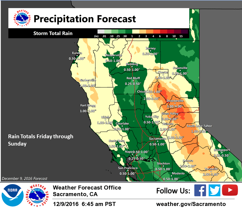
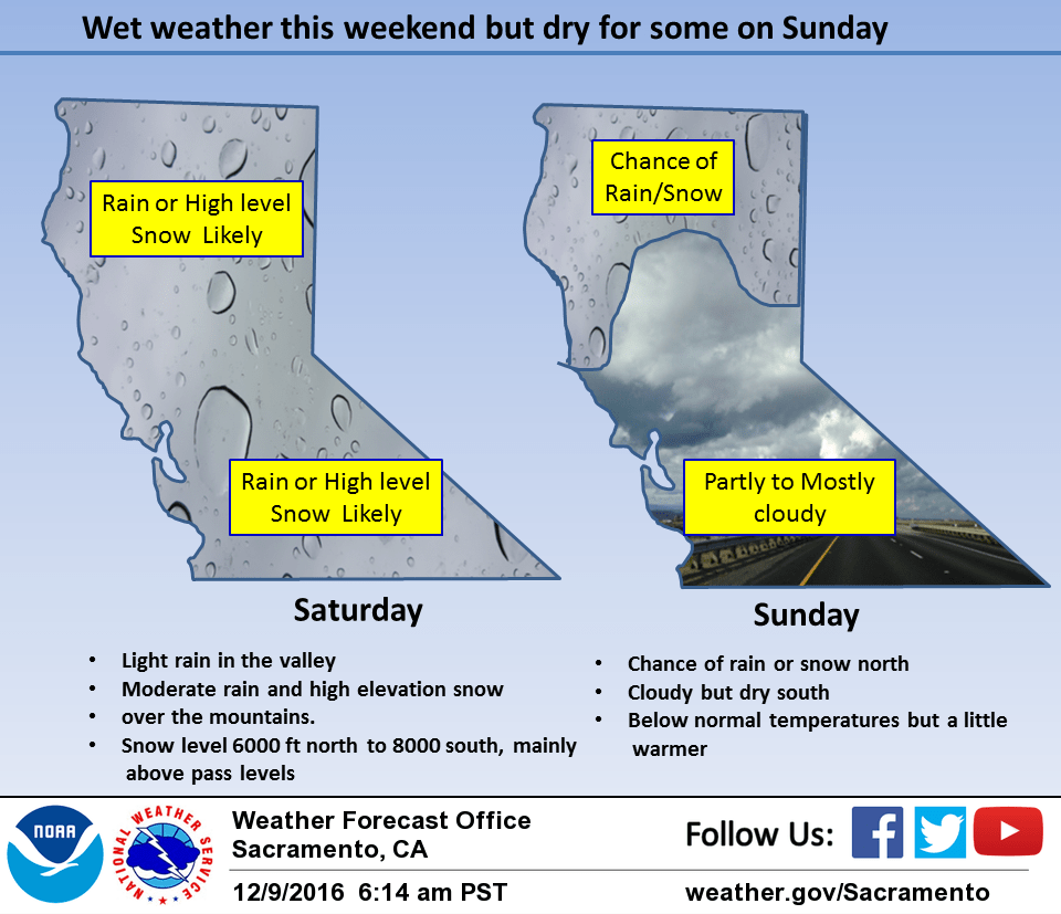
A more significant disturbance is expected to move through the region on Saturday continuing the wet weather pattern. Overall precipitation totals in the valley will stay fairly low but orographics over the Sierra will bring moderate precipitation there. Again, snow levels should remain above pass levels so impacts will be limited.
A slight upper ridging over the west coast on Sunday should shift the precipitation line northward. This should bring a break in the wet pattern for much of the forecast area except for the northern counties. Precipitation remains over the northern zones on Monday under a slight upper ridging.
Snow levels lower Sunday and Monday but should remain above the lower passes where precipitation is expected. Cloud cover and cooler airmass will keep daytime highs a little below normal.
Extended discussion (Tuesday through Friday)
Pacific moisture plume will bring precipitation into the area Tuesday into Wednesday, focused over the northern Sierra. Snow levels will initially be below pass levels, then rise above them during the day Wednesday. This could bring some travel impacts in the mountains. Models diverge after Wednesday, with high uncertainty on timing of following systems. Will keep general chances of precipitation through the extended, though there will likely be breaks at times. Late in the week there are hints of a cold system with low snow levels, but timing and precipitation amounts are uncertain.