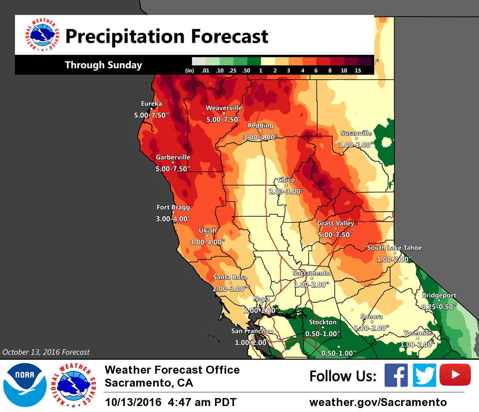
October 13, 2016 – A series of weather systems will bring periods of rain (heavy over the mountains) and gusty winds through early next week.
Wind Advisory from 3 PM this afternoon to noon PDT Friday for Burney Basin / Eastern Shasta County-Central Sacramento Valley- Northeast Foothills/Sacramento Valley-Northern Sacramento Valley- Shasta Lake Area / Northern Shasta County-Western Plumas County/Lassen Park.
Discussion
Light precipitation has begun overnight across far northwest California with generally light winds along with increasing mid and high clouds further inland across interior NorCal. Temperatures are on the mild side, generally in the 50s and 60s.
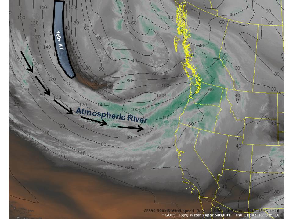
Today will remain dry for most of the forecast area, though the northern mountains will likely see some light precipitation. Satellite imagery shows a Pacific basin-wide moisture plume originating from Typhoon Songda feeding into this frontal system. NAEFS ensembles continue to show record-level Integrated Vapor Transport (IVT) values with this wave, suggesting a very strong atmospheric river event, and strong consensus among the models.
The first wave will primarily impact the region tonight into Friday bringing a period of heavy precipitation along with gusty southerly winds. Wind and water-related impacts are the primary concerns, as snow levels will remain high.
Gusty winds to 30-50 mph across portions of the Central Valley are likely to bring down small branches and weakened trees, causing local power outages. Winds this gusty are also likely to blow around loose objects, including Halloween decorations.
Urban ponding of water on roads is likely during periods of high intensity rainfall. The Friday morning commute across the Sacramento area is likely to be very slow as rain spreads inland through the valley. Clogged drains and gutters are also possible as rain and wind bring down tree leaves.
Weather becomes more showery the latter half of Friday into Saturday before the next wave arrives Saturday night into Sunday night. This second wave will also have the potential to bring more heavy rain and strong gusty south winds. Snow levels will lower a bit bringing the potential for some significant snow accumulation along the crest of the northern Sierra and over the higher elevations of Mt Lassen.
Extended discussion (Monday through Thursday)
Wave pushes east of the area Monday with decreasing threat of showers. ECMWF then swings another weak disturbance across far northern portions of Interior NorCal Tuesday with some light QPF, while the GFS/GEM keep precip NW and N of CWA. Upper ridging gradually increases through midweek leading to a warming trend with high temperatures returning to near normal by Thursday.