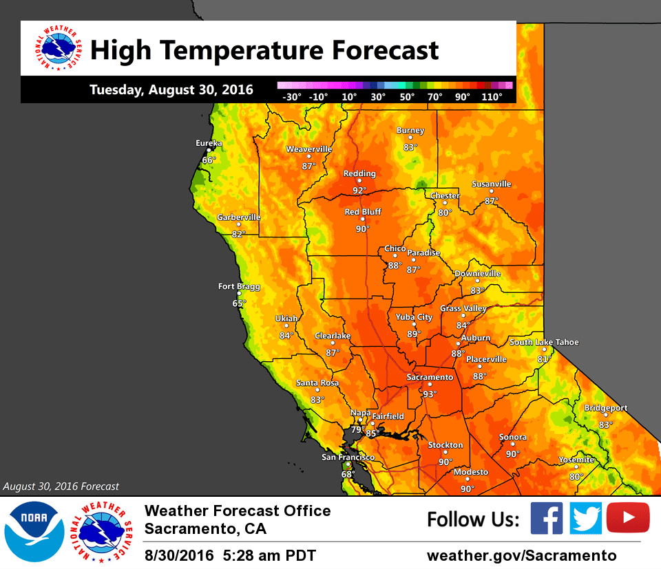
August 30, 2016 – Dry weather with below average temperatures this week. Locally breezy at times.
Discussion
Mostly cloudy skies across interior NorCal early this morning as high-level moisture moves northward ahead of the low off the BC coast. Steady onshore flow continues through the Delta with winds gusting above 20 kts at KSUU, but the increase in cloud cover is resulting in milder temperatures across most of the area.
Satellite imagery shows the short-wave presently off the NorCal coast which will move rapidly across far northern California this morning. Forecast soundings show plenty of moisture above 500 mbs, but dry below, and only minimal elevated CAPE. Expecting the most we’ll see will be abundant virga.
Trough deepens along the West Coast through the remainder of the week as the low is forecast to eventually make it southward into the PacNW by Friday. Dry weather expected with below average temperatures and locally breezy southwest winds.
Extended discussion (Saturday through Tuesday)
NorCal will be under the influence of a longwave trough axis overhead through the weekend. This will continue below normal temperatures. No precipitation expected. By the end of the weekend into early next week, the trough axis pushes east into the Great Basin and ridging may gradually build in, bringing a warming trend in temperatures and more northerly flow.