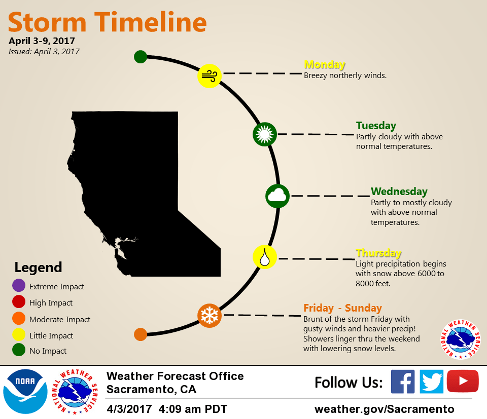
April 3, 2017 – Dry and warm weather continues through Wednesday. Some afternoon breezes today. Wet weather returns Thursday with a wetter storm Friday into the weekend, potentially bringing heavy mountain snow and strong winds.
Discussion
Skies have mostly cleared out across interior NorCal as a strong vort slides southeastward across northeast California early this morning heading into Nevada. Available moisture across NorCal is very limited, so the threat for showers will remain well east of the area. Current temperatures range from the mid 20s to mid 30s in the colder mountain valleys to the mid 40s and 50s elsewhere.
Upper ridging re-amplifies today behind this wave returning some gusty northerly wind to the region. Local downslope warming will be offset by stronger low level cold-advection resulting in a net average of about 5 degrees of cooling across the area compared to Sunday.
Gradual airmass warming into mid-week with the upper ridge transiting the region will result in slightly warmer temperatures Tuesday and Wednesday. Some increase in mid and upper level clouds ahead of the approaching late-week trough may temper the warming trend a bit.
Models continue to be in generally good agreement returning shower chances to the northern half of the forecast area on Thursday as the initial wave lifts out across far northern California ahead of the stronger system for late-week.
Extended discussion (Friday through Monday)
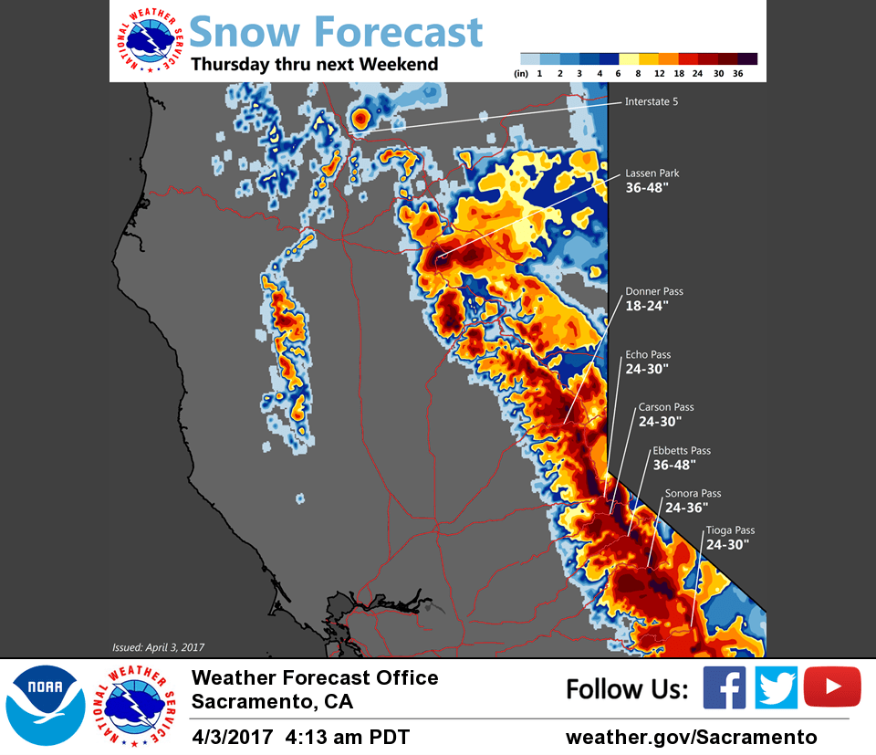
Return to a wet pattern for the extended forecast. After the first storm wave on Thursday, a stronger storm wave arrives early Friday morning and continues into the weekend. Expect moderate to heavy precipitation across interior NorCal throughout the day on Friday with strong winds as the brunt of this storm tracks across our region. Precipitation will be lighter on Saturday and Sunday with lighter winds.
Snow levels will be around 6000 ft early Friday but will lower as the weekend progresses. Snow levels by Saturday morning are forecast to be around 4500 ft lowering to around 3000 ft by Sunday morning. However, keep in mind that precipitation amounts will be much lighter by Sunday.