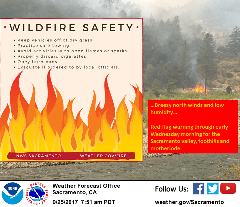
September 26, 2017 – Breezy north winds today through early Wednesday for increased fire danger. Remaining warmer than normal through the end of the week with lighter winds. A little cooler over the weekend.
Red Flag Warning until 7 AM PDT Wednesday for Carquinez Strait and Delta-Central Sacramento Valley in Glenn, Colusa, Yuba, Northern Sutter, and Butte County Below 1000 Ft-Eastern Mendocino NF-Eastern Portion of Shasta/Trinity NF-Lake County Portion of Lake-Napa-Sonoma Unit-Northern Motherlode From 1000 to 3000 Ft. Includes portions of Nevada-Yuba-Placer-Amador and ElDorado Units-Northern Sacramento Valley to Southern Tehama County Line Below 1000 Ft-Northern Sierra Foothills from 1000 to 3000 Ft. Includes portions of Shasta-Trinity and Butte Units- Northern Sierra Including Lassen NP and Plumas and Lassen NF/S West of the Sierra Crest (West of Evans Peak-Grizzly Peak- Beckworth Peak)-Northern Sierra Including the Tahoe and ElDorado NF/S West of the Sierra Crest-Southeast Edge Shasta-Trinity NF and Western Portions of Tehama-Glenn Unit-Southern Motherlode From 1000 to 3000 Ft. Includes portions of Calaveras-Tuolumne Unit-Southern Sacramento Valley in Yolo-Sacramento Far Western Placer, southern Sutter and Solano County Below 1000 Ft- Stanislaus NF West of the Sierra Crest.
Discussion
Temperatures running a few to several degrees warmer than 24 hours ago as high pressure continues to build over the eastern Pacific. Overall airmass warms a few degrees today so expect daytime highs to come in a few degrees above Monday and about 5 degrees above normal for this time of year. Combination of northerly flow aloft and moderately tight surface gradient will bring another day of breezy north winds. RDD to SAC gradient also higher than 24 hours ago so expect the north winds to be a little higher today. Combination of breezy north winds and low RH continue to bring increased fire danger so Red Flag warning will remain in place through Wednesday morning. Upper level ridge is forecast to center over the west coast by Wednesday afternoon bringing a slight warming trend and lighter surface gradients so should see lighter winds by the afternoon hours. Weather pattern changes little on Thursday as the upper ridge slides slowly eastward over the region. An upper low pushing into the Pacific Northwest is forecast to displace the upper ridge into the Rockies on Friday. This will bring daytime highs Friday down to near normal. At this time, it appears any precipitation associated with this low pressure system will remain north of the forecast area.
Extended discussion (Saturday through Tuesday)
The extended forecast is now trending cooler for the weekend as a trough moves through Saturday, potentially followed by a deeper trough early next week. Extended models have struggled with consistency, so confidence has lowered. Current forecast now projects below normal temperatures for Sunday into Monday, with Valley highs in the low 80s, along with breezy northerly winds. Have introduced a slight chance of rain Monday and Tuesday, mainly for northern Shasta County. May need to expand this further if deeper trough solution trend continues.