December 2, 2016 – Breezy north winds continue today with winds decreasing on Saturday. Morning low temperatures will be chilly, with warming daytime temperatures into the weekend. Light showers and cooling temperatures Sunday into Monday mainly north of Sacramento and over the northern Sierra. Turning much colder Tuesday through mid week. Valley minimum temperatures dropping to near freezing Tuesday through Thursday. A chance of rain or mountain snow again by the end of the week.
Short Term Discussion
Breezy north winds today with surface gradient from MFR to SAC about 8 and 1/2 mb this morning. These winds have kept temperatures this morning up a few to several degrees higher than 24 hours ago.
Upper ridging over the west coast will bring warmer temperatures today with daytime temperatures climbing to a bit above normal for this time of year. Surface high pressure forecast to drop into the Great Basin tonight allowing the northerly surface gradient to decrease a bit while easterly gradient over the Sierra keeps breezy winds going there tonight.
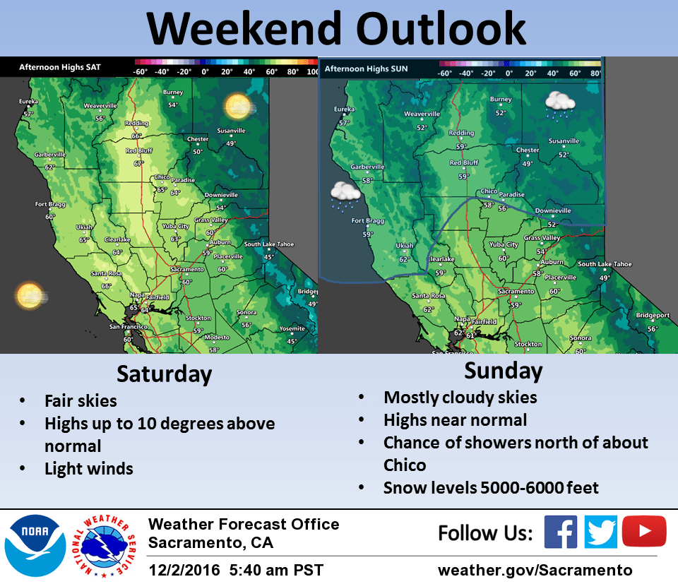
Lighter winds tonight may allow temperatures in the valley to cool a bit tonight while a warming airmass allows mountain temperatures to climb a bit. High pressure pushing in over the southwest U.S. will bring some warming most areas Saturday under mostly fair skies. Daytime highs Saturday will be the warmest of the week and in some cases up to 10 degrees above normal.
Surface gradients drop off significantly Saturday night. Despite drop off in winds, overnight lows should come in similar to Friday night lows as airmass continues to warm under the ridge.
Upper ridge begins to flatten on Sunday as a shortwave trough off the Pacific pivots into the Pacific Northwest. Impact for most areas will be cloud cover and a significant drop in daytime highs although maximums will are still expected to be a bit above normal. Areas north of about Chico will also see a chance of light rain.
An upper low dropping out of the Gulf of Alaska will usher in much colder air into the region on Monday as well as bring a chance of rain and mountain snow into the northern portions of the CWA as well as the northern Sierra. Snow levels will drop in the colder airmass with snow levels down to around 3000 feet in Shasta county. Cloud cover and colder airmass will bring daytime highs Monday down to several degrees below normal.
Extended discussion (Tuesday through Friday)
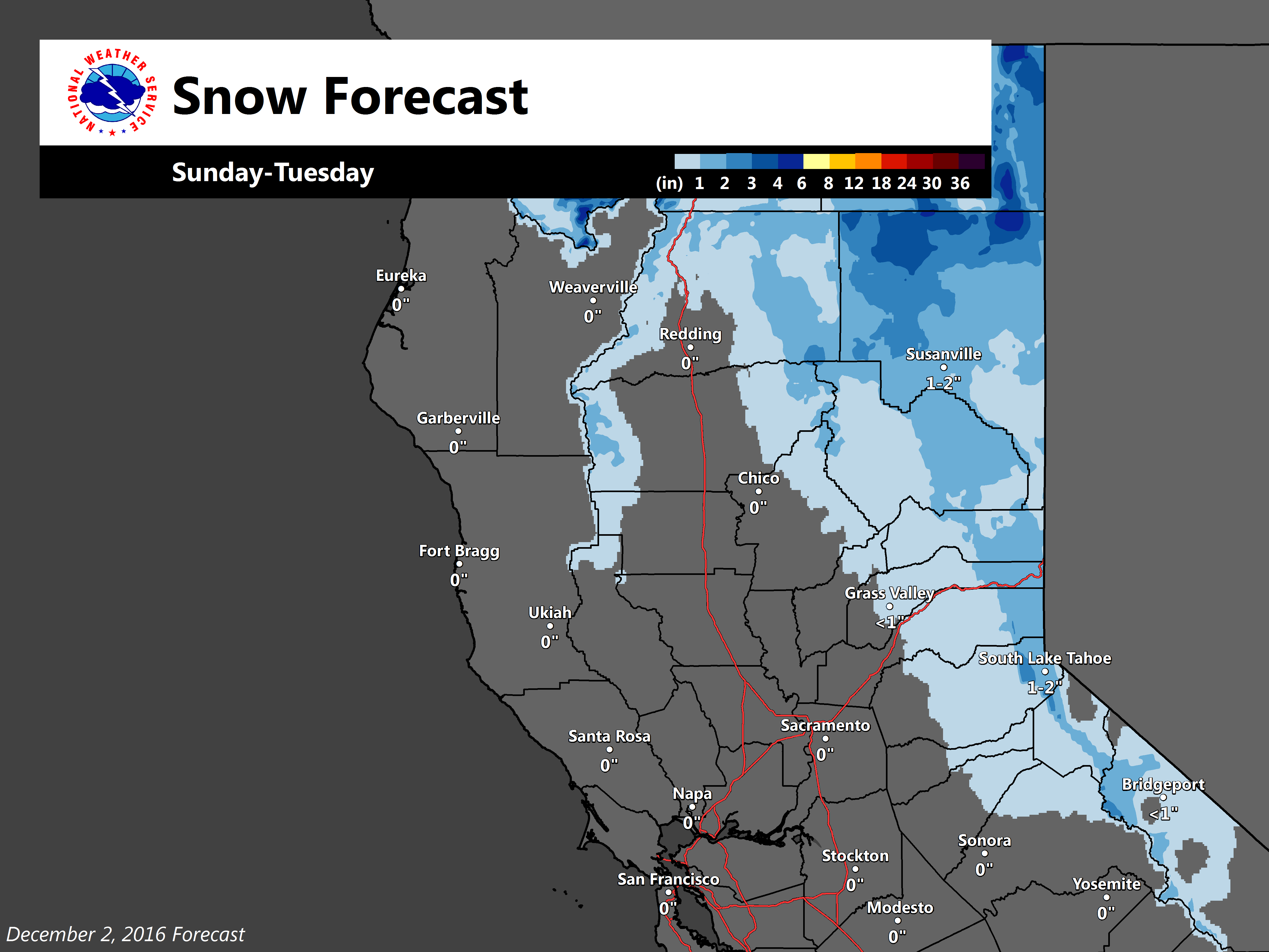
A longwave trough of low pressure will rotate through the upper CONUS and bring cooler conditions to northern California with some chances for precipitation Tuesday. Light rain for the northern portions of the Sacramento valley are possible with light snow for the Sierra and northern mountains. Accumulations less than an inch are expected at this time Tuesday for elevations higher than 1500 feet.
ECMWF and GFS models indicate different amplitudes in the upper flow pattern Wednesday and Thursday, but the general consensus is a shortwave ridge of high pressure will create dry weather Wednesday for much of the forecast area.
Differences in timing of precipitation associated with the progression of the next upper level disturbance create uncertainty of precipitation for the latter end of next week, but the best chances for precipitation look to be Thursday into Thursday night at this time. High and low temperatures for the middle of next week will range between 5 and 10 degrees below normal for this time of year, with some morning low temperatures at or below freezing.