December 1, 2016 – Breezy north winds Today and Friday. Dry except isolated Sierra crest showers possible this morning. Winds decreasing slowly on Saturday with daytime temperatures warming to above normal. Light showers possible Sunday into Monday then turning much colder Tuesday through mid week. Valley minimum temperatures dropping to near freezing Tuesday and Wednesday.
Short Term Discussion
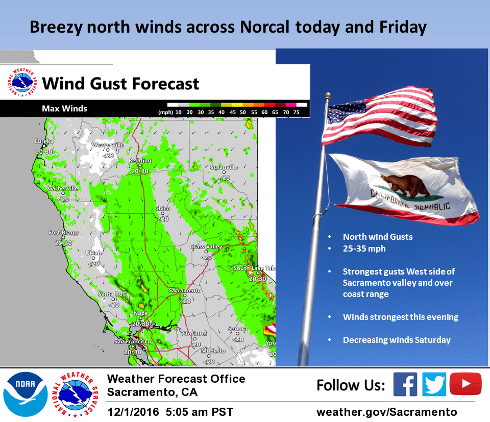
The upper trough which brought light precipitation to much of Norcal on Wednesday has moved into the Great Basin. GFS and NAM models show light precipitation in the Tahoe area this morning so a slight threat of precipitation along the Sierra crest in this area is reasonable. Surface gradient from MFR to SAC this morning is over 7 mb and increasing. Upper level flow and support is forecast to become more northerly today bringing an increase in northerly winds over the CWA. Northerly surface gradient maxes out this evening with about a 10 mb surface gradient predicted by NAM and GFS from MFR to SAC.
Look at high res models indicates sustained wind speeds in the valley at around 20 knots with gusts up to around 35 knots based on 925 mb windspeed progs. This puts wind speeds just under advisory criteria although brief periods of stronger winds are likely.
Temperatures warm slightly today under building ridge close to near normal for this time of year. Northerly surface gradients weaken slightly on Friday as the surface high shifts into the Great Basin. This brings surface gradient to more northeast for an increase in northeast winds over the Sierra. More warming under the ridge will bring daytime highs up to above normal Friday.
Surface gradients take a significant drop off on Saturday with more warming. Daytime highs Saturday will be the warmest of the week reaching several degrees above normal. Upper ridge breaks down a bit on Sunday as a Pacific system pushes through the Pacific Northwest. This will bring a turn to more onshore flow, cooler temperatures and a chance of showers north of interstate 80 and over the Sierra Cascade range. Precipitation amounts with this system will be light with moderate snow levels.
Extended discussion (Monday through Thursday)
A positively tilted upper level trough of low pressure and strong associated jet stream flow is forecast to enter northern California for the start of next week. This weather making system will bring increased cloud cover, cooler temperatures, and chances for rain and mountain snow. High and low temperatures will range between 5 and 10 degrees below normal, with some Valley locations reaching the freezing point in the lower 30s.
Snow levels will range between 1500 feet for the northern mountains to 2000 feet for the Sierra, but only light accumulations between 1 and 3 inches of snow are expected Monday through Tuesday.
A shortwave ridge of high pressure will provide dry weather for northern California as showers taper off Tuesday through Wednesday. Model solutions begin to diverge for later next week, although current consensus is a stormy pattern will bring more wet weather to the forecast area.