March 30, 2017 – Weak front will bring light rain and snow to NorCal today with lowering snow levels. Gusty north winds are likely Today and Friday. Seasonably dry weather anticipated for Saturday with chances for light rain over the mountains late Sunday and Sunday night.
Discussion
IR satellite imagery shows back edge of weak frontal band moving across the north coast at this time. Precipitation amounts across the north state with this system have been quite light and generally a tenth inch or less except over the Sierra were orographics have squeezed out a few tenths. A shortwave trough pivoting through southwest flow ahead of the front has brought isolated thunderstorms southeast of Redding but this storm should dissipate as it moves into the mountains.
Any precipitation threat should end by this afternoon as the upper low shifts into the Great Basin except over the Sierra where rap around moisture may bring a few lingering showers. Snow levels should drop from over 8000 feet this morning to below 5000 feet this afternoon but limited precipitation should limit impacts.
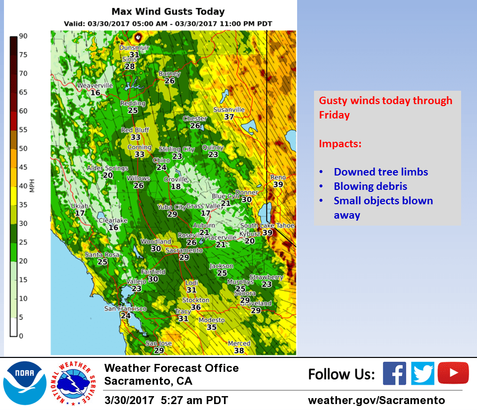
Cooler airmass behind the front will bring down daytime highs today to near normal for this time of year. Northerly flow between upper low moving eastward and upper ridging over the eastern Pacific will bring breezy to gusty north winds across the north state. Surface gradients this afternoon through Friday are forecast to run between 8 and 10 mb.
With surface gradients and upper level support, breezy to gusty winds should continue most areas through the nightime hours. Upper ridge axis pushes eastward to near the coast by Friday afternoon bringing several degrees of warming and fair skies for NorCal.
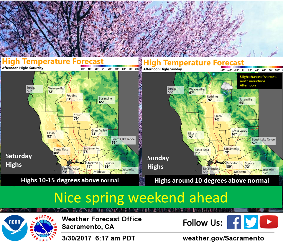
Still more warming is expected on Saturday as the upper ridge shifts over the west coast. Daytime highs should come in around 10-15 degrees above normal. Upper ridge axis breaks down by Sunday allowing for a chance of precipitation across the northern mountains by afternoon.
Extended discussion (Monday through Thursday)
Ridging builds over the region Mon and Tue with temperatures remaining around 5 degrees warmer than normal. A larger upper level trough approaches the Pacific NW next Wed and Thu, bringing a wetter Atmospheric River storm pattern. The probability of Integrated Vapor Transport tool shows increasing confidence of a steadily strengthening AR event. Right now the brunt of the energy is still northward of 40 deg N and into Oregon, but the last couple runs have trended farther south. This certainly grabs our attention.