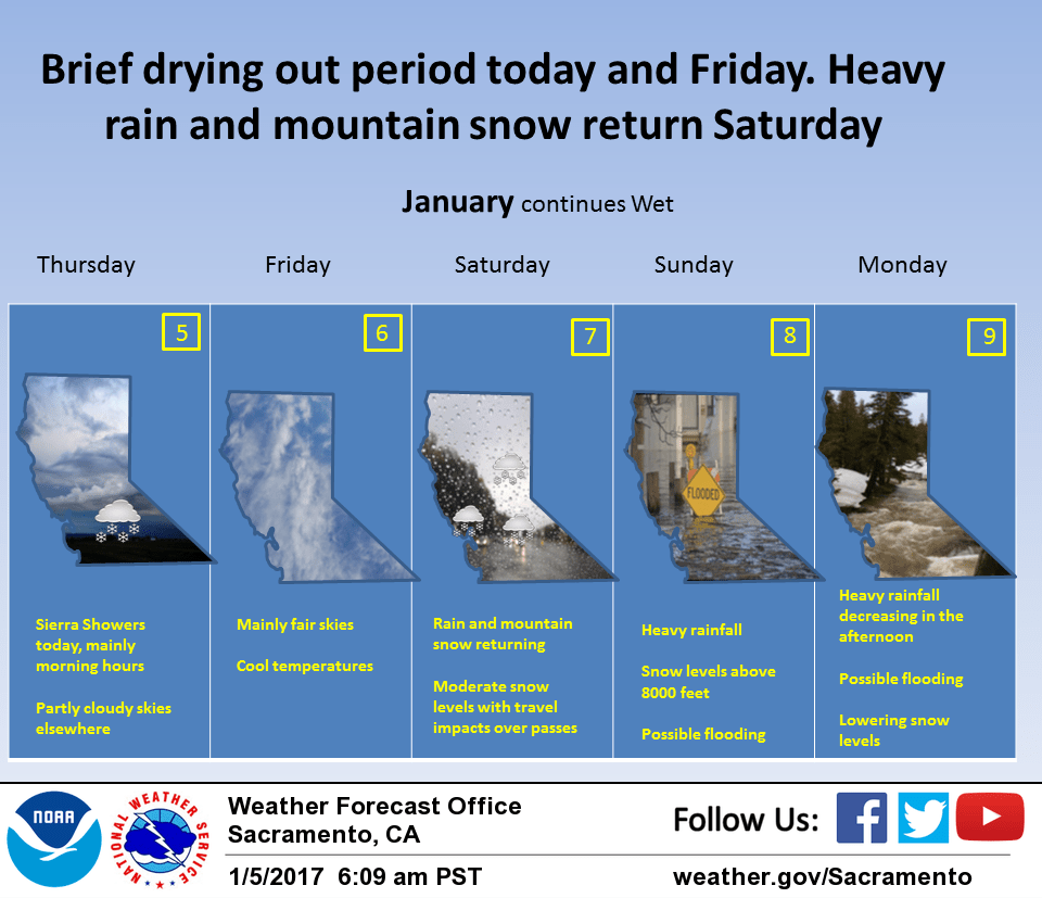
January 5, 2017 – Showers ending over the Sierra today. Below freezing temperatures in the valley Friday morning. Dry Friday. Rain and mountain snow spreading back over the north state Friday night and Saturday. Snow levels climbing back above pass levels Saturday night with periods of heavy rain Saturday night through Monday. Wet pattern continuing through mid week. More moderate snow levels mid week.
Discussion
Subtropical moisture continues to flow into central California this morning and combined with orographics is bringing scattered light showers to the northern Sierra. As an upper trough over Norcal drops into the Great Basin, these showers should continue to decrease so will allow winter storm warning for the Sierra Cascade range to expire at 4 am. A few showers will continue over the higher Sierra elevations today but significant additional snowfall accumulations are not expected. Most areas should see partly cloudy skies today with a cool airmass keeping daytime highs below normal. Upper level high pressure sliding over the state will bring a dry day Friday with fair to partly cloudy skies and a little warmer temperatures.
This upper ridge shifts east of the coast by Friday evening allowing subtropical moisture to return to the coast. Precipitation spreads over the north state Friday night and Saturday. Snow levels start out moderate through Saturday and mountain snow is likely to impact pass levels again. A winter storm watch is already in place for this impact. Increased warm advection ahead of a Pacific frontal system will bring increasing snow levels Saturday night.
By Sunday morning snow levels should climb to above most pass levels. Overrunning precipitation will transition to heavier rainfall early Sunday as a Pacific frontal system moves onto the coast. Current QPF forecasts show orographically assisted areas of the Sierra picking up over an inch of rain per six hour period over 5 straight six hour chucks. Rainfall totals Sunday and Monday total up to over 10 inches over portions of the Sierra and over 3 inches in the valley.
A flood watch remains in effect late Saturday through Monday for all interior northern California. Frontal passage into the Great Basin will bring decreasing rain rates Monday afternoon but a low over the northeast Pacific promises to bring more precipitation going into the extended period.
Extended discussion (Monday through Thursday)
Flooding concerns are likely to continue into next week as another land-falling atmospheric river impacts Northern California. The GFS and ECMWF are in reasonable agreement bringing moderate to heavy precipitation along with gusty winds to the region Tuesday into Wednesday.
This system currently looks to be a bit colder than the weekend system, potentially meaning very heavy snow for the higher elevations. With rivers and streams still expected to be running high in this timeframe, any additional rainfall along the midslopes and lower elevations will bring the potential for flooding.
Longer-range models deviate a bit from next Wednesday onward, but the ECMWF and GEM are both currently hinting at yet another atmospheric river impacting Northern California late next week.