October 26, 2016 – Wet and unsettled weather continues this week with a brief break today, then continues into early next week as several weather systems move across the area.
Discussion
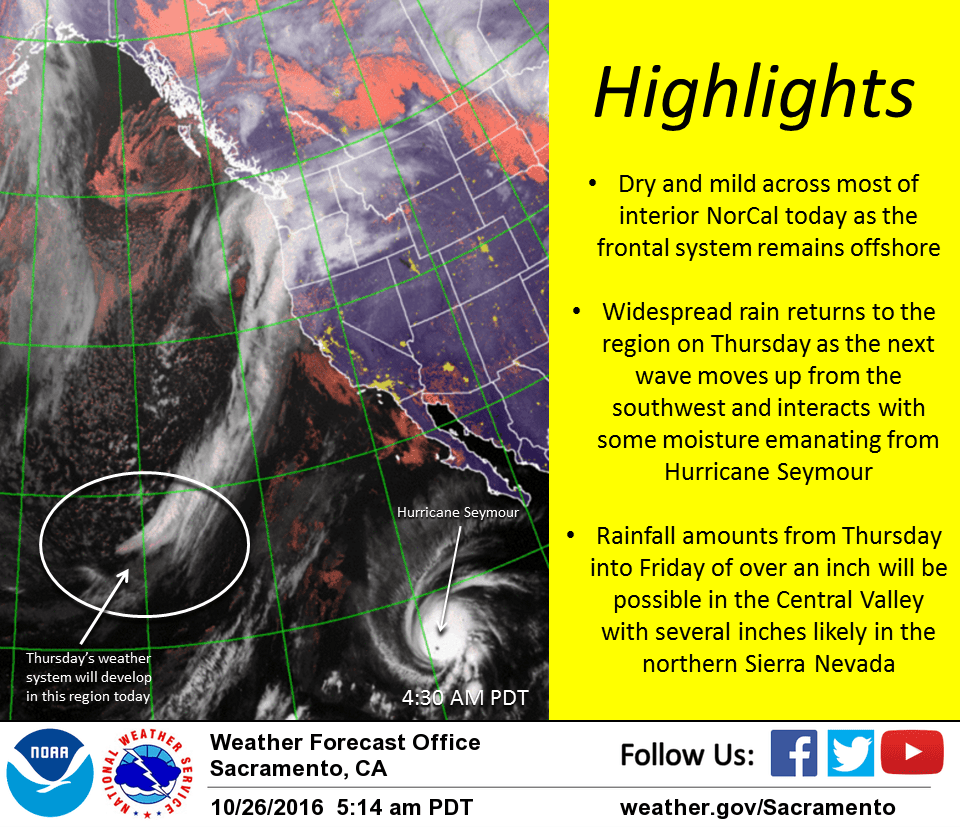
Rain has retreated to north of Redding overnight where some warm-advection and upslope flow is continuing to wring out light amounts. Partly to mostly cloudy skies cover the remainder of interior NorCal and temperatures remain generally mild – 40s and lower 50s in the mountains with 50s and lower 60s elsewhere.
Satellite imagery shows the next system maturing as it moves north off the PacNW coast with the trailing cold front nearly stationary off the NorCal coast. The front is expected to make little if any eastward progress today, so most of interior NorCal will enjoy a brief return to dry and mild weather lasting through tonight.
The period from midday Thursday into midday Friday is looking increasingly wet for much of the region as another wave lifts up from the southwest around the persistent Gulf of Alaska trough. It looks like this system will interact with deeper moisture moving up from the south (some of it originating from Seymour), and with the front remaining draped across NorCal a prolonged period of steady light to moderate rain can be expected. QPF in excess of an inch will be possible in the Central Valley with several inches likely in the northern Sierra. Snow levels will remain very high with little to no impact to travel anticipated.
Showers are expected to linger later Friday into Saturday as moist southwesterly flow continues across the region, especially in the northern Sierra where upslope flow will continue to enhance precipitation.
Extended discussion (Sunday through Wednesday)
Active weather pattern will continue for much of the extended period. Models in general agreement although vary just a bit in timing of each wave and precip amounts. Next wave progged to move across the area Sunday into early Monday. GFS remains on faster side of the guidance envelope with ECMWF lagging about 6 hours behind. Regardless, another shot of widespread precipitation likely during this timeframe.
This wave looks fairly wet, especially across higher terrain, and colder than previous systems this week. Snow levels will lower during the day Sunday into Monday morning and will fall below major pass levels. Accumulating snow a good bet down to around 7000 feet which would serve to cause some travel impacts, especially given busy weekend traffic. Breezy winds will accompany the system with locally gusty conditions across higher terrain.
System should shift to the east during the day Monday which would keep Halloween forecast dry Monday evening for trick or treaters in most areas. Next system will move onshore on Tuesday, but this one looks weaker than Sunday’s at this point with light precipitation amounts. Additional systems possible past Tuesday but model solutions differ. Below normal temperatures will rule through the period.