May 16, 2017 – A strong late-season weather system will bring showers to the region today into Wednesday. The higher elevations of the northern Sierra Nevada will see several inches of accumulating snow. Dry and warmer weather returns for the second half of the week.
Discussion
Radar and satellite imagery indicates clouds and showers beginning to increase across far northern California early this morning as a strong late-season weather system digs southeastward from the PacNW. The increase in cloud cover along with breezy southerly winds ahead of the system are resulting in milder temperatures across the region. Current temperatures are in the 30s and 40s in the mountains with mainly upper 40s to upper 50s elsewhere.
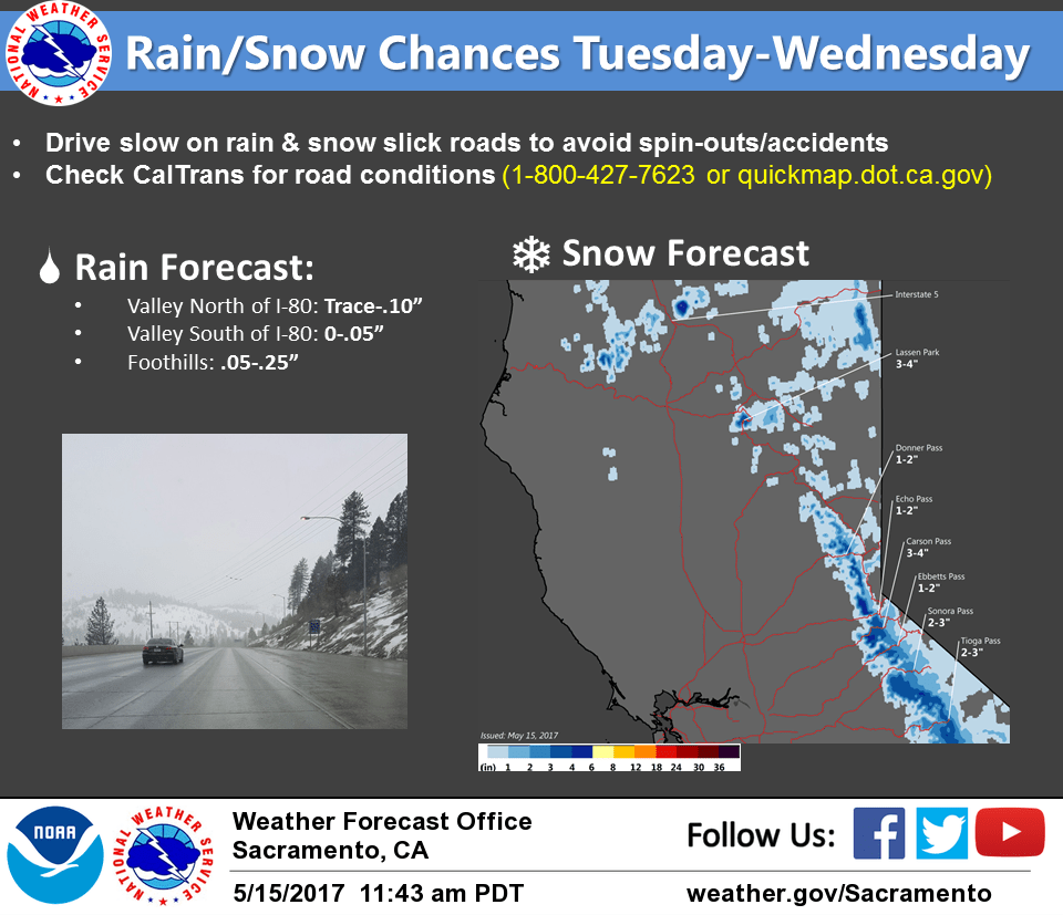
Showers are expected to spread southward to around I-80 by midday, then spread further south through the afternoon and evening as the cold front moves through. While we’re only expecting a glancing blow from the system, much of the northern Sierra will likely see from 1/4 to 1/2 inch of precipitation with some higher elevations spots perhaps approaching an inch.
The higher peaks may receive up to 4 inches of snowfall accumulation. Some slushy accumulation may occur over the higher passes later today and this evening which could result in some travel impacts. We’ll continue to monitor.
At the lower elevations, breezy southerly winds will continue today as the front approaches. Showers will be more scattered into this evening with amounts generally less than a tenth of an inch expected.
The system moves quickly out of the area later tonight and early Wednesday with dry and progressively warmer weather expected through the remainder of the week.
Extended discussion (Saturday through Tuesday)
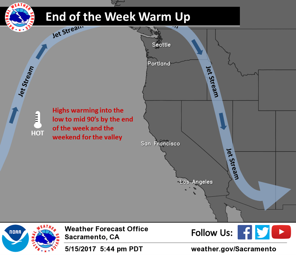
Strong high pressure over the eastern Pacific will continue to build into Northern California over the weekend into early next week. The Sunday-Tuesday timeframe currently looks to be the hottest period of that stretch, with potential for the first 100 degree days of the year for much of the Sacramento Valley. Mountain temperatures will be in the 60s to 80s – likely contributing to rapid snowmelt and cold/fast river hazards.
Both the GFS and ECMWF hint at just enough moisture and lift to bring the potential for thunderstorms over the high Sierra this weekend into early next week.