
October 15, 2017 – Dry weather with less breezy conditions thru mid-week. Models continue to show a major pattern change towards the end of this week, with the first widespread rain event of the season and cooler temperatures. Exact timing and strength are still uncertain this far out, but current projections have rain starting Thursday and continuing through Friday, with heaviest precipitation Thursday night into early Friday. Snow levels look to be above major pass levels (Donner Pass and Echo Summit) initially, though seasonal passes such as Sonora and Ebbetts passes may see some snow late Thursday. Cold air may spread in quickly enough early Friday to bring some accumulating snow to major passes, but confidence is not high at this point. Cooler temperatures across the area will also accompany the pattern change.
Discussion
Generally clear skies except for some high clouds spilling into the region early this morning. Temperatures are cooler and winds much lighter compared to 24 hours ago. Lingering easterly gradient (RNO-SAC still 9 mbs) will result in some locally gusty east winds this morning near the west facing canyons in the northern Sierra and over the crest, and red flag warning continues until 8 am.
Lighter winds continue early this week. Temperatures will trend up a few degrees thru mid-week with valley highs in the lower to mid 80s. Ridge begins to weaken Wednesday as the next trough approaches leading to a little cooler temperatures along with locally breezy southwest winds.
Extended discussion (Thursday through Sunday)
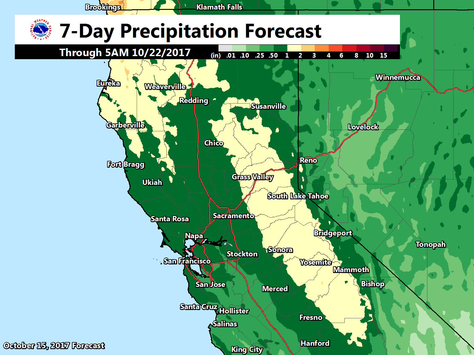
Models show a cold front approaching NorCal on Thursday which will bring much needed precipitation to the region.
Best chances for rain will be Thursday into Friday for interior NorCal. Daytime highs will range 5-15 degrees below normal on Thursday and Friday with valley highs in the upper 60s, foothill/mountain highs should range in the 40s to 60s.
Drier and warmer weather by Saturday as the front moves eastward and weak ridging develops over our area.