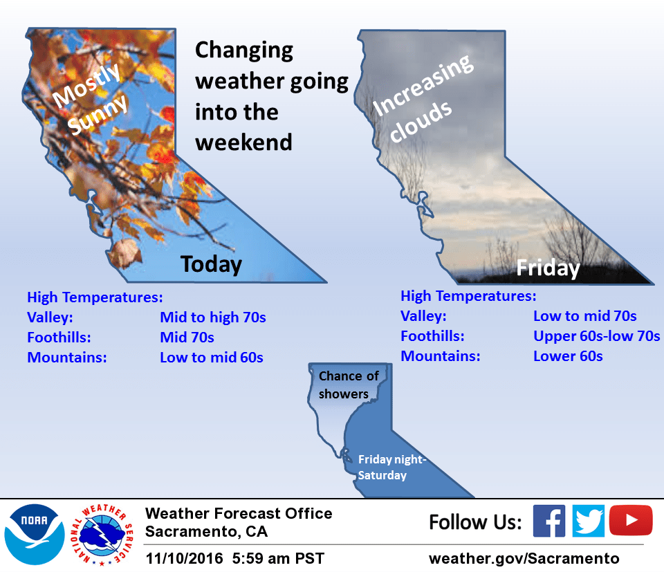
November 10, 2016 – Dry with above normal temperatures today through Friday. A slight chance of showers in the far west and north Friday night into Saturday with near normal temperatures over the weekend. Wetter pattern develops Monday night through the end of the week with below normal daytime temperatures. Snow levels low enough to impact pass levels by mid week.
Discussion
Fair skies over the CWA this morning under a high pressure ridge over the western U.S. This has allowed patchy fog to form again throughout the central valley from about Marysville southward. An upper level shortwave crossing the west coast will bring high cloudiness across the north state today. Overall airmass will be similar today to yesterday so daytime highs should come in about the same or several degrees above normal for this time of year.
The upper ridge gets displaced eastward on Friday as a weak Pacific trough approaches the coast. At this time, the interior of northern California looks to remain dry Friday but the forecast area will see increasing clouds and cooler temperatures. This system will bring a chance of showers to the coast range Friday night before lifting northward on Saturday. The northern mountains and Sacramento valley will see a threat of showers through Saturday afternoon. Otherwise the north state will see cloudy skies with daytime highs cooling to right around normal for this time of year. Upper ridging rebuilds a bit on Sunday for clearer skies and a little warming.
Extended discussion (Monday through Thursday)
Upper level ridging gives way early in the week to a cool trough which is expected to bring widespread precipitation through mid week.
A weak system riding over the ridge will bring the potential for some light precipitation over the northern mountains on Monday. Dry weather is expected elsewhere.
A cold, deep trough approaches Tuesday, bringing precipitation across the area. Periods of moderate precipitation are possible Tuesday night through Wednesday. While timing remains uncertain this far out, snow levels are currently expected to remain high through the day Tuesday, then drop to below pass levels Tuesday night/early Wednesday morning. Accumulating snow could cause travel difficulties. Cooler temperatures are expected, with Valley highs in the 60s by Wednesday, with 40s- 50s over higher terrain.