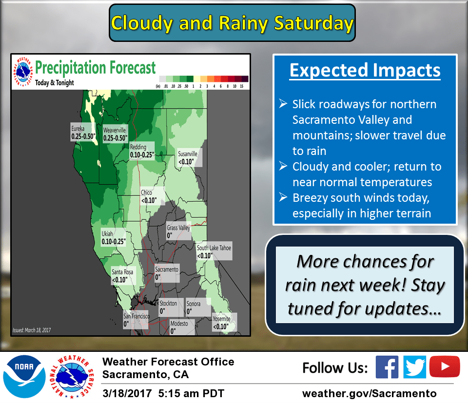
March 18, 2017 – An upper level disturbance will bring light rain this weekend, while another stronger disturbance is expected to arrive .
Discussion (Today through Tuesday)
Radar returns overnight were showing streaks of precipitation developing along the northern mountains and northern Sacramento valley ahead of a trough pushing into the west. Water vapor imagery indicated moisture streaming ahead of the trough will allow for the continued development of precipitation today. Model atmospheric profiles differ as to the chances for thunderstorms today, but some instability may result in a strike or two across the northern Valley. Due to model differences, decided to leave the mention out of the forecast.
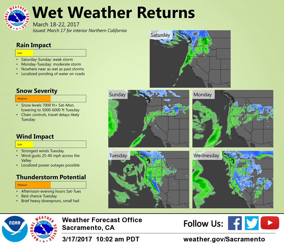
Light precipitation chances are possible on Sunday as the upper level flow pattern transitions ahead of the next weather making system this coming work week. Sierra snow at elevations higher than 6000 feet are possible Monday and Monday night with widespread moderate to heavy rainfall elsewhere. Atmospheric profiles look better for the valley on Tuesday to bring thunderstorms with the potential for hail and gusty winds. Sierra snow will continue Tuesday with accumulations that could bring travel delays.
Extended discussion (Wednesday through Saturday)
Cool and unsettled pattern continues thru the middle of next week as long wave trough remains over the West supporting shower and mainly diurnal thunderstorm chances across the region.
Short-wave ridging may bring a brief break later Thursday into early Friday, then a potentially stronger system is forecast to impact the area later Friday and heading into next weekend. GEFS and latest operational runs of the EC and GFS indicate a deeper moisture tap with this system resulting in the potential for heavier QPF.