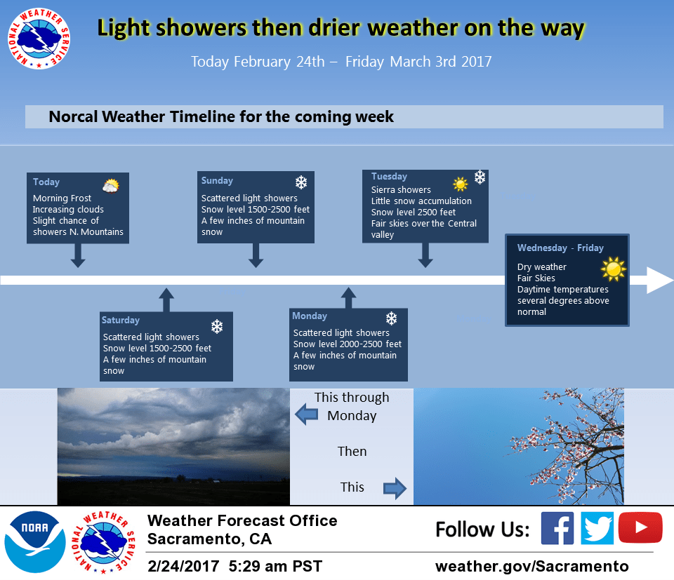
February 24, 2017 – Flooding concerns continue as runoff from the recent rain continues to work its way downstream adding stress to waterways. A couple of weak but cold storms move through around Saturday and Monday. An extended period of dry weather starts the middle of next week.
Discussion
Mainly fair skies over the CWA this morning as Norcal sits under upper northwest flow between low pressure over the central U.S and a weak system dropping down the Pacific Northwest coast. The fair skies and cool northwest flow are making for a cold morning. Valley temperatures are currently running about 1 to 3 degrees below 24 hours ago so expect many locations will drop to near freezing. This means lots of valley dwellers will be using ice scrapers before going to work today.
As the day progresses, skies will cloud over as the upper low drops down from the north. Cloud cover and cool airmass will keep daytime highs today below normal. By the end of today the northern mountains could see a few light showers. The threat of light showers will continue to spread southward overnight with a chance of showers over the entire CWA by mid day Saturday as the upper trough sinks over NorCal. Still appears that most of the energy from this system will remain offshore so precipitation amounts will be fairly minimal.
Snow levels over the northern mountains will be relatively low at between 1000 and 2000 feet. With low QPF, snow accumulations will be low but snow ratios of 15 to 1 or higher could make for a few inches of snow causing minor travel issues. Upper trough shifts south of the forecast area by early Sunday bringing an end to the shower threat most areas. Another upper low follows quickly on the heals of the Saturday system dropping out of the Pacific Northwest and into NorCal by Sunday afternoon.
Light shower chances will exist over the region again mainly Sunday night and early Monday. A more eastward track of this system will make it a slightly wetter one for the CWA but precipitation totals remain on the low side. Snow totals from Sunday to Monday will come to just a few inches but with the snow levels again between 1000 and 2000 feet over the northern mountains, minor travel impacts are likely.
Extended discussion (Tuesday through Friday)
Slight chance of snow showers over the higher terrain of the Sierra Nevada Tuesday otherwise drier weather sets up through the extended forecast period as upper ridge builds over Interior NorCal. Warming trend expected with highs in the mid to upper 60s for the Central Valley towards the end of next week.