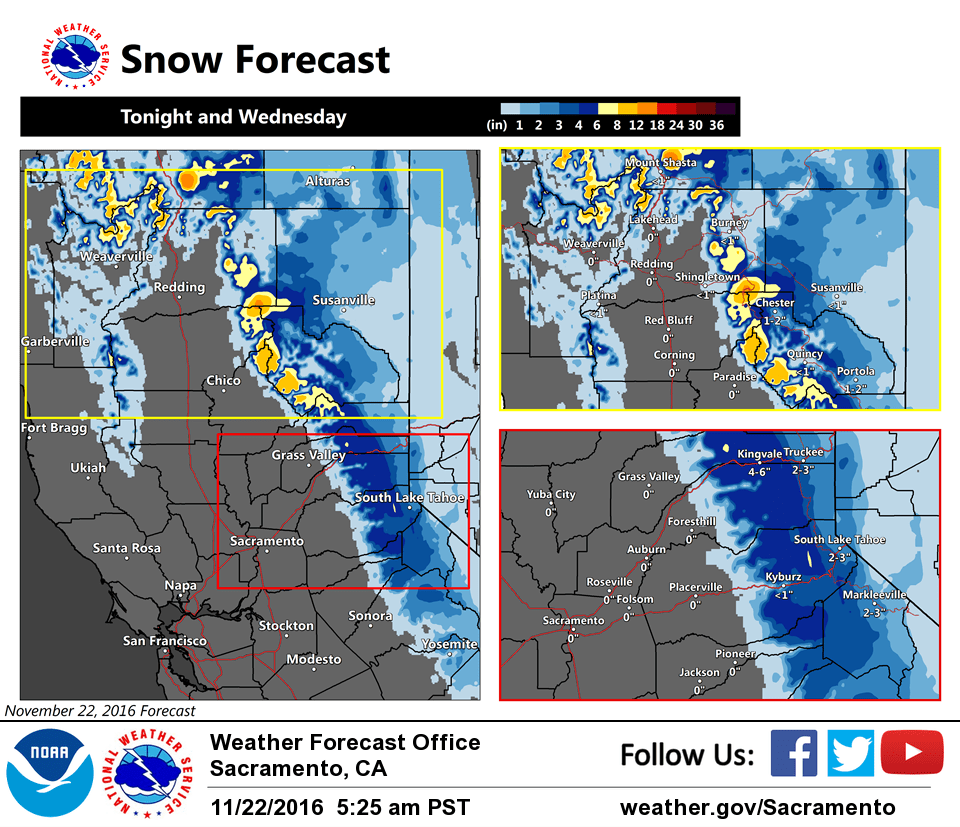
November 22, 2016 – Areas of valley fog this morning. The next storm moves into NorCal tonight into midday Wednesday followed by another arriving late Thanksgiving into Friday. Winter Weather Advisory from 6 PM this evening to noon PST Wednesday for West Slope Northern Sierra Nevada-Western Plumas County/Lassen Park.
Discussion
Mostly clear skies across interior NorCal early this morning as short-wave ridging covers the region. Some high clouds ahead of the next system are beginning to move into areas north of I-80. Current temperatures are in the 20s and 30s in the mountains with 40s elsewhere, around 5-10 degrees cooler compared to 24 hours ago. Most valley locales are saturated and patches of dense fog may become more extensive around sunrise.
The next system will be a quick hitter, moving through NorCal tonight and early Wednesday. It will be colder with snow levels well-below pass levels. QPF is not expected to be overly impressive, though snow amounts will be enough to lead to travel impacts across the northern Sierra passes tonight into midday Wednesday.
Another brief break in the weather is expected later Wednesday through Thanksgiving, as the next upstream trough deepens over the eastern Pacific slowing its eastward progress, before another system moves in Friday. This one will also be relatively cold and has the potential to bring more significant QPF with greater travel impacts heading into the holiday weekend.
Extended discussion (Saturday through Tuesday)
An upper level trough of low pressure remains on track to move through northern California this coming weekend resulting in Valley rain showers and snow to elevations higher than 3500 feet. Model forecast differences regarding the system amplitude are still evident with the ECMWF not having as strong of a frontal system as the GFS, and as a result, the GFS is more optimistic about precipitation amounts. The difference between the two forecasts could result in much different snow total accumulations and Valley rainfall as the system continues through early next week. Forecast confidence is still low to the amount of precipitation for the weekend, but timing leads to higher confidence that there will be a wet pattern. Model forecasts have since backed off a bit on the strength of the jet stream winds, but the trajectory of the jet stream could still lead to some gusty winds saturday night for some higher terrain in the Sierra.