June 2, 2021 – Well above average temperatures with generally dry conditions continue. Temperatures lowering by late weekend. Scattered mountain thunderstorms possible today and Thursday afternoons.

Discussion
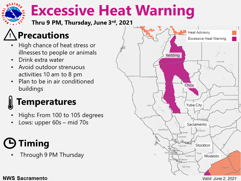
A few more hot days are in store for interior Northern California as upper level ridging continues over the area. Afternoon highs today should be a few degrees less than those of yesterday, although high heat risk continues for portions of the northern Sacramento Valley and surrounding terrain. Elsewhere, the Delta breeze will help to limit highs across the Valley to the mid to upper 90s with moderate heat risk expected. Temperatures nudge up a degree or two again Thursday, before the ridge begins to really flatten out Friday into Saturday. Have opted to continue the Excessive Heat Warning in portions of the northern Sacramento Valley and surrounding areas through Thursday due to the continued high heat risk and the duration of this event.

Besides the continued heat, a few chances for high elevation mountain showers and thunderstorms are possible both later this afternoon and again on Thursday. The better chances look to be mainly along the crest of the Sierra over Alpine/Tuolumne Counties, although a stray shower can’t be ruled out over more northern portions of the Sierra.

Temperatures cool slightly Friday and Saturday although they still remain above average with some continued areas of moderate Heat Risk in the Valley.
Extended discussion (Sunday through Wednesday)
Ensemble guidance and cluster analysis indicate a gradually deepening trough along the West Coast early next week. This pattern would likely remain dry, but temperatures will cool significantly from the recent hot weather and return to close to average for early June.