September 20, 2017 – Cooler weather continues this week with a chance of showers into Thursday.
Discussion
Western North America trough continues to evolve with the initial wave from earlier this week now lifting out through the northern Great Plains while the next wave drops south off the PacNW coast. Across interior NorCal, skies are partly to mostly cloudy to the north of I-80 while they’re clear to the south. Radar indicates showers have so far been remaining over northwest California.
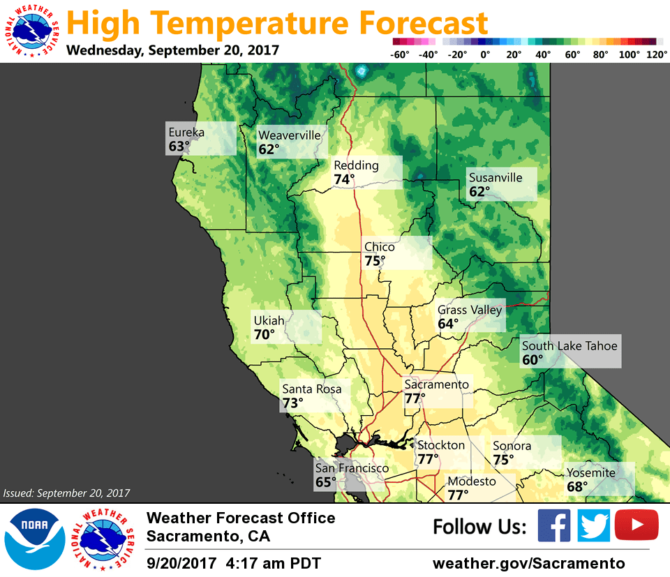
Current temperatures range from the mid 30s to mid 40s in the mountain valleys to the mid 50s to mid 60s in the Central Valley.
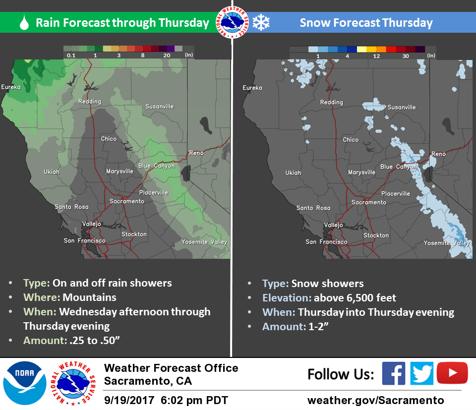
The upper trough is forecast to deepen across NorCal over the next 24 hours pushing another cold front southward later today and this evening. Most precipitation is expected over the mountains as the front moves through, but some sprinkles or light showers may brush through portions of the valley as well. QPF will be light, generally less than a third of an inch across the higher elevations and less than a tenth of an inch elsewhere.
Colder air will move into the region tonight behind the front lowering snow levels to around 5500-6500 feet. Even a few inches of snowfall accumulation will be possible across the higher peaks.
Temperatures will be well below average (10-20 degrees) across the region the next few days with highs only in the 70s across the Central Valley through Friday.
Dry and milder weather returns for the weekend.
Extended discussion (Sunday through Wednesday)
High pressure returns to northern California this weekend with dry conditions and a warming trend to the afternoon temperatures. High temperatures Saturday will remain below normal, but temperatures Sunday into early next week will return to normal or slightly above normal. Breezy north and east valley and ridgetop winds can be expected for the weekend and into next week.