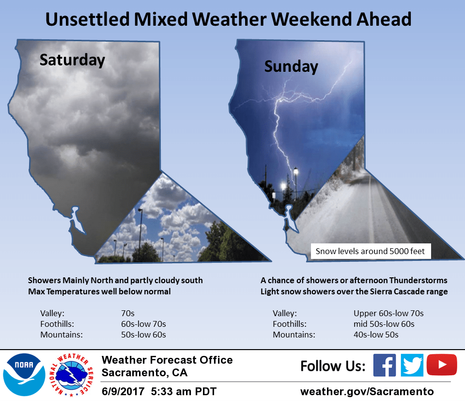
June 9, 2017 – A few showers mainly over the mountains today and Saturday. Cooler system this Sunday may bring showers, thunderstorms, and light mountain snow most areas. Dry and warmer next week.
Discussion
Southwest flow aloft over NorCal this morning as a late season upper low drops into the eastern Pacific. Orographics may be able to squeeze out a few light showers over the northern mountains and Sierra Cascade range but elsewhere should remain dry today.
Max temperatures will warm a bit over Thursday but still come in about 10 degrees below normal. Upper low center continues moving southeast tonight and forecasted to be off the southern Oregon coast by Saturday. Lift and instability nearest the low center will bring a chance of showers over the northwest half of the forecast area.
Models now in good agreement in moving the low center across the northeast corner of the state on Sunday. Cold air aloft will bring instability to the entire CWA with enough mid and upper level CAPE indicated by GFS to keep thunderstorm chances over most of the forecast area in the afternoon and evening hours.
Cold air associated with the low will bring down daytime temperatures still further. Daytime highs could be as low as 20 degrees below normal. Cold airmass will bring down snow levels to below pass levels over the Sierra. An inch or two of snow will be possible with some minor travel impacts likely.
Upper low finally shifts into the Great Basin on Monday with upper northerly flow and more stable conditions bringing an end to precipitation threat across the forecast area. Upper ridging will bring the beginning of a warming trend that will last through the extended period.
Extended discussion (Tuesday through Friday)
Warming and drying trend expected during the EFP as the upper low moves into the Nrn Plains and Srn Canada during the period. The flow aloft transitions to Wly as 5H heights rise over the area. This will allow warmer air to advect into the area and temps will be trending upward through the period.
Slightly below normal max temps on Tue rise to near normal on Wed and then rapidly warm well above normal Thu/Fri, especially on Fri with readings some 9 to 14 degrees above normal, and reaching triple digits in the Valley.
09/00z GFS a little cooler than the ECMWF on Thu and have blended the two while leaning towards the warmer ECMWF due to the strength of the ridge. By Fri, there is better model agreement and confidence is higher that triple digit heat will return to the Valley. 850 mbs temps forecast in the low to mid 20s degrees C support max temps in the 90s to low 100s and 70s and 80s in the mountains for the latter half of the EFP. Lowering humidities and drying katabatic winds will accompany the warming trend.