September 28, 2016 – Cool down begins today with much cooler temperatures by the end of the week as a weather system moves toward NorCal. Chance of precipitation early next week.
Discussion
Clear skies and mild temperatures across interior NorCal early this morning as strong high pressure is gradually giving way to a trough approaching from the Gulf of Alaska. Offshore flow is slackening allowing shallow stratus to return to the coast, and consequently a weak Delta Breeze is developing, but yet to provide much cooling inland.
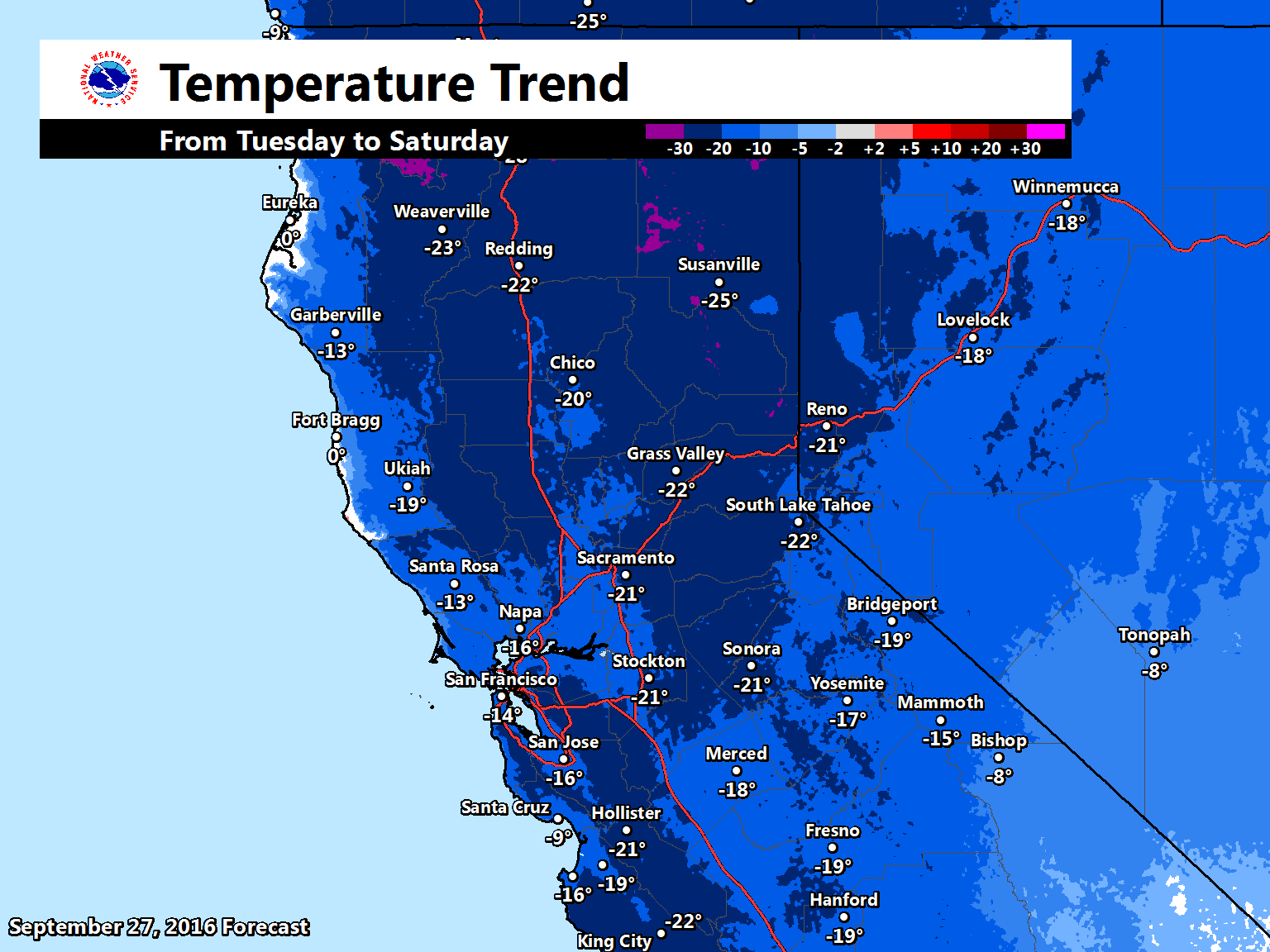
The approaching trough will gradually deepen off the PacNW coast over the next several days bringing a cooling trend to NorCal along with increasingly breezy southwest winds. In addition to the synoptic cooling associated with the weakening high pressure, the increasing onshore flow will provide additional cooling. It looks like the Delta Breeze will gradually pick up today and become robust tonight and Thursday. By Friday and Saturday, highs in the Central Valley will be down into the mid 70s to lower 80s.
A few showers will be possible across the far northern mountains of California by Saturday as an initial short-wave lifts out ahead of the main offshore low.
Extended discussion (Sunday through Wednesday)
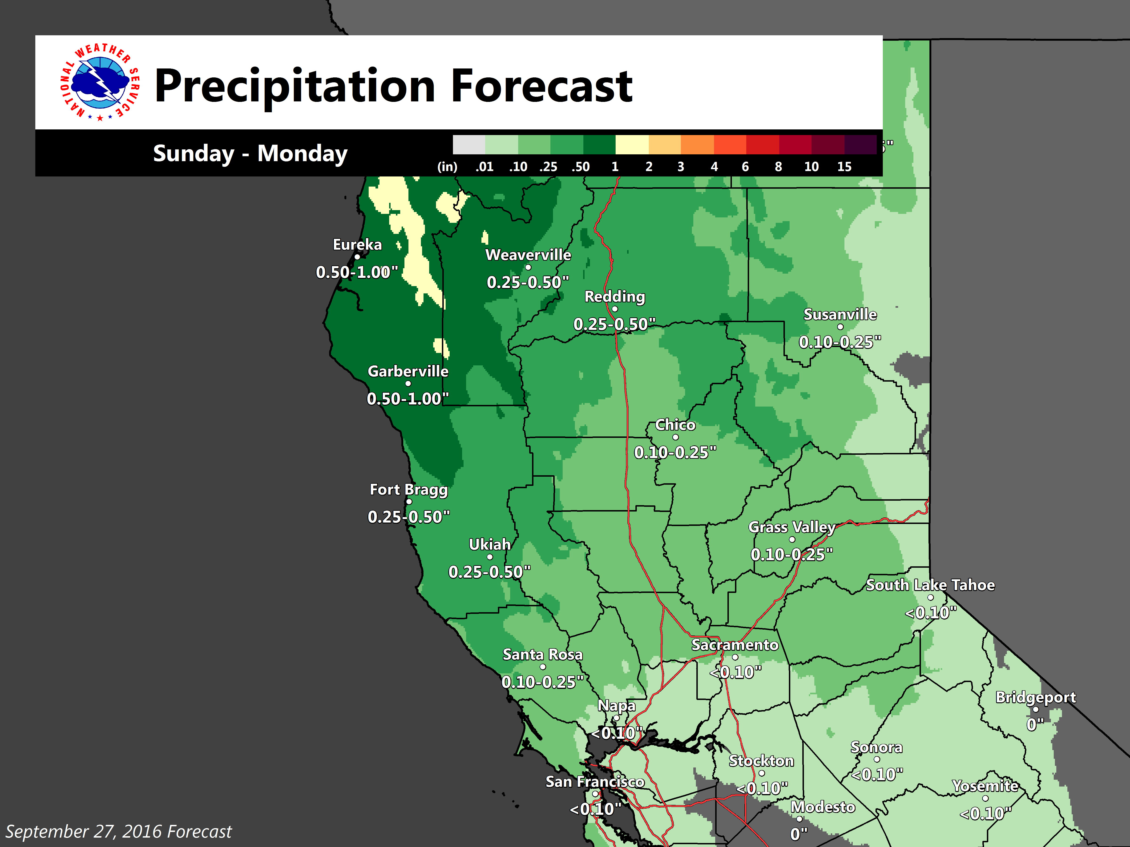
Confidence is increasing in idea of precipitation across portions of NorCal on Sunday with models agreeing on solution of upper trough dropping into Norcal by afternoon. Small differences in timing still exist but GFS and ECMWF in pretty good agreement. Best chances of precipitation will be across the northern most CWA with decreasing chances farther south. All areas will see cooling for the second half of the weekend as cooler air continues to push into the area. Combination of cooler airmass and cloud cover will bring daytime highs on Sunday down into the 60s and 70s throughout the valley or about 15 to 20 degrees below normal.
Models diverge significantly on Monday and as result, forecast confidence plummets as well. ECMWF model moves the upper low into the Great Basin on Monday bringing upper north flow and drying to Norcal. GEM model moves the low along much slower keeping precipitation over much of the forecast area. GFS moves the low out so quickly the next upstream system is on the coast by afternoon. With such disparity, did an average of models and surrounding office blending for now. If more ridging solutions verify, then there might be a slight warm up Monday but daytime highs will remain well below normal.
Model differences continue into Tuesday but all show slight ridging and northwest flow aloft so kept precip primarily over the mountains and north valley. Both GFS and ECMWF show ridging over the west coast by Wednesday with GEM the outlier showing a trough over Normal. Have gone with model majority for middle of next week with a forecast of a drying and warming trend.