May 6, 2017 – Cooler with a chance of mountain showers and thunderstorms this weekend. Gusty north winds Sunday. Turning warm again early next week.
Discussion (Today through Tuesday)
Upper low will be dropping SEwd along the central CA coast today and into SOCAL tonight and Sun. Generally the meridional flow over Norcal will become more cyclonic and this should help the precip chances to trend Wly, from the Sierra today, and into the Sierra Foothills and possibly portions of the Ern Central Valley tonight. The last couple of runs of the HRRR Model REF prog shows some mid to upper 30s dBZ echoes working Wwd (from the “backdoor”) and toward the I-5 corridor between 8-10 pm Sat. This higher resolution model seems to be capturing the short waves/impulses that are forecast to rotate Wwd this evening to the N of the closed low.
Radar currently detects some weak echoes moving Nwd over the Srn portion of our zone 69. These echoes should expand in areal coverage and intensity as moisture wraps around the low center. Associated height falls and available instability aloft will produce some Sierra showers and thunderstorms this afternoon and possibly into the evening. Heavy downpours will be possible with some small hail. Snow for elevations higher than 7000 feet are possible for Sierra peaks along and south of I-80 this afternoon through tonight with up to several inches of snow expected.
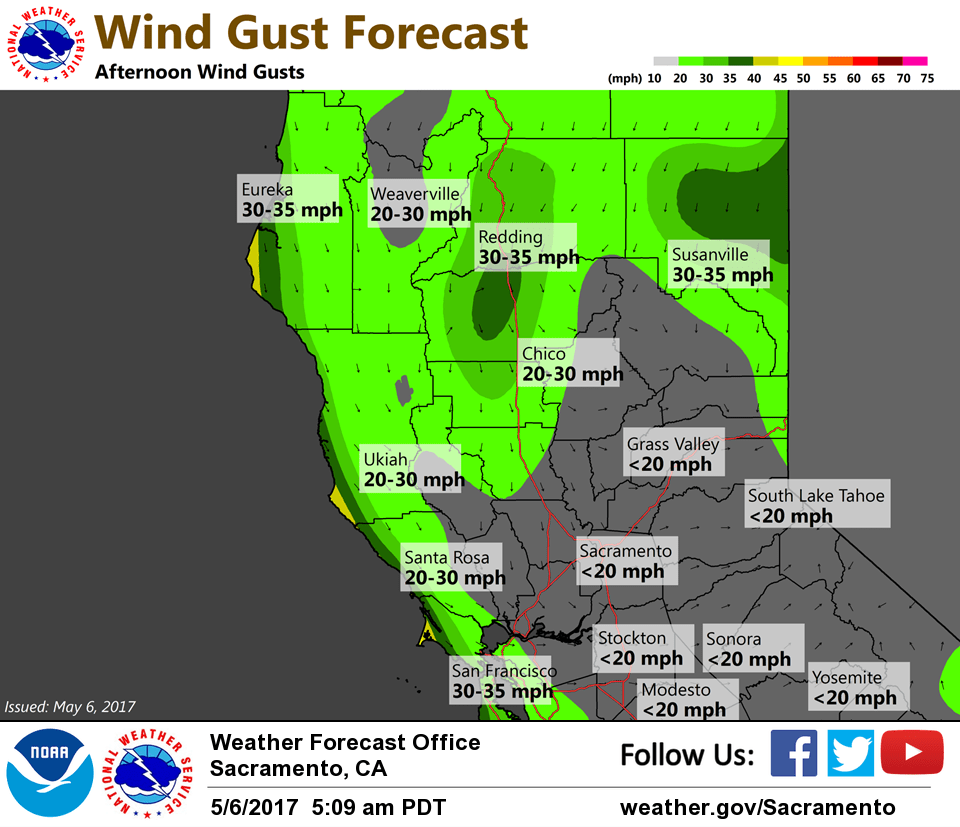
Building surface high pressure system off the coast will increase the pressure gradient across the valley and the northern mountains starting this afternoon into Sunday. This will bring breezy winds for the northern Sacramento Valley today with gusty winds for most of the valley Sunday. Forecast pressure gradients increase from 10 mbs to 13-14 mbs this evening and overnight which should push winds to near/above WAD criteria mainly on the W side of the Valley and lee side of the Coastal range. Gradients and 925 mbs wind support decreases rapidly Sun afternoon.
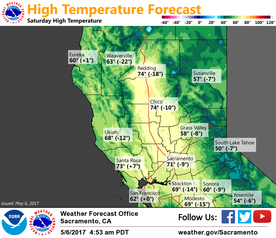
As the upper level ridge builds from the west on Sunday, dry conditions will return for the forecast area with high temperatures will warm to slightly above normal for Sunday and between 5 and 10 degrees above normal for Monday/Tuesday.
Extended discussion (Wednesday through Saturday)
High confidence in cooler and breezier conditions returning for interior NorCal after mid-week as upper ridge breaks down and shifts east as another trough approaches the West Coast. Showers chances expected to be confined to mainly the northern mountains late next week.