May 15, 2017 – Cool weather with a chance of mountain showers and thunderstorms today. Spring weather system will bring showers to the region Tuesday into early Wednesday. Dry and warmer later this week.
Discussion
Satellite imagery shows the upper low moving into SoCal. Clouds and a few showers are wrapping around the low into the far southeast corner of the forecast area. Elsewhere, skies are mostly clear other than some low clouds across some of the mountain valleys. While a little milder compared to 24 hours ago, current temperatures remain on the chilly side and generally range from the upper 20s and lower 30s in the colder mountain valleys to the mid 40s to mid 50s in the Central Valley.
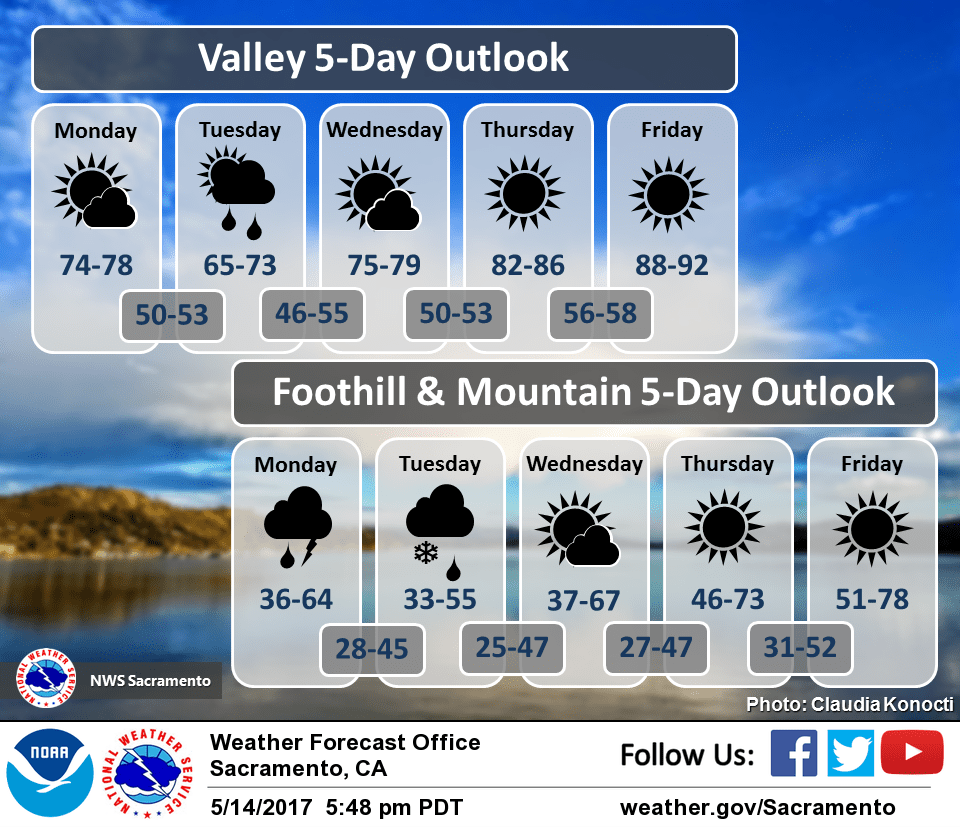
Low will close off over SoCal today with showers developing northward through the northern Sierra during the day. Enough instability around for a few more thunderstorms. Temperatures will warm slightly, but will remain below normal.
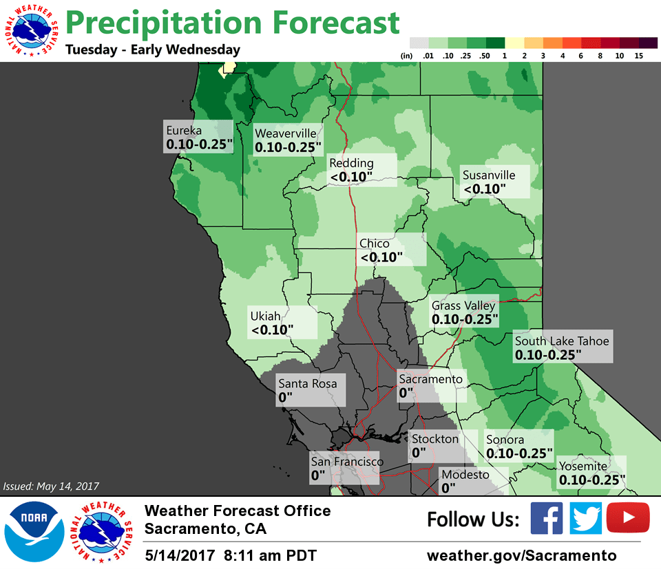
Next system will dig from the Pacific Northwest into the Great Basin Tuesday into early Wednesday. Breezy onshore flow likely Tuesday ahead of the wave with gusts of 20-30 mph in the Valley. As has been the trend over the past several days, storm track continues to shift east. This pattern tends to favor northern and eastern portions of the area, while leaving most of the Valley and Coast Range dry. Have cut back precipitation chances in these areas. Still could see a few showers across eastern portions of the Valley but accumulations should be light.
QPF over the mountains has also trended a bit less. Snow levels will be around 6000 feet but with drier forecast, only a few inches expected across higher terrain. This should limit impacts but could still be enough to catch travelers off guard given the time of year. Wave will bring cooler temperatures with valley highs topping out in the 60s to around 70 and 40s-50s across the mountains.
Wave quickly shifts east Tuesday night into Wednesday, ending precipitation chances. Drier weather expected for most of Wednesday into the extended period with warming temperatures.
Extended discussion (Friday through Monday)
Weather through the extended period will largely be influenced by an expansive area of high pressure over the eastern Pacific. As such, expect temperatures to remain well above normal, with 90s expected across the Valley, 80s across the foothills, and 60s to 70s over higher terrain. A series of weak shortwave troughs are currently projected to move through the Pacific Northwest and drop into the Great Basin early next week, which could bring a few thunderstorms over the Sierra.