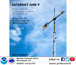
June 9, 2018 – Cooler temperatures, breezy winds, and a chance for showers and isolated thunderstorms across far northern California today. Dry weather for Sunday into mid-week with substantial warming trend.
Discussion
Upper level trough will move across the area today. Strengthening pressure gradient will result in breezy winds with gusts to 30 mph in the valley, higher across the Sierra and through the Delta. Onshore flow will also bring much cooler temperatures today. Valley locations will top out in the 70s with 50s in the mountains. Moisture is limited with this system but may be enough to squeeze out a few showers and isolated thunderstorms for areas across far northern portions of the state.
Trough lifts northeast on Sunday with dry weather and warm temperatures returning. Breezy, drying northerly flow likely in wake of the trough, especially across the central valley. Dry weather continues into mid-week as ridging builds into the area. Temperatures will warm substantially with valley locations nearing the triple digit mark by Tuesday.
Extended discussion (Wednesday through Saturday)
Upper ridge over the west coast shifts eastward on Wednesday as a Pacific trough moves into the Pacific Northwest. Main impact on the forecast area will be a slight cool off but daytime temperatures are still expected to come in well above normal.
At this time, any precipitation is expected to remain well north of the CWA. Upper troughing over the west coast will bring a little more cooling on Thursday with daytime highs expected to drop to near normal. Weak troughing remains over the west coast on Friday so overall expect little change from Friday.
Models diverge going into next weekend. ECMWF shifts the west coast trough inland on Saturday and starts to build a ridge over the west coast for warming and drying. GFS in contrast forms a low over NorCal for a threat of showers and continued near normal temperatures. Leaning towards the GFS solution but not buying off completely until models come into better agreement.

