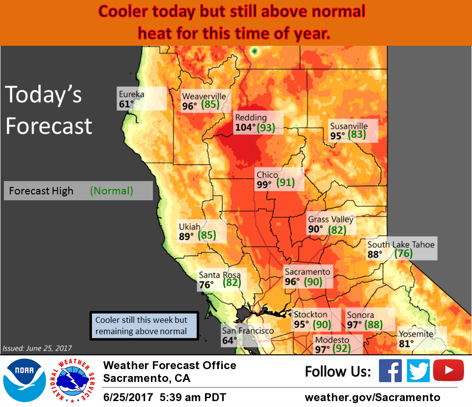
June 25, 2017 – Cooling expected for the entire region today with cooler but still above normal temperatures through the week. Isolated afternoon/evening thunderstorms possible over portions of mountains today.
Discussion
Upper ridge which brought the Norcal heat wave for the last week is finally shifting inland. Upper level southeast flow pulling some mid/high moisture out of the sub-tropics for scattered clouds over parts of the forecast area this morning. A small disturbance pivoting northward is squeezing out a shower in the Chico area at this time but this cell will likely disperse in the next hour or two.
Upper ridge axis currently shifting east of the CWA allowing for a stiff delta breeze this morning. Travis AFB showing gusts to over 30 knots. Onshore flow and airmass cooling will bring a significant drop in daytime temperatures.
Even with this cooling, daytime highs will still come in a few to several degrees above normal.
Isolated thunderstorms will be a possibility again over the mountains this afternoon with GFS showing the most instability over parts of the coast range, over the Lassen area and Sierra crest south of Tahoe.
Week upper troughing over the west coast will bring more cooling on Monday with daytime highs forecast to come in just a little above normal. A continued strong delta breeze will likely bring another morning of scattered coastal stratus to the delta. Stable southwest flow aloft should keep skies mainly fair through the day. One exception might be far northwest Shasta county which might pick up an isolated shower if the upper trough digs far enough south. Fair skies and a bit more cooling expected on Tuesday as weak upper troughing lingers along the west coast. Upper ridge begins to rebuild by mid-week bringing the beginning of a warming trend.
Extended discussion (Thursday through Sunday)
High pressure returns to the region Thursday and Friday this week, bringing a brief period of hot temperatures. A weak upper trough then passes through the Pacific Northwest. This system looks rather dry, with precipitation expected to remain well to our north. As such, the primary impacts with this weather system will likely be modest cooling and stronger onshore flow through the Delta.