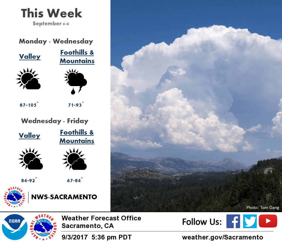
September 4, 2017 – Downward trend in temperatures starts today with near seasonal temperatures by Wednesday. Showers and thunderstorms possible through Wednesday, mainly over the mountains.
Discussion
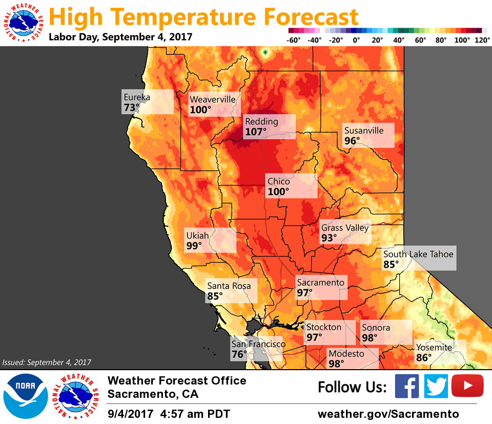
Variable amounts of mid and high clouds continue across interior NorCal, with a few sprinkles mixed in, as remnant moisture from Lidia spreads northward. Little relief yet as current temps are milder compared to 24 hours ago across most of the area and range from the mid 40s in the colder mountain valleys to the lower 90s at the north end of the Sacramento Valley.
Moisture and instability will continue to spread northward the next several days leading to a chance for showers and thunderstorms, mainly over the mountains. However, we’ll have to keep our eyes peeled for any little impulses moving up from the southeast for the potential of seeing some elevated convection over the valley as well.
Temperatures are expected to begin trending downward today as high pressure begins to lose its grip, some areas see an increase in cloud cover, and onshore gradients return. We’re already seeing the gradients trend toward onshore, but it’s a slow process with only a Delta trickle so far at Travis AFB.
More substantial cooling is expected to spread inland across the region by mid-week as a stronger northern stream trough is forecast to displace the strong ridge further to the east.
Extended discussion (Friday through Monday)
A trough from the Gulf of Alaska will pass into the area on Friday, with the southern portion becoming a closed low and sitting over southern CA through the weekend. There will be a lack of moisture with this system and that is going to limit shower and thunderstorm activity. Temperatures are expected to be around normal through Saturday, trending a little above normal on Sunday.