September 12, 2017 – Showers and thunderstorms into mid-week. Cool down begins today and continues into Thursday.
Discussion
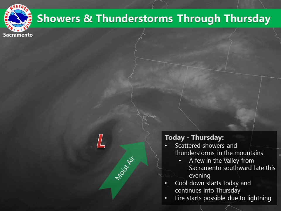
Satellite imagery shows that last evening’s band of deep convection has shifted north of Sacramento and lies across the far northern portion of the state. Radar shows a few light showers continuing across the northern end of the Sacramento Valley with stronger convection to the east along the Nevada border. Current temperatures remain very mild ranging from the upper 40s in the mountain valleys to the lower to mid 80s across warmer portions of the Central Valley.
The closed low off the central California coast is forecast to remain near stationary today before moving closer to the coast tonight, then inland across central California on Wednesday and Wednesday night. Plenty of moisture and elevated instability remains in place across NorCal, so much of the region will remain susceptible to spotty showers and thunderstorms (especially the southern third of the forecast area – closer to the low) as disturbances pinwheel around it. Temperatures will begin to cool a bit today with cloud cover and some synoptic cooling.
By Thursday, the low is forecast to shift east of the area as a trough digs southward from the PacNW. This will bring stronger synoptic cooling later in the week along with pushing the deeper moisture and instability out of the region, but the mountains will continue to see a chance for showers and thunderstorms.
Extended discussion (Saturday through Tuesday)
Northern California will be under a weak upper trough pattern through the weekend, which should bring dry weather and near- normal temperatures. A more substantial trough then approaches the Pacific Northwest early next week. Model differences still exist, particularly with how far south this system will drop. At the very least, it seems there will be a chance of precipitation across far northern CA, along with a notable cooling trend.