August 13, 2017 – Warm and dry through the weekend, then cooler early next week.
Discussion
No changes to the current forecast. Marine layer has been deepening this morning up to around 1600 ft as the trough slowly deepens over the west coast. Temperatures will be a little bit cooler today than yesterday with a number of areas around Sacramento topping out in the 80s today. Delta breeze will increase once again by late afternoon.
Previous Discussion
Clear skies across the region early this morning. Current temps are cooler compared to 24 hours ago and range from the 40s in the mountain valleys to the upper 50s and 60s in the Central Valley (except mid 70s northern Sacramento Valley).
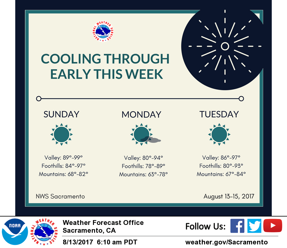
Cooling trend today and Monday as the upper trough moves through the PacNW and NorCal. Marine layer currently around 1000 feet deep at Fort Ord should deepen by tonight with some stratus possibly intruding into the Sacramento region early Monday morning. Slight chance of a late-day thunderstorm near Mt. Lassen Monday afternoon as the upper trough moves through.
Temperatures forecast to return to around average by mid-week as the trough shifts east and ridging from the eastern Pacific builds into the region.
Extended discussion (Thursday through Sunday)
Ridging aloft will bring stable conditions and a warming trend across interior NorCal Thursday into Friday. Temperatures are forecast to run 5-10 above normal with triple digit heat over the northern Sacramento valley. A gradual cooling trend is anticipated this weekend as an upper trough moves along the West Coast. Regardless, highs will remain near to slightly above seasonal normals.
Elevated instability charts suggest the potential for afternoon convection generally south of Lake Tahoe late this week. However, have not included thunderstorms at this point given that the most favorable dynamics appear to remain outside of the forecast area. We’ll continue to monitor future model runs.