Red Flag Warning from 11 PM this evening to 7 PM Tuesday. Wind Advisory from 11 PM this evening to 11 PM Monday. Mild temperatures and dry weather today. Critical fire weather conditions Monday and Tuesday due to strong north winds and low humidities. Lighter winds and a warming trend mid to late next week.

Discussion
Weak ridging continues over NorCal today with high temperatures this afternoon slightly warmer than those of yesterday. Winds will generally be light through the afternoon with mostly clear skies. These conditions will change by later this evening as a deep trough begins to dig across the PacNW into the Great Basin area tonight through Tuesday.

Forecast looks to still be on track for strong north winds late Sunday night through Tuesday across much of the Valley and into the western foothills. The strongest winds are expected late tonight and Monday with max wind gusts ranging from 35 to near 50 mph, locally higher, during this time. A few models hint at an earlier onset of strong winds, especially in the northern and central Sacramento Valley down into the Delta.

Mid level flow also increases between 06-12Z Monday over interior NorCal increasing confidence for stronger winds to perhaps develop earlier. With this said, updated the High Wind Watch to a Wind Advisory beginning as early as 06Z for some locations. Winds decrease slightly overnight and have the Advisory ending at 06Z Tuesday.
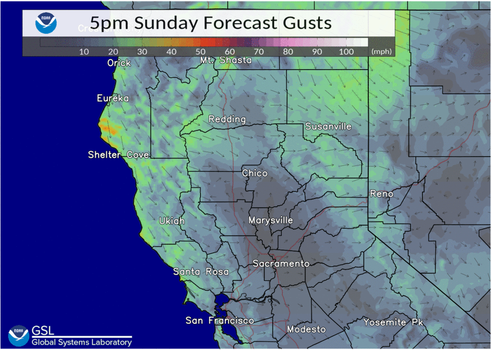
Strong winds are still in the forecast for Tuesday, albeit, not as strong as those seen on Monday. Gusts on Tuesday will generally be more in the 25 to 35 mph range, locally higher in some areas. The deep closed upper low located over the Great Basin will continue to move east this day, decreasing winds by late Tuesday night. As for the Sierra, do expect some stronger east to northeast winds as well with peak winds Monday morning into late Tuesday morning.
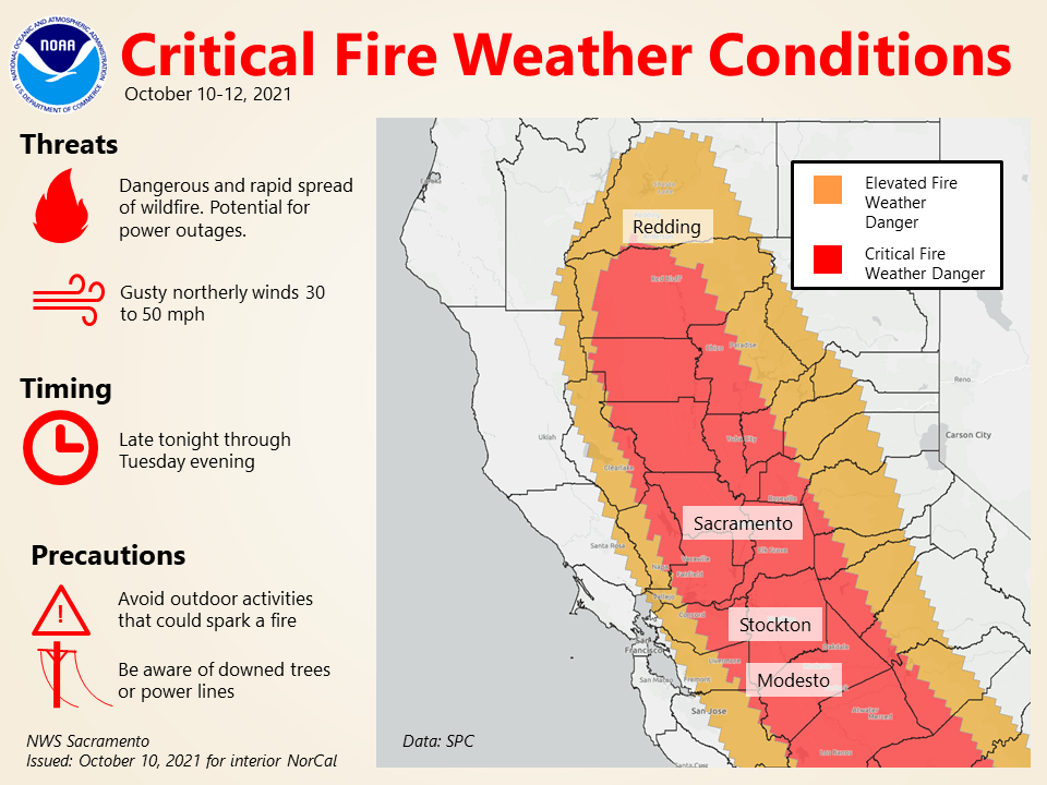
Pertaining to fire weather, these breezy offshore winds will bring decreasing humidity to much of the area through Tuesday. Combined with the already dry fuels, do expect critical fire weather conditions to occur beginning late tonight through Tuesday evening.
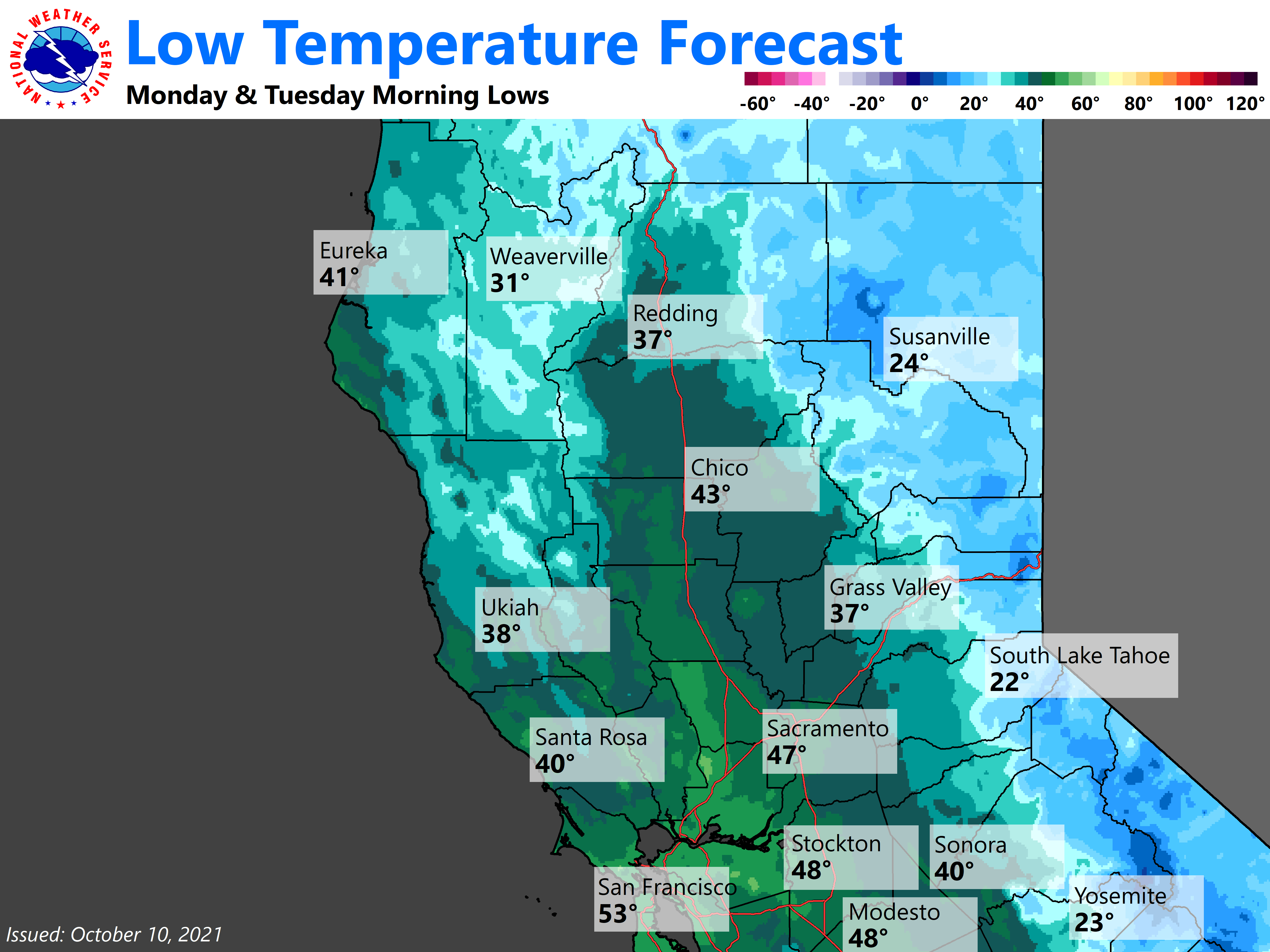
There is a brief period from Monday morning into the evening that a few light rain/snow showers may form over the northern Sierra Nevada as the upper low drops into the Great Basin. Elsewhere, dry weather is expected. After this windy and dry system passes, lighter winds are expected for mid week.
Extended Discussion (Thursday through Sunday)
Ensembles and cluster analysis indicate a gradual warming trend is likely later in the week as ridging from the eastern Pacific moves over NorCal. Another bout of north winds is likely Thursday as a short-wave moves through the ridge.
Although there is still quite a bit of uncertainty, the ensemble average has inched up a bit and now indicates gusts around 30 mph in the Central Valley (a few members are indicating gusts in the mid 40s mph). Nevertheless, it is still looking less impactful than the upcoming early-week event.
With a dry airmass and relatively clear skies, high temperatures will warm to a little above average while overnight lows will be a little below average.