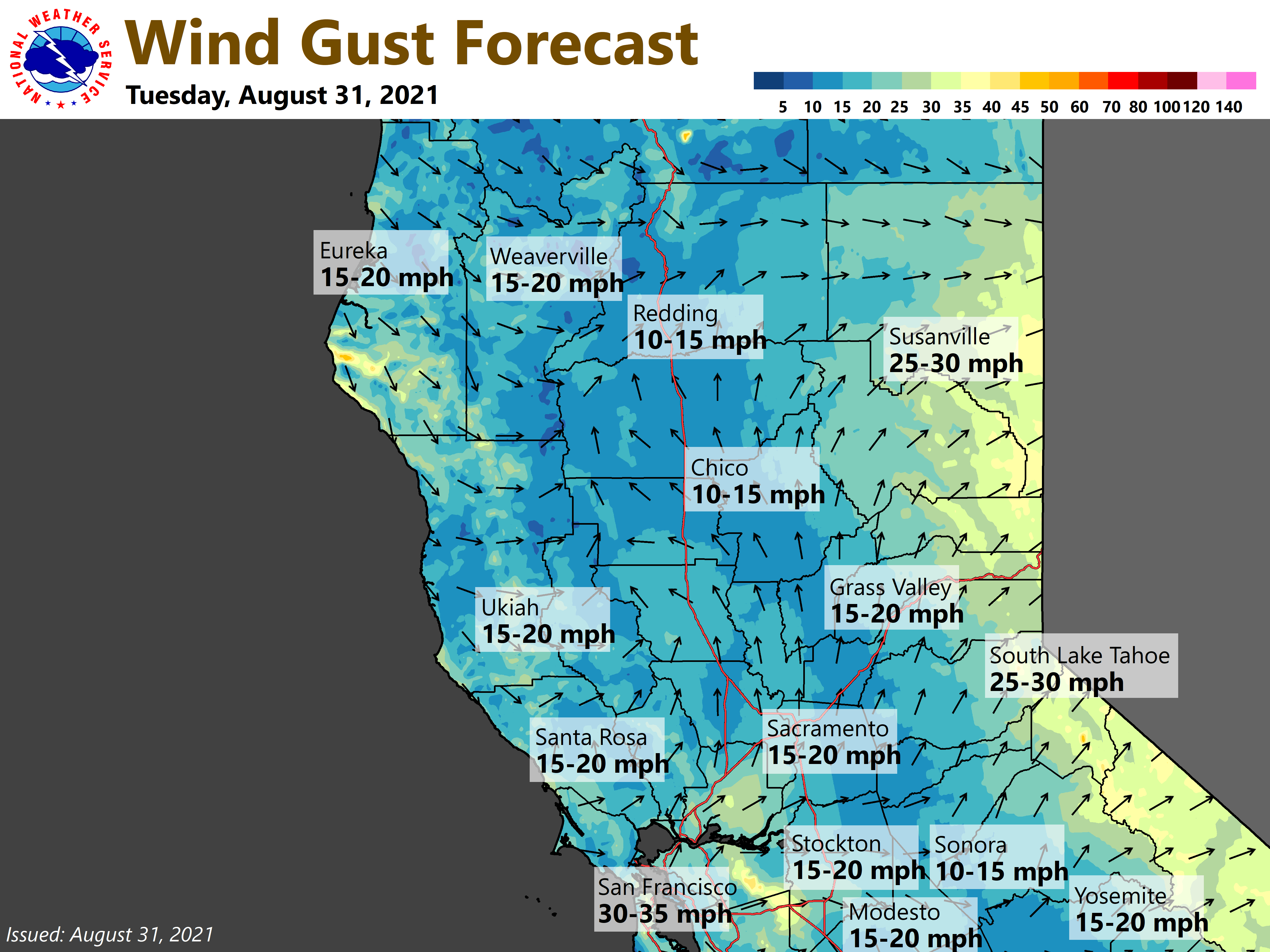
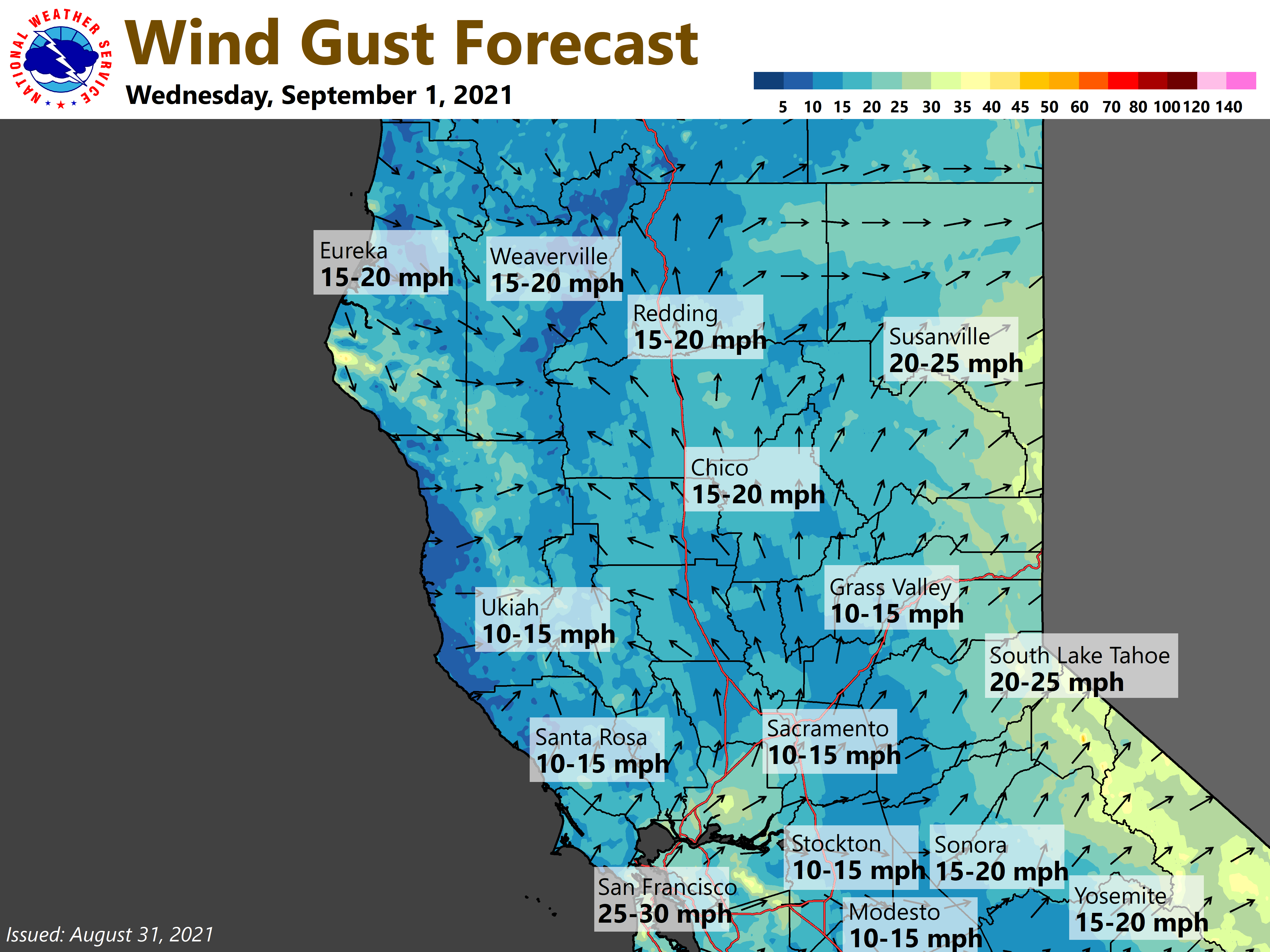
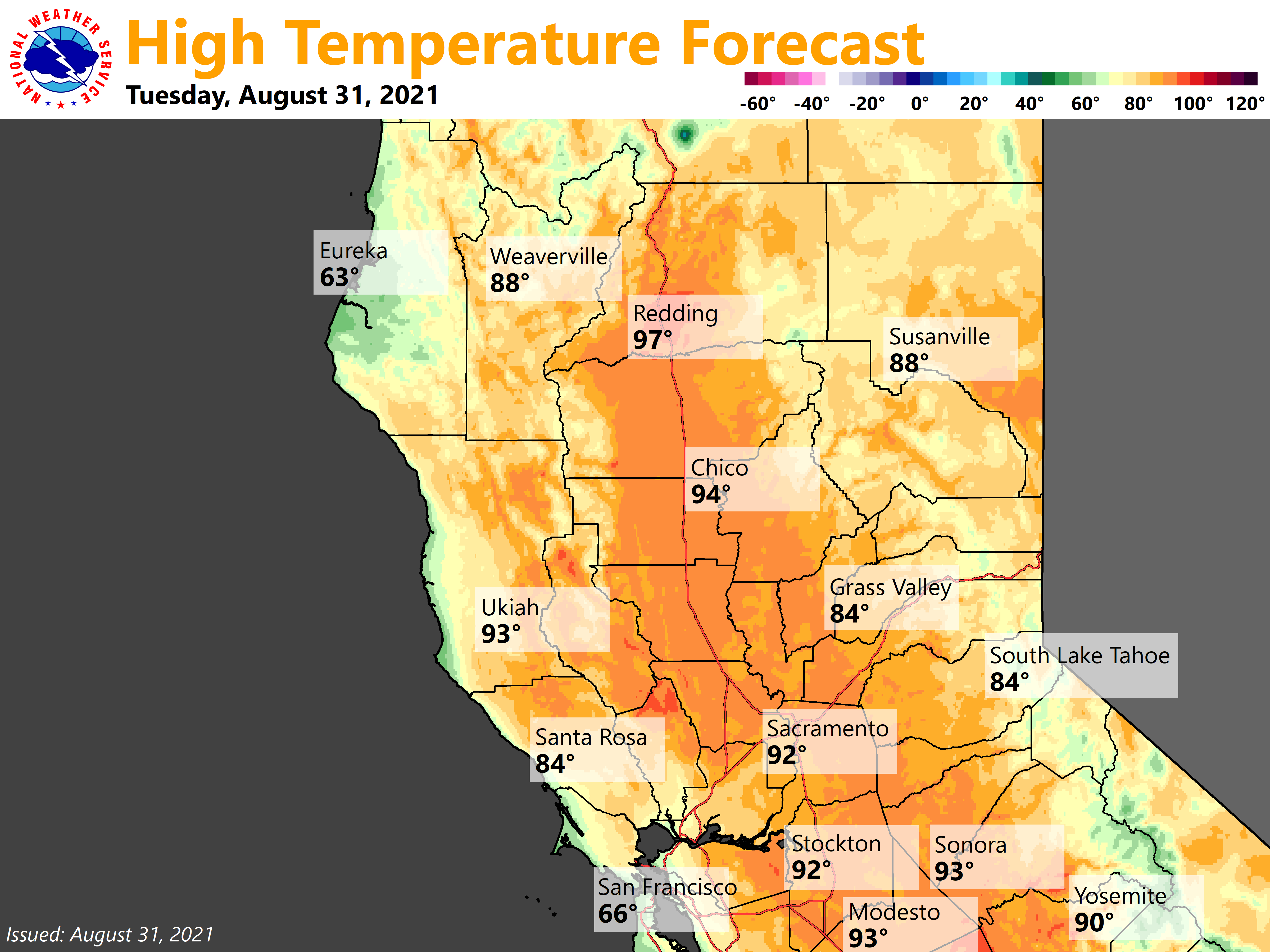
Gusty southwest winds will result in critical fire weather conditions over the northern Sierra and southern Cascades through mid-week. Cooler temperatures expected through the remainder of the week.
Discussion
Clear skies cover interior NorCal, and a very dry airmass remains in place. GOES-W shows intense burning continuing overnight on the Caldor Fire and portions of the Dixie Fire. Humidity remains very poor across the northern Sierra and foothill ridges with most locales currently observing values from the upper teens to lower 30s percent.
A weak to moderate Delta Breeze persists at Travis AFB despite the lack of stratus in the Bay Area early this morning, but it’s influence doesn’t extend much further inland than about the Sacramento region where temperatures are a bit cooler compared to 24 hours ago and RH is up slightly.
Ensemble means indicate that the upper trough will gradually deepen into mid-week resulting in periods of critical fire weather conditions over the northern Sierra and southern Cascades through mid-week. Southwest to west wind gusts of 20 to 35 mph are possible, locally higher over ridgetops. The strongest winds are expected in the afternoon and evening hours, especially today.

These winds combined with very low humidity and extremely dry fuels will continue critical fire weather conditions. The Red Flag Warning has been extended until Wednesday evening for the northern Sierra, given the potential for rapid spread of new or existing wildfires. This includes the Caldor Fire and portions of the Dixie Fire. Please practice fire safety.
Onshore flow will pick up again this afternoon, and again on Wednesday, and this will help to improve air quality across much of the Central Valley and western slopes of the northern Sierra. However, it looks like it won’t be strong enough to clear smoke out of the northern Sacramento Valley today where poor air quality may linger in Redding and Red Bluff.

Cooling develops across the region the next couple of days. Temperatures will lower to a little below average by Wednesday. Despite the cooling, humidity will remain low outside portions of the Central Valley influenced by the Delta Breeze. Valley temperatures will cool back into the mid 80s to lower 90s during the Wednesday-Thursday timeframe, then begin to warm slightly Friday.
Extended Discussion (Saturday through Tuesday)
An upper level low will spinning off of the coast of southern CA with the Four Corners ridge building into NorCal. This will bring warming temperatures over the weekend with highs pushing close to the century mark by early next week. Some monsoon moisture starts to push north after Tuesday but does not make it this far north keeping the forecast dry.