May 8, 2021 – Dry weather with increased north winds and critical fire weather conditions over the weekend into Monday. Warming trend develops into next week.


Discussion
North winds are picking up across the northern half of the forecast area early this morning as the trough shifts east and surface pressure gradient tightens in its wake and slides south across the region. The MFR-SAC gradient has climbed to nearly 13 mbs while the RNO-SAC gradient has turned positive and is about 2.5 mbs.
Local northerly gusts of 25-35 mph have developed already in the Sacramento Valley, while a few northeasterly gusts of 25-45 mph are occurring over the northern Sierra Nevada.
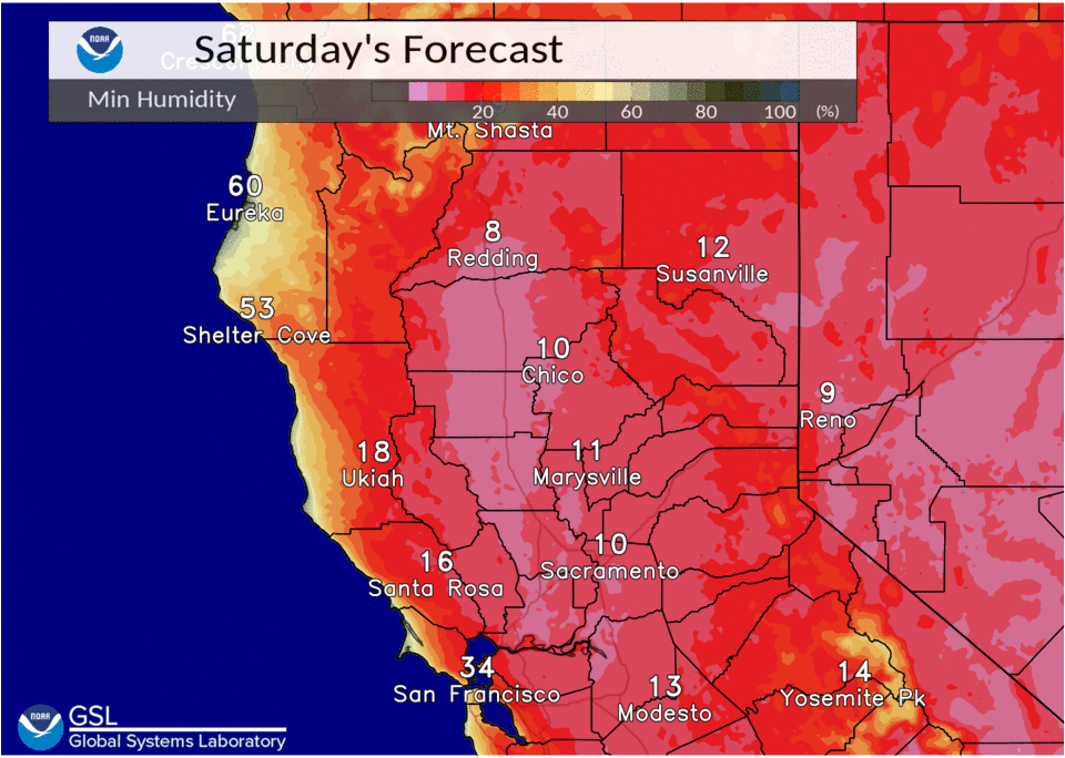
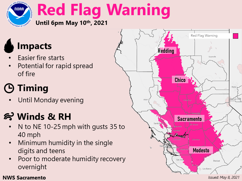
Pattern amplifies over NorCal during the weekend with tight surface gradient and northwesterly flow aloft supporting an extended period of gusty north winds. The winds combined with unseasonably warm temperatures and very low RH (single digits to mid teens with poor overnight recovery) will result in a large area of elevated to critical fire weather conditions across the Central Valley and foothills.
The strongest winds are expected today and Sunday generally west of Interstate 5 with gusts of 30-40 mph likely.
A Red Flag Warning remains in effect into Monday, and a wind advisory is in effect today. Avoid using outdoor equipment that could create a spark and obey local burn bans.
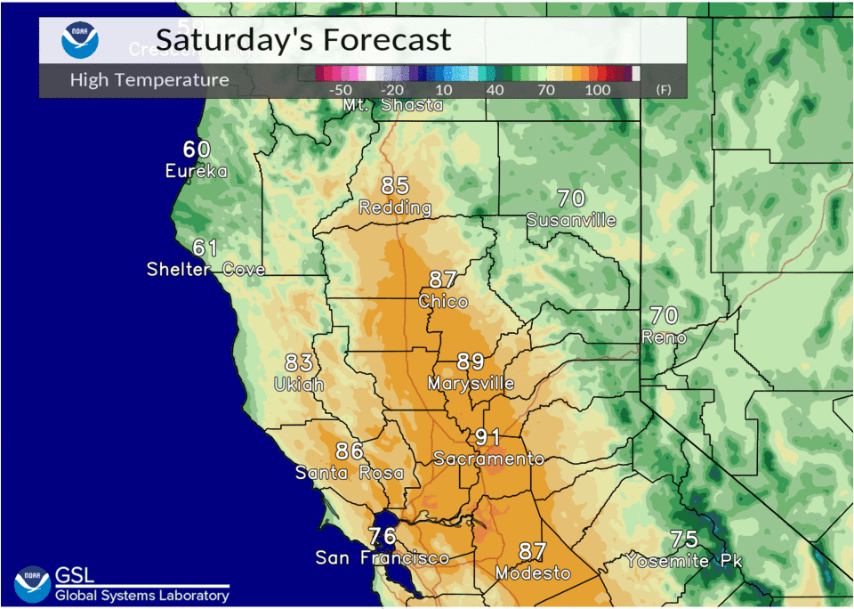
Warmer temperatures expected into early next week as high pressure rebuilds. Valley highs will be mainly in the mid 80s to lower 90s this weekend, warming into the 90s by Tuesday.
Extended discussion (Wednesday through Saturday)
EPAC upper ridge axis remains dominant synoptic feature over interior NorCal Wednesday into Thursday continuing dry weather with above normal temperatures. Highs expected to be 10 to 20 degrees above normal.
Short wave trough approaches towards the end of the week with varying model solutions on depth and progression.
Main impact at this time appears to be increased onshore flow with some synoptic cooling Friday into Saturday.